Map Resources for Backcountry Travel
Trip Planning Maps
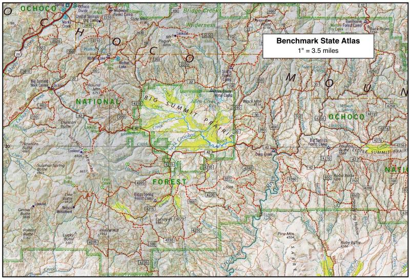
When planning
a trip into unfamiliar territory, a State Travel Atlas is a
helpful tool. The best ones we’ve found are by
Benchmark Maps, at a scale of about 1” = 4
miles. These give a good overview of travel distances,
road types, and land ownership. For the specific areas
in which we’re interested, we make 11”x17” color copies
of the relevant State Atlas pages, tape them together
into a composite, then highlight the paved roads, the
primary gravel roads, the developed campgrounds and
drinking water sources. From this a rough travel plan
emerges.
Maps of Forest Service Lands
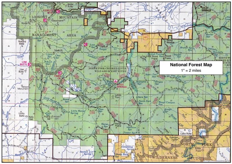
The Forest
Service publishes two levels of map detail for each forest:
a National Forest Map and several Ranger District Maps. The
National Forest Maps (aka Recreation Maps) are large color,
4’x4’ folded maps at a scale of 1” = 2 miles. These give a
valuable “second opinion” on the State Atlas information.
Often, a National Forest Map is all you’ll need for general
travel on forest lands.
The Ranger
District Maps (aka Fireman Maps) are also giant folded maps
about 4’x4’, but at a scale of 1” = 1 mile. These are black
and white, contour base maps over which the Forest Service
road network is drawn. Also included are road numbers,
gates, closed roads, fence lines, private inholdings. These
maps are essential for exploring in especially remote
forest areas.
To purchase these maps from the Forest Service, see their
website for each individual national forest.
Maps of BLM Lands
The BLM has
recently begun publishing a Recreation Map Series, covering
each BLM district. These are large color, 4’x4’ folded maps
at the scale of 1” = 2 miles. They are comparable in detail
to the National Forest Maps above, showing land ownership,
road networks and developed recreation sites. These also
show areas with motorized travel restrictions where roads
are closed or limited in use. These Recreation Series Maps
are by far the best available for travel on BLM lands.
Unfortunately, the BLM no longer publishes more detailed
maps of the lands they manage. If you need more detail, the
best option is USGS topo maps, either the 30x60 minute
series (1” = 1.6 miles) or the 7.5 minute series (1” = 0.4
miles).
To purchase maps from BLM, see the website for each
individual BLM District.
Aerial Photo Coverage
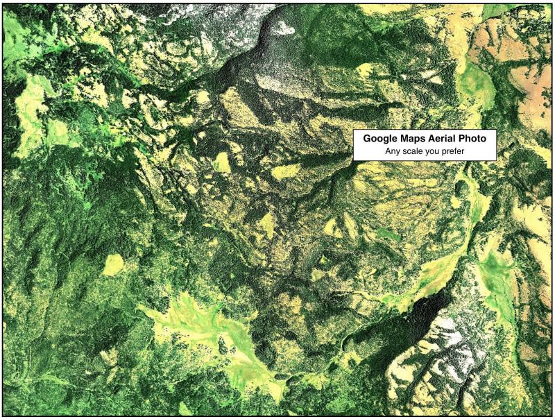
Since aerial
photography is now so freely available online (Google Maps
or Bing Maps), it’s easy to print out aerial photos ahead
of time for each area you plan to visit. These color
aerials provide unique information that just can’t be
gleaned from maps alone. For example, we’ve discovered
newly constructed roads, areas that have recently burned,
and forests recently killed by pine beetles — all in places
that we’ve planned to visit. So do take advantage of this
free resource, available online to the backcountry trip
planner.
Day Hiking Maps
The standard
hiking map is still the USGS 7.5 minute topographic series
(1” = 0.4 miles). These are now widely available in digital
form, so you can purchase topo maps for an entire state on
just a few discs. However, before leaving home, you’ll need
to print out all the topo maps for the areas you plan to
visit — or else pack your laptop in the car, along with a
portable printer.
For each hike on this website, we provide a USGS topo map,
as well as a detailed road map to each trailhead, both as
PDF downloads.
Map Summary
In sum, the map gathering process for backcountry travel
is:
1. Order a State Atlas from Benchmark Maps for your area of
interest.
2. Order either a National Forest Map or a BLM Recreation
Map for your area.
3. If you need more detailed road maps, order either Ranger
District Maps
(for USFS
lands) or USGS topographic maps (for BLM lands).
4. Print out aerial photos from Google Maps or Bing Maps
(optional).
5. Print out USGS 7.5 minute topo maps — or just download
the ones we've provided.
Page
last updated: 12/17/11