Less Traveled Northwest
Day Hikes for the Adventurous

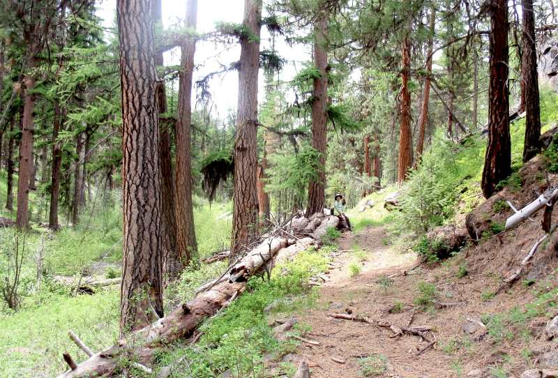
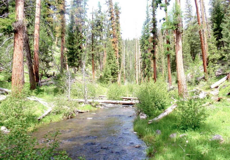
Crane Creek Trail
NOTE: The Crane Creek Trail area burned in Black Butte Fire of August 2021. It may be a few years before this area recovers for recreational use.
Hike Rating: Easy
Hike Length: 7.5 miles roundtrip (variable)
Elevation Loss: 500’
Trailhead Elevation: 5,240’
Best Season: June through September
Driving Access: Any vehicle
Plus Points
• A pleasant walk through a small, intimate stream canyon
• Trail follows the historical Dalles-Boise Military Road, built in 1867
• A very gentle grade, suitable even for children
• Streamside wildflowers in late spring and early summer
• Beautiful old growth larch groves at 1.5 to 2.5 miles
• Colorful and rugged tuff cliffs in the lower canyon
Minus Points
• Moderate cow activity on the streamside flats during summer
• ATVs use the trail in the lower canyon, driving up from the river crossing
• Though interesting, canyon is not as dramatic as the larger Malheur rivers
Download (PDF, 657 KB): Photos of Crane Creek Trail
Download (PDF, 484 KB): Topo Map for Crane Creek Trail
Download (PDF, 452 KB): Road Map for Crane Creek Trail
Trail Notes

From 1.5 to 2.5 miles, the walk is through pure stands of western larch, the Northwest’s only deciduous conifer. These trees' foliage is a distinctive chartreuse in spring, grassy green in summer, then strikingly yellow in October.
Road to Trailhead
The road access to this trailhead is excellent and easy. From paved Road 16, follow gravel Road 1663 for about 1.1 miles, to a dirt side road branching off to the left (east). This side road has a green, steel gate across it that is visible from Road 1663. Park on this side road and begin the walk through the steel green gate.
Camping Options
The best camping option is the Big Creek Campground in scenic Logan Valley, about 11 miles west of the trailhead. This is a large, developed campground with 14 sites, vault toilets, tables, grills and drinking water. The fee is $8.00 per night in 2011. The spring wildflower display in Logan Valley is worth the visit, as are the potential elk, deer and sandhill crane sightings in the extensive meadows here.
Another option is the Little Crane Creek Campground, a no frills (but no fee) campground off paved Road 16, about 7 miles east of the trailhead. This has five basic sites, with a vault toilet but no drinking water. Tents and small camping trailers will work fine here, but not big camping rigs.
Agency Contact: Malheur National Forest, Prairie City District, (541) 820-3800
DISCLAIMER: Every effort has been made to ensure the accuracy of this information, but the authors do not guarantee that it is either current or correct. The reader assumes full responsibility for any use of this information, and is encouraged to contact local federal land agencies to inquire about current conditions before traveling.
Page last updated: 12/20/11