Less Traveled Northwest
Day Hikes for the Adventurous
North Fork Malheur River Trail
NOTE: The North Fork Malheur River Trail burned in Black Butte Fire of August 2021. It may be a few years before this area recovers for recreational use.
Hike Rating: Easy
Hike Length: 6.5 miles roundtrip (variable)
Elevation Loss: 200’
Trailhead Elevation: 4,650’
Best Season: June through September
Driving Access: Any vehicle, with care
Plus Points
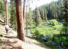
• One of the prettiest day hikes in Central Oregon
• Beautiful braided stream channel with green island meadows
• Easy streamside trail, suitable for both adults and children
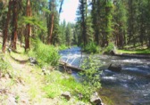
• Log footbridges at all stream crossings, so no wading is required
• Old growth ponderosa pines on the wide river terraces
• Osprey and red-tailed hawks are common overhead
Minus Points
• First 2.5 miles of the access road is a bit rough (details below)
Download (PDF, 698 KB): Photos of North Fork Malheur Trail
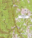
Download (PDF, 528 KB): Topo Map for North Fork Malheur Trail
Download (PDF, 472 KB): Road Map for North Fork Malheur Trail
Trail Notes
After first crossing two log footbridges, the trail runs along the west river terrace, away from the stream, for about a mile through old growth ponderosa groves. It soon rejoins the stream where, for the next 1.5 miles, it closely follows the braided river channel, which features green grassy islands covered in corn lily and alder. There are several nice rest spots in this section of the trail.
At 2.5 miles, the trail crosses a footbridge over Crane Creek, which comes in from the west on the historical Dalles-Boise Military Road. Here the trail passes through a primitive riverside campground where the old military road fords the North Fork Malheur River.
Below this ford, the canyon narrows and becomes much rockier, with colorful tuff cliffs and a more mixed forest of larch, fir, ponderosa and lodgepole pine. The river here is bedrock controlled into a single channel, forming a 50’ wide continuous riffle. One can follow the well-built trail along the stream bank for as long as desired. Look for nesting osprey in this section of the river.
Road to Trailhead
The first 2.5 miles of Road 1675, before it reaches the North Fork Malheur River bridge, is well-built — but is never graded, so it is fairly rocky and rough. One can easily tow a camping trailer down this road, but it requires going slow and taking precautions in the bumpier spots. Beyond the bridge, however, the road becomes much smoother, over river silt and sand, as it approaches the campground and trailhead.
Camping Options
The closest camping option is the North Fork Malheur Campground, just one mile upriver from the trailhead. This is a very pleasant, picturesque campground on the east bank of the river, with five free camp sites, a vault toilet, but no water supply. Tents and camping trailers, both small and large, are all fine here.
If this campground is not to your liking, there are several nice dispersed camping sites at river’s edge off Road 1675, for a half mile above and below the campground.
Another nearby option is Elk Creek Campground, about 4.0 miles from the trailhead, off paved Road 16. Here are five developed campsites, with a vault toilet and no fee or drinking water. This campground will handle tents and any size camping trailer.
Agency Contact: Malheur National Forest, Prairie City District, (541) 820-3800
DISCLAIMER: Every effort has been made to ensure the accuracy of this information, but the authors do not guarantee that it is either current or correct. The reader assumes full responsibility for any use of this information, and is encouraged to contact local federal land agencies to inquire about current conditions before traveling.
Page last updated: 12/20/11


