Less Traveled Northwest
Day Hikes for the Adventurous

North Fork Sprague River Hikes
NOTE: The North Fork Sprague River area burned in Bootleg Fire of July 2021. It may be a few years before this area recovers for recreational use.
West Hike
Hike Length: 5.5 miles roundtrip
Elevation Gain: 100’
Trailhead Elevations: 6,090’
Best Season: July through September;
after spring runoff has subsided
Driving Access: Any vehicle
East Hike
Hike Length: 2.7 miles roundtrip
Elevation Loss: 35’
Trailhead Elevation: 6,250’
Best Season: July through September
after spring runoff has subsided
Driving Access: Any vehicle
Plus Points
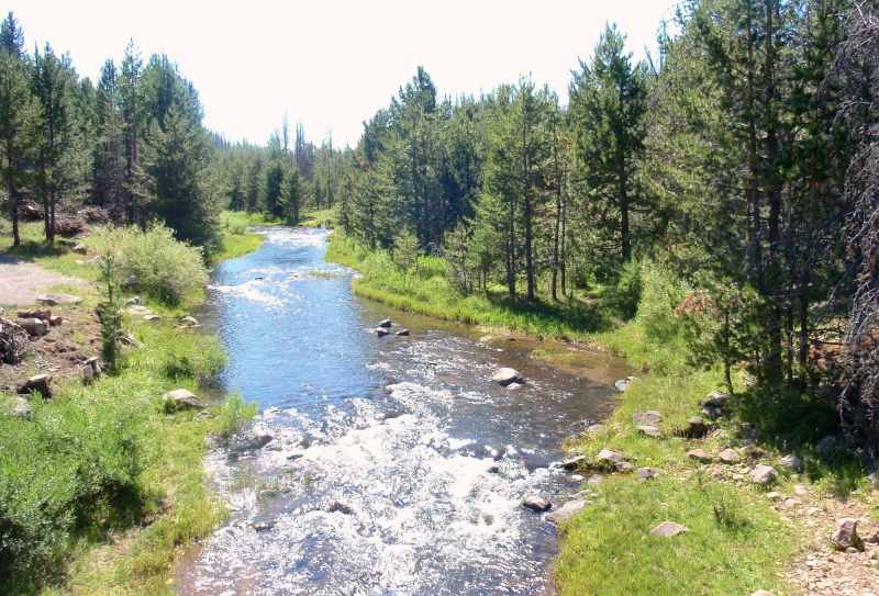
• Two separate hikes along a designated Wild-and-Scenic river
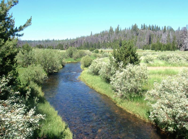
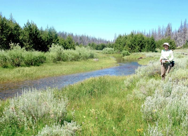
• Extensive riverside meadows, with sage uplands flanked by pine forests
• Secluded and easy hiking on grassy streamside terraces
• The eastern hike is through ungrazed, pristine riparian meadows
• Lots of wildflowers into summer, especially on ungrazed eastern hike
• Easy trailhead access, off good roads and near campgrounds (details below)
Minus Points
• No official trail, so hiking is along streamside cow trails
• The western hike has at least one stream crossing, so wear suitable footwear
• Cows may be present on the western hike up to about August 1
Download (PDF, 691 KB): Photos of North Fork Sprague River Hikes
Download (PDF, 400 KB): Topo Map for North Fork Sprague River Hikes
Download (PDF, 440 KB): Road Map for North Fork Sprague River Hikes
Trail Notes

One can ford the stream anywhere here, as both banks are walkable. For the last mile, there’s a nice route along the north bank, through streamside meadows and pine forest, to the turnaround at fenced private land on Lee Thomas Meadow.
Road to Trailhead
Both trailheads are easily accessible off gravel Road 3411. The western trailhead is on the northeast bank at the Sandhill Crossing bridge, near the Sandhill Crossing Campground. The eastern trailhead is just east of the Lee Thomas Campground, at the bridge where Road 3411 crosses the river, on the east bank.
Camping Options
There are two developed campgrounds in the area, both with vault toilets and potable drinking water. They've both have been extensively cleared of beetle-killed pines and can appear quite stark — but they are the best camping options in this area. As both campgrounds are near wet meadows, be prepared for a few mosquitoes.
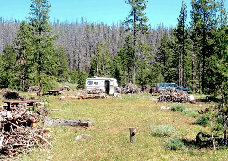
The Sandhill Crossing Campground has five sites on an elevated bench above the river, and also has no fee. There’s nice views up and down the canyon from this campground, though it is unfenced, so you may encounter a few wandering cows here.
Agency Contact: Fremont National Forest, Paisley District, (541) 943-3114
DISCLAIMER: Every effort has been made to ensure the accuracy of this information, but the authors do not guarantee that it is either current or correct. The reader assumes full responsibility for any use of this information, and is encouraged to contact local federal land agencies to inquire about current conditions before traveling.
Page last updated: 1/16/13