Less Traveled Northwest
Day Hikes for the Adventurous

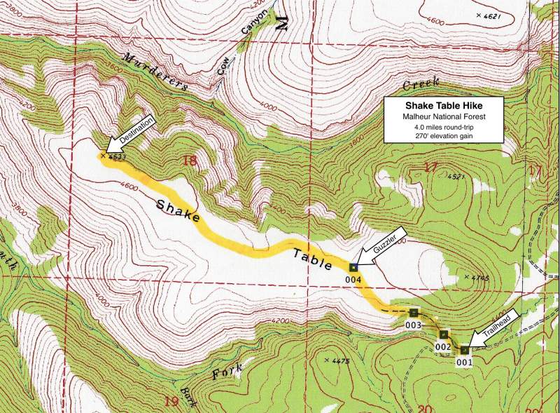
Shake Table Hike
NOTE: Shake Table burned in South Fork Complex Fire of September 2014.
It may be a few years before this area recovers for recreational use.
Hike Rating: Moderate
Hike Length: 4.0 miles roundtrip
Elevation Gain: 270’
Trailhead Elevation: 4,360’
Best Season: June through September;
after soils dry out in spring
Driving Access: Any vehicle
Plus Points
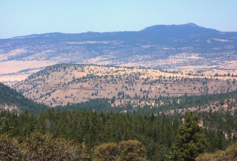
• A pleasant, cross-country ramble up onto a flat tableland
• Shake Table is a protected Research Natural Area
• Plant communities are low sagebrush/bunchgrass with scattered junipers
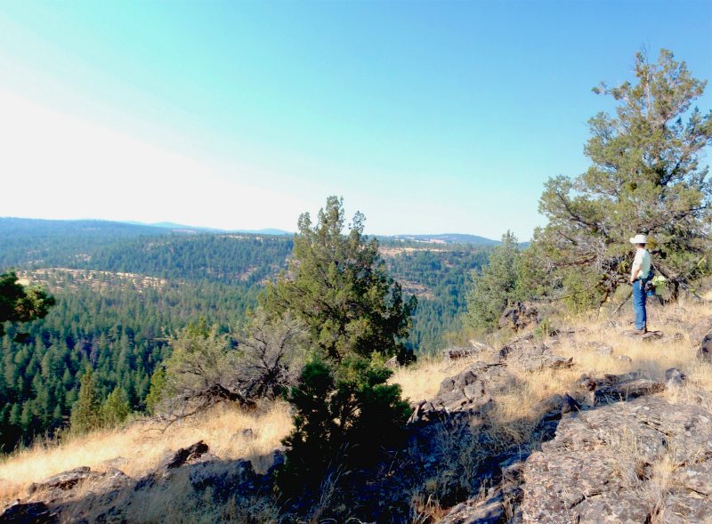
• Panoramic vistas of Aldrich Mountains and South Fork John Day River
• Potential for wild horse sightings in early summer, when grass is still green
• An historical wild horse trap is found on the access trail
• Solitude is nearly guaranteed up on the top
Minus Points
• No developed trail up on top and walking is over thin soils and exposed rocks
• Can be extremely muddy in early spring (best to wait until the soils dry out!)
Download (PDF, 804 KB): Photos of Shake Table Hike
Download (PDF, 452 KB): Topo Map for Shake Table Hike
Download (GPX, 4 KB): GPS Points for Shake Table Hike
Download (PDF, 592 KB): Road Map for Shake Table Hike
Trail Notes
Within two hundred yards, the trail passes through an historical wild horse trap made of pine poles. This elongated corral, with a gate at each end, was apparently activated by first closing the downhill gate, allowing the unsuspecting horses on the trail to enter the trap on the uphill side, then rushing to close the uphill gate before they escaped.
Road to Trailhead
The roads to this trailhead, once they dry out in late spring, can be traveled with any passenger car. From paved Road 21, follow paved Road 2170 for 2.2 miles. Turn left onto dirt/gravel Road 2490 and proceed 4.2 miles to a pullout on the right, in a low swale, just before the road starts uphill (GPS Point 1 marks the trailhead).
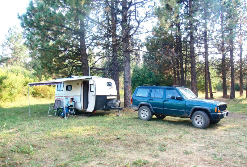
Camping Options
The closest developed campground is the Oregon Mine Campground, about 6 miles from the trailhead, east back up the Murderers Creek canyon off paved Road 2170. This is a small campground, sandwiched between Murderers Creek and the paved road. There are four free sites, with a vault toilet but no drinking water.
Agency Contact: Malheur National Forest, Blue Mountain District, (541) 575-3000
DISCLAIMER: Every effort has been made to ensure the accuracy of this information, but the authors do not guarantee that it is either current or correct. The reader assumes full responsibility for any use of this information, and is encouraged to contact local federal land agencies to inquire about current conditions before traveling.
Page last updated: 12/21/11