Less Traveled Northwest
Day Hikes for the Adventurous

Baldy Lake Trail
Hike Rating: Easy
Hike Length: 4.6 miles roundtrip
Elevation Gain: 250’
Trailhead Elevation: 7,030’
Best Season: July through September
Driving Access: High-clearance vehicle,
once access road is snow-free
Plus Points
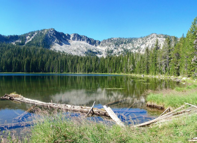
• Hike to a stunning, high-elevation lake, set in a glaciated granite amphitheater
• Route is entirely within the North Fork John Day Wilderness Area
• Primeval grand fir forests that have never been logged throughout the hike
• Wildflowers into mid-August, including pink monkeyflower, goldenrod and asters
• Trail intersects route of an historical, early 1900s, electric line to mining districts
• The last 1.5 miles of trail to the lake is well-built on a good, gradual grade
Minus Points
• Hour-long drive on a narrow, rocky and steep access road to reach trailhead
• One 0.4-mile section of trail is steep and poorly-defined, requiring route finding skills
Download (PDF, 714 KB): Photos of Baldy Lake Trail
Download (PDF, 684 KB): Topo Map for Baldy Lake Trail
Download (GPX, 1 KB): GPS Points for Baldy Lake Trail
Download (PDF, 851 KB): Road Map for Baldy Lake Trail
Trail Notes
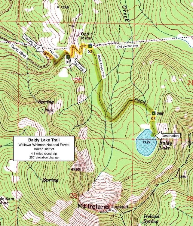
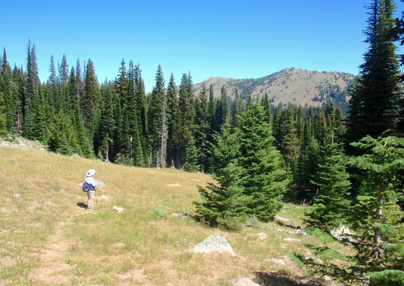
From the trailhead sign, the route follows an old mining road northeast down the hillside for about 200 yards, then switchbacks southeast down a steep track to an open grassy hillside, with more views of the Elkhorn Ridge. The trail becomes poorly-defined here, but if one just keeps switchbacking east down the hillside, in about 250 yards one meets the well-defined, north-south Baldy Creek Trail (at GPS Point 2). In this last 250 yards, look for old poles and ceramic insulators from the early-1900s electric line running to the Cable Creek Mining District in the east.
At lake's edge, if one wants to explore further, a good walking trail goes left (south) along the lakeshore, past several campsites and wet meadows. Another trail goes right (north) on a bench above the lake to its outlet, where one finds an immense moraine of car-sized granite boulders about 100 yards wide and 500-600 yards long.
Road to Trailhead
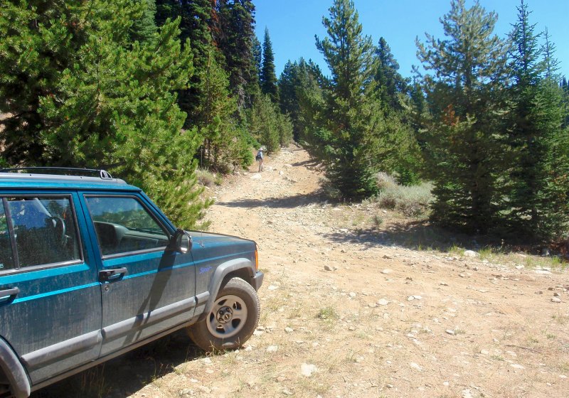
NOTE: Road 7345 is rocky and rough throughout its length. The roadbed is made up of sharp, fist-sized rocks and is rutted in spots, requiring a high-clearance vehicle with strong tires. Plan on a slow trip, taking about an hour from Hwy 73 to the parking spot. The upper road can be blocked by snow into late June after winters with high snowfall.
Camping Options
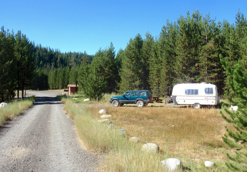
The nearest developed camping area is the USFS North Fork John Day Campground, about 8 miles north of Granite on paved Hwy 73 and about 10 driving miles from the trailhead. Located next to the highway in a lodgepole pine forest above the river, there are 20 sites for tents, trailers and RVs.
The next nearest developed campground is the USFS Olive Lake Campground, 12 miles east of Granite on gravel Road 10 and about 21 driving miles from the trailhead. This is a popular recreation area, with 28 sites for any type of camping setup, spread out on the hillside east of the lake. It has 7 vault toilets, a boat ramp and two docks, plus tables and fire rings at most campsites. There is no drinking water or garbage pickup, but it does have a camp host in summer. Fees were $12.00 per night in 2013.
NOTE: The only publicly-available drinking water is at Gold Center Spring, 7.4 driving miles south of Granite on Hwy 73. This is a piped, free-flowing spring at a wide pullout east of the highway. Gas and supplies are available at the store in Granite.
Agency Contact: Wallowa-Whitman National Forest, Baker District, (541) 523-6391
DISCLAIMER: Every effort has been made to ensure the accuracy of this information, but the authors do not guarantee that it is either current or correct. The reader assumes full responsibility for any use of this information, and is encouraged to contact local public land agencies to inquire about current conditions before traveling.
Page last updated: 11/13/13