Less Traveled Northwest
Day Hikes for the Adventurous

Boulder Butte Hike
Hike Rating: Easy
Hike Length: 7.4 miles roundtrip
Elevation Gain: 535’
Trailhead Elevation: 6,990’
Best Season: July through September
Driving Access: Any vehicle, with care,
once access road is snow-free
Plus Points
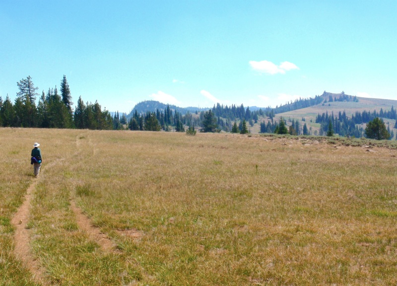
• An easy ridge walk through the protected Indian Rock-Vinegar Hill Scenic Area
• Fantastic views throughout, both along the ridge and into the adjacent watersheds
• Prime summer habitat for elk and mule deer, with sightings always possible
• Long wildflower season, extending from early spring into late summer
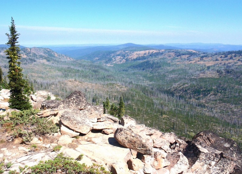
• The destination at Boulder Butte has 360 degree views of Southern Blue Mountains
• Trail is little-used, but well-marked overall with rock cairns and wood posts
Minus Points
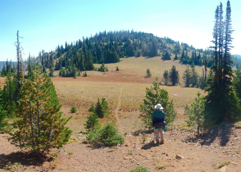
• Trail can be faint in spots, requiring route-finding between the rock cairns
• Some boulder-hopping is required to reach final summit of Boulder Butte
• Afternoon thunderstorms can present a lightning hazard on the exposed ridge
Download (PDF, 672 KB): Photos of Boulder Butte Hike
Download (PDF, 678 KB): Topo Map for Boulder Butte Hike
Download (GPX, 1 KB): GPS Points for Boulder Butte Hike
Download (PDF, 897 KB): Road Map for Boulder Butte Hike
Trail Notes
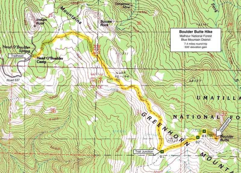
From this point, the trail follows the ridge line south and east, with more views south into the Middle Fork John Day River watershed. Look for elk beds in the fir stands along the ridge or on the grassy slopes between the trees.
About 0.5 miles past the junction, the trail descends into a low saddle just below Boulder Butte (GPS Point 2). Here the route leaves the main trail and traverses northeast cross-country about 250 yards down to the prominent northwest ridge of the butte (GPS Point 3). Note that this northwest ridge is the safest route to the top of the butte, as most other sides of the butte have sheer rock cliffs. Scramble up this northwest ridge, through stunted subalpine firs and over granite boulders, for about 0.2 miles to the summit.
Road to Trailhead
From the south on paved Hwy 20 along the Middle Fork John Day River, take gravel Road 45 north about 10 miles toward the crest of Greenhorn Ridge, to its junction with Road 537 on the right. With care, this road can be traveled by any passenger car. From the north on Forest Road 10 along Desolation Creek, turn south onto Road 45 and drive about 8.3 miles to its junction with Road 537 on the left. This route is passable only by high-clearance vehicles and only when dry.
Once at Road 537, follow it east about 2.4 miles to the trailhead at Head O' Boulder Campground on the right. This road is passable by any passenger car, but only after the snow has melted off it, which can be as late as early July in wet years.
Camping Options
Tent campers and those with small travel trailers (say up to 16') can stay right at the trailhead in the rustic Head O' Boulder Campground. There are 4-6 sites in the trees here, on both sides of Road 537.

On the south, in the Middle Fork John Day watershed, the closest developed camping area is the Lower Camp Creek Campground, 1.5 miles south off Hwy 20 on Road 36, and about 18 driving miles from the trailhead. There are 6 sites, on a forested bench above Camp Creek, that will accommodate any camping style, including travel trailers up to 40'. There is a vault toilet, picnic tables and fire rings at each site, but no drinking water. Fees were $6.00 per night in 2013.
On the north, in the Desolation Creek watershed, the nearest developed camping area is the Olive Lake Campground, off Forest Road 10, about 17 driving miles from the trailhead. This is a popular recreation area, with 28 sites for any type of camping setup, spread out on the hillside east of the lake. It has 7 vault toilets, a boat ramp and two docks, plus tables and fire rings at most campsites. There is no drinking water or garbage pickup, but it does have a camp host in summer. Fees were $12.00 per night in 2013.
Agency Contact: Malheur National Forest, Blue Mountain District, (541) 575-3000
DISCLAIMER: Every effort has been made to ensure the accuracy of this information, but the authors do not guarantee that it is either current or correct. The reader assumes full responsibility for any use of this information, and is encouraged to contact local public land agencies to inquire about current conditions before traveling.
Page last updated: 11/15/13