Less Traveled Northwest
Day Hikes for the Adventurous

Buck Creek Loop Hike
Hike Rating: Difficult
Hike Length: 6.0 miles roundtrip
Elevation Loss: 1,800’
Trailhead Elevation: 6,100’
Best Season: June through September,
once access road is snow-free
Driving Access: Any vehicle, with care
Plus Points
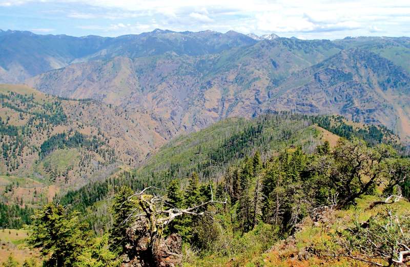
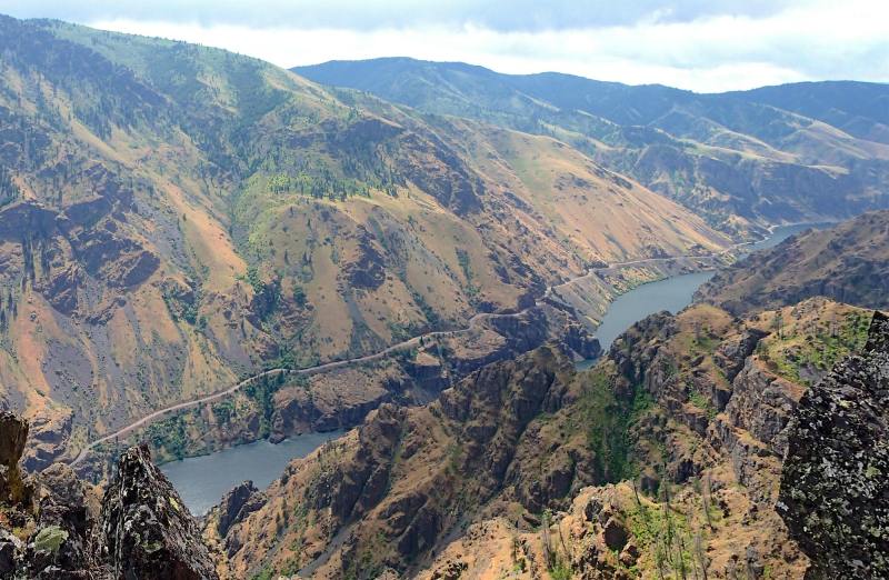
• Hike descends to overlooks in the deep interior of the Snake River canyon
• The trails are very lightly used and all within Hells Canyon Wilderness Area
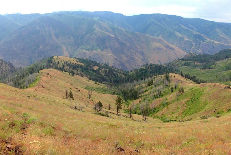
• Carpets of Spring wildflowers into mid-July on the north-facing slopes
• With binoculars, potential sightings of bighorn sheep, elk and mule deer
• Hike intersects the historical 1834 route of the Bonneville Party in Hells Canyon
• Day-long solitude is nearly guaranteed on this rugged, rarely traveled loop hike
Minus Points
• Very challenging terrain, with steep 20% trail grades on return hike to the rim
• Trails are very faint or nonexistent in places, so our GPS points are recommended
• Rattlesnakes are a possibility at lower elevations through the Summer, so be alert
Download (PDF, 828 KB): Photos of Buck Creek Loop Hike
Download (PDF, 771 KB): Topo Map for Buck Creek Loop Hike
Download (GPX, 1 KB): GPS Points for Buck Creek Loop Hike
Download (PDF, 673 KB): Road Map for Buck Creek Loop Hike
Trail Notes
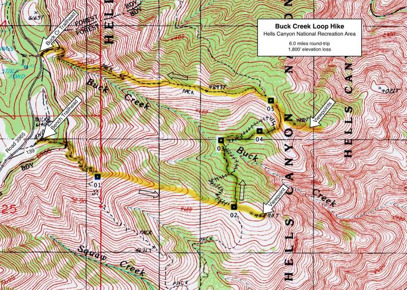
At 0.6 miles (GPS Point 1), the ridge divides in two and the route leaves the Bench Trail and goes cross-country down the left (north) branch of the ridge. The hiking is steep for a few hundred yards, but the slope soon levels out and game trails are easily to follow on the ridge crest. At 1.4 miles, the route enters a broad saddle on the ridge where it intersects a north-south trail (at GPS Point 2). Before continuing left (north) down this trail into Buck Creek, it's worthwhile to walk the 400 yards east up to the rounded end of the ridge, for nice views of the inner gorge and Hells Canyon Reservoir.
Past the crossing, the trail ascends gradually northeast, following a low ridge through thick brush until it reaches the dry grassy hillside (GPS Point 4). Once on the open slope, the trail is easy to follow as it climbs steeply north up the hillside, reaching the top of the ridge at 3.0 miles (GPS Point 5). From here, for another nice side trip, one walks southeast cross-country about 300 yards down the ridge crest to spectacular viewpoints at its end. There are multiple viewpoints from the rocky crags, all with vistas of the contorted geology of the inner Snake River gorge. Be careful on the rock ledges and watch for rattlesnakes.
NOTE: A more moderate (but still challenging!) day hike would be to start at the Buck Creek Trailhead and do an out-and-back route down the ridge to the rocky viewpoints below. Starting at the unsigned rock cairn, just across Road 3965 from the campground entrance, follow the Buck Creek Trail for about 2 miles as it descends along the ridge crest, to where the trail begins to curve south and drop down into Buck Creek (GPS Point 5). Leaving the trail, one goes east cross-country another 300 yards down the ridge to the rocky viewpoints at its end. Return as you came. This hike is 4.4 miles roundtrip, with 1,400' of elevation loss — still a strenuous day hike.
Road to Trailhead
From Joseph, OR, drive 8 miles east on the Imnaha Hwy (#350). Turn right (south) on Hwy 39 and drive about 33 miles to Road 3962 on the left (east). This turnoff is 1.1 miles south of the Imnaha River bridge near the Ollokot Campground. If coming from the south on Hwy 39, this turnoff is about 32 miles north of Halfway, OR.
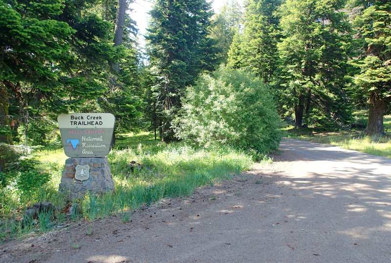
The Buck Creek Trailhead itself is directly east across Road 3965 and is marked by a rock cairn, but no sign. To find the Bench Trailhead, backtrack 0.5 miles south on Road 3965 to dirt Road 139 on the east. The Bench Trailhead is 150 yards up Road 139 on the right (east) and is also marked by an unsigned rock cairn. Gravel Roads 3962 and 3965 are accessible by a passenger car or a camping trailer, but with care, as they have quite a few potholes. A Northwest Forest Pass is required at both trailheads.
Camping Options

Agency Contact: Hells Canyon National Recreation Area, (541) 426-5546
DISCLAIMER: Every effort has been made to ensure the accuracy of this information, but the authors do not guarantee that it is either current or correct. The reader assumes full responsibility for any use of this information, and is encouraged to contact local public land agencies to inquire about current conditions before traveling.
Page last updated: 12/10/14