Less Traveled Northwest
Day Hikes for the Adventurous
Eureka Wagon Trail
Hike Rating: Moderate
Hike Length: 7.3 miles roundtrip
Elevation Loss: 1,770’
Trailhead Elevation: 5,240’
Best Season: June through September
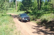
Driving Access: High-clearance vehicle
Plus Points
• An easy walking descent into Hells Canyon over an old historical wagon road
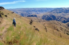
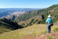
• Panoramic vistas of the lower Snake, Imnaha and Salmon River canyons
• Wagon road built in 1903 to supply mines at Eureka Bar on the Snake River
• Spring wildflowers include blue lupine, purple penstemon, scarlet gilia, wild roses
• Prime mule deer and elk habitat, with sightings possible if one is stealthy
• Wilderness solitude is likely, though trail is occasionally used by equestrians
Minus Points
• Return hike to the rim ascends over 1,700' on a long, unrelenting 10% grade
• Very little shade or cover on this hike, so plan to start in the early AM on hot days
• Cows graze the area in early Spring, but are mostly gone by mid-summer
Download (PDF, 795 KB): Photos of Eureka Wagon Trail
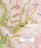
Download (PDF, 820 KB): Topo Map for Eureka Wagon Trail
Download (PDF, 679 KB): Road Map for Eureka Wagon Trail
Trail Notes
The unsigned trail starts at a wide parking area on Cemetery Ridge, at a steel gate that blocks the road. The old wagon road then descends the west side of the ridge, through a mixed forest of scattered fir and ponderosa pine, with views of upper Cherry Creek. In the first half mile, the road passes though a wire gate, then descends into a small saddle at 0.6 miles, where a jeep road branches to the left (north). Follow the main road east from this junction as it contours around the hillside, with wide views over Tulley Creek to the Imnaha River canyon beyond.
At 1.0 miles, just past a prominent viewpoint, the road passes through a fence line covered with wild roses (no gate here). The road continues to descend the southeast side of the ridge, past steep cuts in the rock, down to Spain Saddle at 2.1 miles. At the saddle, the road passes through a second wire gate (leave it as you find it) as it crosses to the northwest side of the ridge. For the next half mile, the road descends through shady, scattered stands of pine, where views open up over the Eureka Creek canyon to the green Snake River far below.
On a dry point at 2.6 miles, the road re-crosses back to the southeast side of the ridge, passing through a third wire gate, and then begins a long, dry descent north toward the Eureka viewpoint. Look for patches of purple penstemon here into late June. Along this stretch, one has long, panoramic vistas up the Imnaha River canyon and its tributaries from the east (Cow, Lightning and Horse Creeks).
At 3.6 miles, just before the road makes a sweeping turn to the right (east), the route leaves the road, climbs cross-country up to dark lava rock outcrops, then follows the ridge north for about 200 yards to the rounded, grassy knob of the Eureka viewpoint. Look for small prickly pear cacti along this ridge. From the high overlook, one has panoramic vistas over the Imnaha, Snake and Salmon River canyons — in fact, one can see the green Snake River waters at three different points from this viewpoint.
Road to Trailhead
From Hwy 82, 3.3 miles southeast of Enterprise, OR, or 3 miles north of Joseph, OR, turn north onto paved Crow Creek Road at a sign for Buckhorn Springs. Drive 5.1 miles on Crow Creek Road, keeping on the main paved road through several turns, to a "Y".
At the "Y", bear right onto Zumwalt Road and follow it for about 32 miles to Road 780 on the right, at the sign for the Buckhorn Overlook. The Zumwalt Road, which becomes Road 46 at the Forest Boundary, is only paved for the first 2.4 miles and the rest is a good gravel track, but has many sections of washboards.
On gravel Road 780, drive east 0.9 miles toward the Buckhorn Overlook, bearing left on a dirt road 0.3 miles before the Overlook. Follow this dirt road east for 1.1 miles to a broad dirt parking area, just before a green steel gate with a "Road Closed" sign. The last mile of dirt road to the trailhead is rough and rocky in spots, requiring a high-clearance vehicle. Those in low-clearance passenger cars will need to park near the Buckhorn Overlook and walk the last mile to the trailhead.
Camping Options
The only developed campground in the area is the USFS Buckhorn Campground off Road 780, about 1.6 miles from the trailhead. This is a primitive camping area, with just 5 sites in a shady, forested glen surrounded by a wire fence and cattle guard. It has a vault toilet, but no drinking water or camping fees. The sites are quite small and designed to accommodate tent campers and small camping trailers only (up to 16' long).
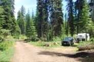
For tent campers with high-clearance vehicles: There are several nice dispersed campsites along Cemetery Ridge, off Road 780 within the last mile to the trailhead. These are mainly in the trees and dry meadows just off Road 780. If not particular, one can also camp in the wide, flat trailhead parking area at the road's end.
For larger travel trailers: Sites at the Buckhorn Campground are too small and Road 780 is too rough for large camping trailers, so the best bet is along Road 46 between Thomason Meadows and the Buckhorn Turnoff. There are several pull-off sites along this road, back in the trees, which are accessible after the soil has dried out in late Spring.
Agency Contact: Hells Canyon National Recreation Area, (541) 426-5546
DISCLAIMER: Every effort has been made to ensure the accuracy of this information, but the authors do not guarantee that it is either current or correct. The reader assumes full responsibility for any use of this information, and is encouraged to contact local public land agencies to inquire about current conditions before traveling.
Page last updated: 12/10/14

