Less Traveled Northwest
Day Hikes for the Adventurous

High Ridge Trail
Hike Rating: Easy
Hike Length: 7.8 miles roundtrip (variable)
Elevation Loss: 940’
Trailhead Elevation: 5,480’
Best Season: June through September,
once access road is snow-free
Driving Access: High-clearance vehicle
Plus Points
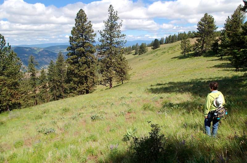
• A scenic ramble down a long ridge, through both open "balds" and pine forests
• This seldom used route follows the boundary of Eagle Cap Wilderness Area
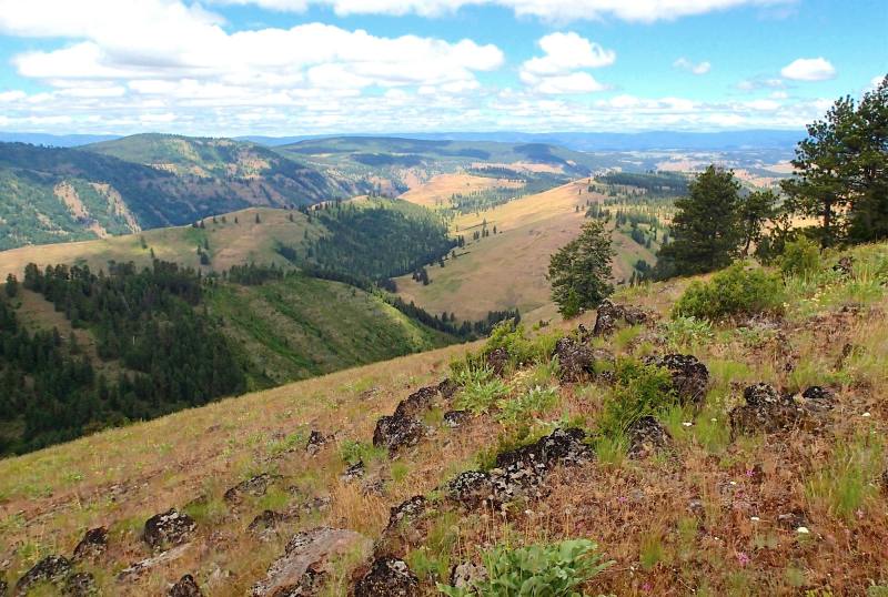
• Sweeping views over the lower Minam River canyon throughout the route
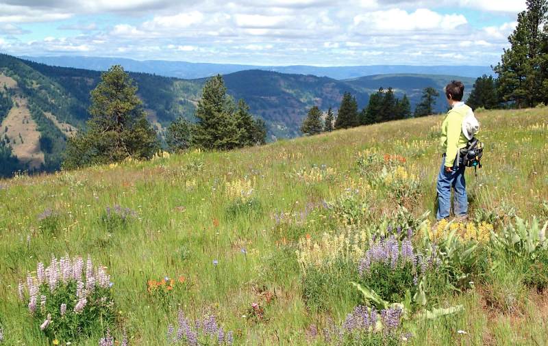
• Spectacular wildflowers into mid-July, including lupines, paintbrush, larkspur, arnica
• The ridge is prime elk and mule deer habitat, with sightings possible if stealthy
• Trail is on a good grade, making for easy walking, and is mostly cow-free
Minus Points
• Good route-finding skills are required, as the trail is faint in some spots
• Afternoon thunderstorms present a lightning hazard along the exposed ridge line
Download (PDF, 912 KB): Photos of High Ridge Trail
Download (PDF, 750 KB): Topo Map for High Ridge Trail
Download (GPX, 1 KB): GPS Points for High Ridge Trail
Download (PDF, 590 KB): Road Map for High Ridge Trail
Trail Notes

In an open meadow at 0.9 miles, the trail passes a rock cairn marking the turnoff for the faint trail down Cougar Ridge to the west. Stay straight at this junction and follow the well-used trail north as it contours around the ridge. At 1.4 miles, the trail descends into a low forested draw with a flowing spring. The trail disappears here, but one can follow game trails north and pick it up again near the crest of the ridge (GPS Point 2).
At 3.2 miles, the trail climbs gradually up to a broad, rounded viewpoint, with long panoramic vistas in two directions, west over the Minam River canyon and east over the Deer Creek canyon and beyond. About 700 yards north past the viewpoint, the ridge line begins to narrow and to drop sharply in elevation. There is a grove of big ponderosas here that can make a
Road to Trailhead
On Hwy 82, drive 13 miles west from the town of Wallowa, OR, or 1.4 miles east from the Minam River bridge. Turn south on Big Canyon Road, then cross the bridge and railroad tracks. Drive 10.0 miles south on Big Canyon Road, past the Forest Boundary, to a "Y" in the road. Take the right fork (southwest) on Road 8270. Follow Road 8270 for 4.9 miles to the trailhead. The last 1.5 miles to the trailhead are very steep and rocky, requiring a high-clearance vehicle. A Northwest Forest Pass and a self-issued Wilderness Permit are required at the trailhead.
Camping Options

Agency Contact: Wallowa-Whitman Natl. Forest, Eagle Cap District, (541) 426-5546
DISCLAIMER: Every effort has been made to ensure the accuracy of this information, but the authors do not guarantee that it is either current or correct. The reader assumes full responsibility for any use of this information, and is encouraged to contact local public land agencies to inquire about current conditions before traveling.
Page last updated: 12/10/14