Less Traveled Northwest
Day Hikes for the Adventurous

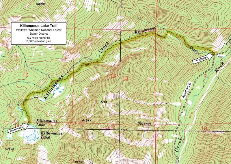
Killamacue Lake Trail
Hike Rating: Moderate
Hike Length: 6.4 miles roundtrip
Elevation Gain: 2,000’
Trailhead Elevation: 5,160’
Best Season: July through September
Driving Access: High-clearance vehicle,
with 4-wheel drive as insurance
Plus Points
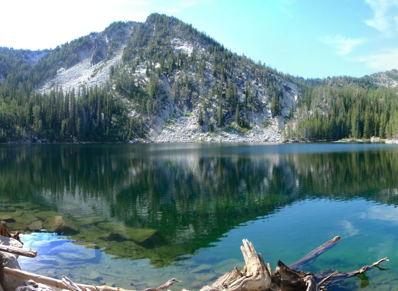
• Hike to a dazzling alpine lake set in a glacial cirque beneath vertical granite cliffs
• The Killamacue basin is rugged and pristine, free of roads, logging and grazing
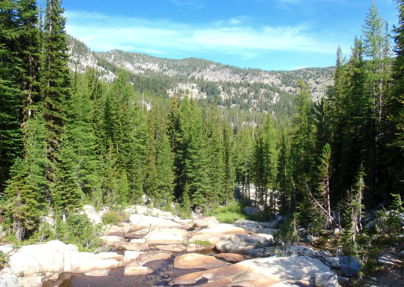
• Mature mixed forest of western larch, grand fir and lodgepole pine shade the trail
• Scenic granite outcrops and sheer palisades line the canyon sides
• Killamacue Creek runs year-round, with a delightful roar throughout the canyon
• Trail is mostly well-built, with good footbridges at every stream crossing
Minus Points
• Last 2 miles of access road is very rugged, challenging even for high-clearance vehicles
• Several sections of the trail are quite steep, but they are fairly short
• Lake is drawn down for irrigation as the summer progresses and may be dry by Fall
Download (PDF, 1.1 MB): Photos of Killamacue Lake Trail
Download (PDF, 689 KB): Topo Map for Killamacue Lake Trail
Download (PDF, 760 KB): Road Map for Killamacue Lake Trail
Trail Notes
Once above the box canyon, the trail continues gradually uphill for about 1.3 miles to a second stream crossing and footbridge, gaining almost 800'. This section of trail is over long granite benches through thick forests of big larch and grand fir, with a diverse understory that completes the primeval forest feel. At 2.2 miles, on the north side of the creek just past the second footbridge, the trail flattens out and skirts around a boggy meadow just visible through the trees. Look for signs of elk here on the meadow edges.
Road to Trailhead
From Hwy 30 in the town of Haines, turn west across the railroad tracks onto paved Rock Creek Road. Drive 5.5 miles west (past the old townsite of Rock Creek at Foothill Road), where the pavement soon ends. Continue west on the graveled section of Rock Creek Road for 2.2 miles, to where the gravel ends and the dirt, high-clearance road begins. Follow the high-clearance road (which becomes Road 5520 at the Forest boundary) for 2.0 miles to the unmarked trailhead —
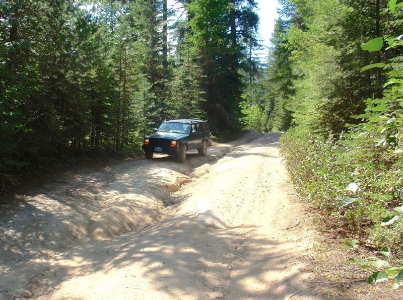
NOTE: The last 2 miles of Rock Creek Road (Road 5520) to the trailhead are deeply rutted and extremely rocky. When dry, it is just barely passable by a high-clearance vehicle using great care — and 4-wheel drive will be good backup insurance in this section.
Camping Options
The nearest developed camping area is the Pilcher Creek Reservoir Campground, about 12 miles west of the town of North Powder and 14.4 driving miles north of the trailhead. There are 17 sites here scattered along
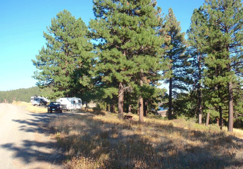
The reservoir is drawn down for irrigation as the summer progresses, but the campsites are mostly under big ponderosas on a bench above the lake, so the atmosphere is nice at any water level. Some sites have views west to the high Elkhorn Range.
Agency Contact: Wallowa-Whitman National Forest, Baker District, (541) 523-6391
DISCLAIMER: Every effort has been made to ensure the accuracy of this information, but the authors do not guarantee that it is either current or correct. The reader assumes full responsibility for any use of this information, and is encouraged to contact local public land agencies to inquire about current conditions before traveling.
Page last updated: 11/13/13