Less Traveled Northwest
Day Hikes for the Adventurous

La Grande Watershed Hike
Hike Rating: Easy
Hike Length: 6.2 miles roundtrip
Elevation Gain: 75’
Trailhead Elevation: 5,880’
Best Season: June through August
Driving Access: Any vehicle
Plus Points
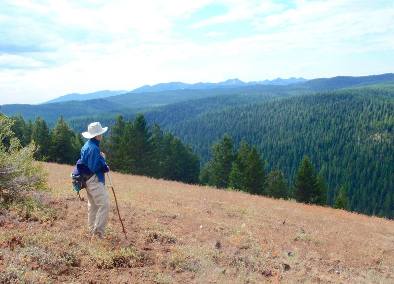
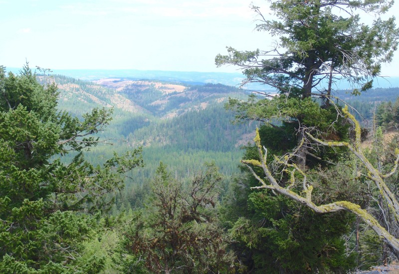
• Sweeping views of the Elkhorn Range and unspoiled forests from an 800'-high rim
• La Grande Watershed is a protected municipal water supply within the National Forest
• Old-growth grand fir forests that have never been logged, grazed or roaded
• Prime summer elk habitat, with potential for elk sightings if one is quiet and stealthy
• Wildflowers are abundant in Spring on the open "balds" within the thick forests
• Hiking is easy on the old forest roads and hunter-maintained trails
Minus Points
• Bow hunters flood the area in September, so hikers should go elsewhere this month
• The network of trails to the rim can be confusing, so basic route-finding skills needed
Download (PDF, 734 KB): Photos of La Grande Watershed Hike
Download (PDF, 842 KB): Topo Map for La Grande Watershed Hike
Download (GPX, 1 KB): GPS Points for La Grande Watershed Hike
Download (PDF, 559 KB): Road Map for La Grande Watershed Hike
Trail Notes
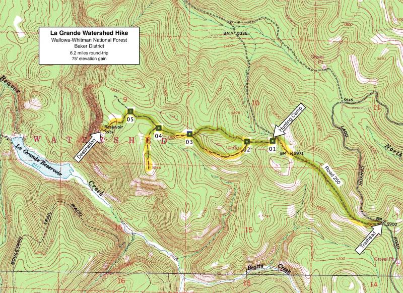
From this second trail junction, the trail continues west, up through an open bald, then into the thick fir forest. Start to look for elk sign here. At 2.4 miles, one reaches a third trail junction (GPS Point 4), with the option of branching left for a side trip up to the views at Promontory 5946 or forking right to continue to the main rim. Continuing to a fourth trail junction at 2.7 miles (GPS Point 5), one takes the left fork southwest through the trees and walks about 150 yards to a large open bald.
Road to Trailhead
Coming from the La Grande area to the north on Hwy 84, take Exit 270 onto Ladd Canyon Road. Drive southwest 4.3 miles to the Forest boundary, where it becomes Road 43. Continue on Road 43 for about 9 miles to the trailhead at Road 250 on the right (west).
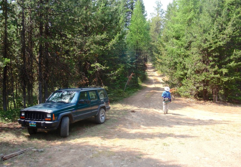
When dry, it's possible for high-clearance vehicles to drive on Road 250 for about 1.2 miles to the hunting camp, thus shortening the hike, but also reducing the potential for elk sightings.
Camping Options
Driving from the north on Ladd Canyon Road, once past the Forest boundary but before starting up the hill on Forest Road 43, there are dispersed camping sites at Ladd Canyon Pond and along Ladd Creek, all about 9 driving miles from the trailhead.
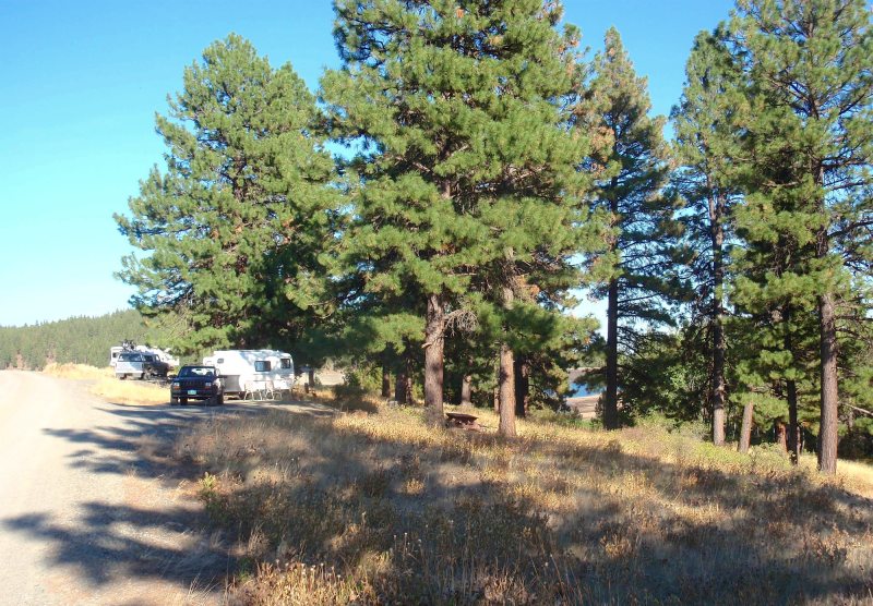
Driving from the south, there is a campground and boat ramp at Wolf Creek Reservoir, just off Wolf Creek Road about 12 driving miles from the trailhead. However, it appears this campground is no longer maintained, as the only functioning toilet is at the boat ramp. There's no drinking water, no fees, and not much to recommend this site. Further up Wolf Creek Road, just inside the Forest boundary at the bridge over Wolf Creek, are 2-3 dispersed sites for tents along the stream,
Further south, the nearest developed camping area is the Pilcher Creek Reservoir Campground, about 22 driving miles from the trailhead. There are 17 sites here scattered along both sides of an aspen-filled draw that drains into the reservoir. Any camping setup, from small tents to large motorhomes, can be accommodated. There are two vault toilets, a hand-pump drinking water spigot, garbage pickup and a volunteer camp host. This campground is managed by Union County and there is no fee.
Agency Contact: Wallowa-Whitman National Forest, Baker District, (541) 523-6391
DISCLAIMER: Every effort has been made to ensure the accuracy of this information, but the authors do not guarantee that it is either current or correct. The reader assumes full responsibility for any use of this information, and is encouraged to contact local public land agencies to inquire about current conditions before traveling.
Page last updated: 11/15/13