Less Traveled Northwest
Day Hikes for the Adventurous

North Fork John Day River Hike - West End
Hike Rating: Easy
Hike Length: 10.4 miles roundtrip (variable)
Elevation Gain: 200’
Trailhead Elevation: 3,280’
Best Season: June through September
Driving Access: Any vehicle, with care
Plus Points
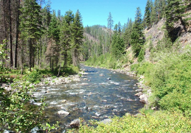
• Easy walk on a jeep road and trail along rugged North Fork John Day River canyon
• Last 1.6 miles is in Wilderness Area and entire route is designated wild-and-scenic
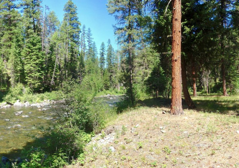
• Nice views of the rushing stream, long riffles and pools throughout the hike
• River canyon is cow-free, so meadows and grassy flats along stream are pristine
• Wildflowers into mid-summer, including mock orange, dogwood, lupine and goldenrod
• Many spots to rest and relax at streamside, so one has a choice of hike destinations
Minus Points
• Road along river is closed, but ATVs can access the first 2.3 miles of the hike
• Wilderness portion of trail is not cleared every year, so expect a few downed trees
• Rattlesnakes are a possibility throughout the summer, so be aware
Download (PDF, 864 KB): Photos of North Fork John Day Hike - West End
Download (PDF, 769 KB): Topo Map for North Fork John Day Hike - West End
Download (PDF, 910 KB): Road Map for North Fork John Day Hike - West End
Trail Notes
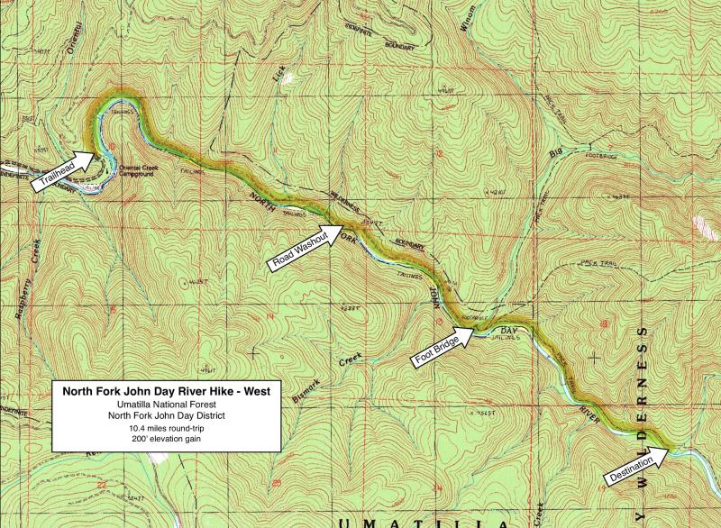
At 2.3 miles, flooding has washed out the roadbed, leaving a narrow trail that can only be negotiated by hikers, equestrians and a few intrepid ATVs. The road gradually deteriorates past the washout, becoming just a rocky track as it approaches the Wilderness boundary. At 3.6 miles, one comes to a wide, well-built footbridge over Big Creek, which marks the start of the Wilderness Area and the limit for motorized traffic.
Road to Trailhead
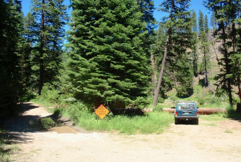
At this junction, look for Road 5506 continuing up the north bank of the river. Follow Road 5506 for about 7.4 miles, past the Oriental Creek Campground, to the "Road Closed" sign. The last 1.7 miles of Road 5506 to the trailhead is rocky, with a few protruding rocks in the road, so passenger cars need to use caution in this section.
Camping Options
There are three developed campgrounds on the road to the trailhead, each of which has a vault toilet (but no drinking water) and is suitable for tents or travel trailers up to about 25' long. The first is Tollbridge Campground (5 sites) just 1.5 miles from Hwy 395, then Driftwood Campground (6 sites) at 4.3 miles from the highway, and finally Gold Dredge Campground (7 sites) about 7.3 miles from Hwy 395. The fee at each campground was $8.00 per night in 2013. Gas and drinking water are available at the store in Dale.

For tent campers only: Just a few hundred yards south of the trailhead is the Oriental Creek Campground, with 8 campsites and 2 vault toilets, but no drinking water or trash pickup. This is a pleasant site on a thickly forested bench above the North Fork John Day River. Fees were $8.00 per night in 2013.
For dispersed campers: All along the 12 miles of access road leading to the trailhead are dispersed campsites near the river. In fact, there may be as many dispersed campsites as developed sites. Within the first 4 miles of Road 55 are several nice sites in grassy meadows along the river. At 4.8 miles, at the road junction at Texas Bar, there are large dispersed sites for anything from small tents to large RVs. Finally, along Road 5506, there are several dispersed sites below the road, all within about 7 miles of the trailhead.
Agency Contact: Umatilla National Forest, North Fork John Day District, (541) 427-3231
DISCLAIMER: Every effort has been made to ensure the accuracy of this information, but the authors do not guarantee that it is either current or correct. The reader assumes full responsibility for any use of this information, and is encouraged to contact local public land agencies to inquire about current conditions before traveling.
Page last updated: 11/18/13