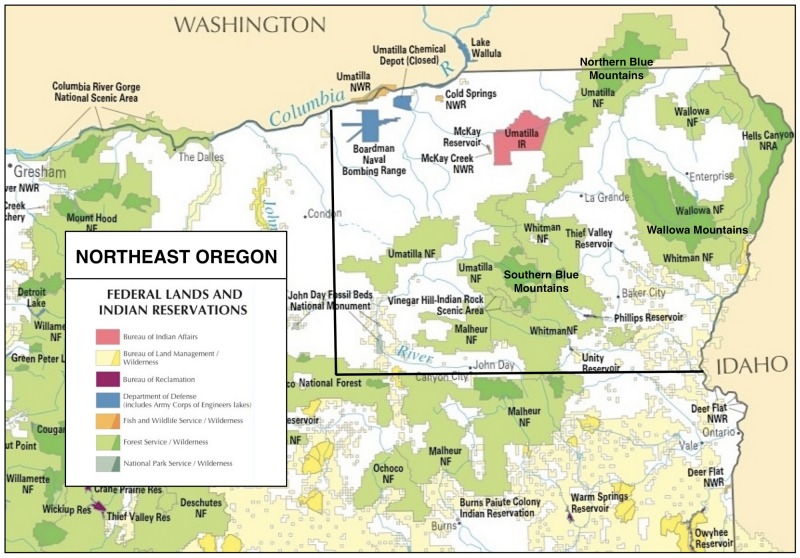
Northeast Oregon Hikes
Northeast
Oregon offers some of the most diverse landscapes for day
hiking in the entire Northwest. These range from the
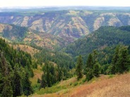
high-elevation, glaciated alpine valleys of the Wallowa and
Elkhorn Mountains to the lower-elevation, dry and treeless
canyons of the Snake and Grande Ronde Rivers. In between
are the forested lands of the Blue Mountains, which are a
mosaic of both moist and dry exposures. In all, there are
nearly 8,000 square miles of federal land in Northeast
Oregon, divided among the Malhuer, Umatilla and
Wallowa-Whitman National Forests, plus the Hells Canyon
National Recreation Area.
Unfortunately
for hikers, the majority of this public land is "well used"
and even abused, making it unsuitable for the quiet
enjoyment of day hikes amidst natural surroundings.
Subtracting out the areas that have been logged, those that
are intensively grazed, the historical mining districts,
the areas devoted to off-highway vehicles and the areas
that have burned, hikers seeking solitude and unspoiled
landscapes are left mostly with the five designated
Wilderness Areas, covering some 1,400 square miles (about
20% of the national forest land), plus a few roadless
areas.
Download
(PDF, 319 KB): Northeast Oregon Regional
Map
The good news
is that these five designated Wilderness Areas are among
the largest in Oregon. They include the Eagle Cap
Wilderness in the Wallowa Mountains (564 square miles), the
Hells Canyon Wilderness on the Snake River (336 square
miles), the Wenaha-Tucannon Wilderness (277 square miles)
and North Fork Umatilla Wilderness (32 square miles) in the
Northern Blue Mountains, and the North Fork John Day
Wilderness in the Southern Blue Mountains (190 square
miles).
But the peaceful enjoyment of remote day hikes is not
always assured even in the remaining wilderness and
roadless areas. Cattle grazing is still prevalent in some
of the wilderness areas of Northeast Oregon and motorcycles
(dirt bikes) are allowed in many of the roadless areas — so
day hiking destinations still need to be chosen with care.
> Hikes in the Southern Blue
Mountains
> Hikes in the Northern Blue
Mountains
> Hikes in the Hells Canyon
Area
> Hikes in the Wallowa
Mountains
NOTE: Since the Northern Blue Mountains extend only about
30 miles into Southeast Washington, for the sake of
simplicity we have included our few Washington Northern
Blues hikes here, within the Northeast Oregon geographic
region, rather than creating a separate Southeast
Washington web page for them.
To
locate hikes in Northeast Oregon, click on your area
of interest:
Page last updated:
11/15/13