Less Traveled Northwest
Day Hikes for the Adventurous

South Fork Desolation Creek Trail
Hike Rating: Moderate
Hike Length: 7.2 miles roundtrip (variable)
Elevation Gain: 635’
Trailhead Elevation: 5,380’
Best Season: June through September
Driving Access: Any vehicle
Plus Points
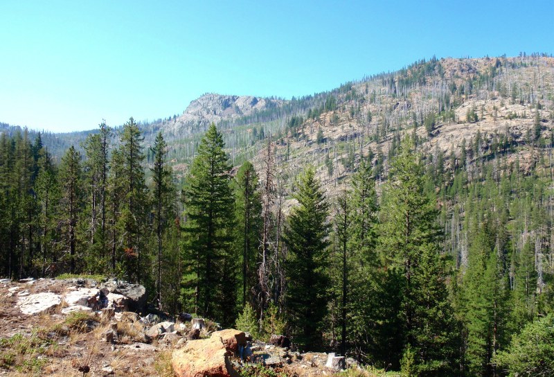
• A cow-free hike through pristine, unlogged forests in a U-shaped, glaciated canyon
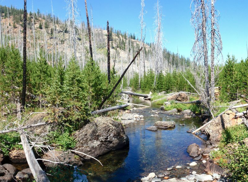
• South Fork Desolation Creek is a perennial stream, with strong flow into late summer
• Uncommon stands of Engelmann spruce at start and old-growth larch higher up
• Striking granite knobs, 300'-400' high, rise above the stream in mid-canyon
• Nice viewpoint with vistas of the rugged, rocky upper basin, which burned in 1996
• Excellent road access to the trailhead on good gravel roads
Minus Points
• Trail is poorly-graded in spots, climbing and descending for no apparent reason
• Trail is not maintained every year, so one may encounter a few deadfall trees
Download (PDF, 861 KB): Photos of South Fork Desolation Creek Trail
Download (PDF, 817 KB): Topo Map for South Fork Desolation Creek Trail
Download (PDF, 657 KB): Road Map for South Fork Desolation Creek Trail
Trail Notes
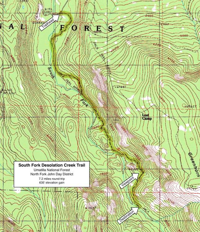
From the creekside flat, the trail climbs up the hillside away from the stream again, up around the granite knobs, until finally topping out above the knobs at 3.2 miles. Here one has panoramic vistas of Squaw Rock, Greenhorn Ridge and the upper basin to the south, all of which burned in the 1996 Summit Fire. The fire killed most of the trees in this upper basin, but it opened up the landscape for great views of the rugged and rocky terrain. Look for glacial polish and a few glacial erratics at this granite viewpoint.
Road to Trailhead
From Forest Road 10, about 6 driving miles west of the Olive Lake Campground, turn south onto Road 45 at an unsigned junction. Drive 1.0 miles south on Road 45 to the trailhead on the left, at a bulletin board flanked by pole fencing. This trailhead is easily accessible by any passenger car. A Northwest Forest Pass is required at the trailhead.
Camping Options
For dispersed camping, with one's own water and sanitation, there are several sites just 100 yards west of the trailhead, where Road 45 crosses South Fork Desolation Creek. Under large firs on the floodplain east of the creek, there are 2-3 sites with tables and fire rings that will accommodate most any camping setup, from small tents to large trailers.
Other dispersed sites can be found at Desolation Meadows, about 3 driving miles east of the trailhead on Road 10, near the old guard station. On spur roads north off Road 10 are camping spots in the trees, with other sites found south of Road 10, on spur roads leading into the big meadow. Be sure these spur roads are dry before driving off the gravel road.
Agency Contact: Umatilla National Forest, North Fork John Day District, (541) 427-3231
DISCLAIMER: Every effort has been made to ensure the accuracy of this information, but the authors do not guarantee that it is either current or correct. The reader assumes full responsibility for any use of this information, and is encouraged to contact local public land agencies to inquire about current conditions before traveling.
Page last updated: 11/18/13