Less Traveled Northwest
Day Hikes for the Adventurous

Squaw Creek Trail
Hike Rating: Moderate
Hike Length: 6.6 miles roundtrip
Elevation Gain: 1,900’
Trailhead Elevation: 5,770’
Best Season: June through September,
after Spring runoff has subsided
Driving Access: Any vehicle
Plus Points
• A hike up through a glaciated alpine valley to a grand wilderness overlook
• The trail is entirely within the Eagle Cap Wilderness Area and is cow-free
• Panoramic vistas over the Minam River valley to the Wallowa Range beyond
• Wet meadows, pristine mixed forests, plus scenic alpine ridges add to the appeal
• Wildflowers into late summer, including aster, paintbrush and pearly everlasting
• Solitude is nearly guaranteed on this little-used route into the mountains
Minus Points
• Trail has an inconsistent grade (steep, then level, then steep again, etc.)
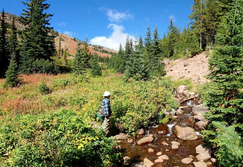
• The fording of Squaw Creek at 1.6 miles can be dangerous during Spring runoff
• Afternoon thunderstorms present a lightning hazard on the exposed high ridge
Download (PDF, 636 KB): Photos of Squaw Creek Trail
Download (PDF, 759 KB): Topo Map for Squaw Creek Trail
Download (PDF, 673 KB): Road Map for Squaw Creek Trail
Trail Notes
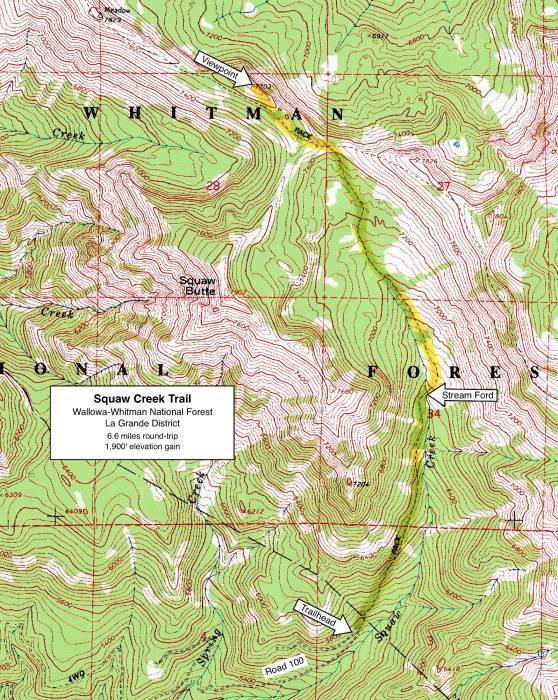
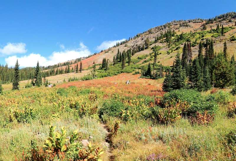
At 1.3 miles, the trail begins to enter the alpine zone, across dry meadows with lush Spring wildflowers and the first views of the high, rounded ridges above timberline to the north. The trail fords Squaw Creek at 1.6 miles, a calf-high torrent in late Spring and just a step-over brook by late Summer.
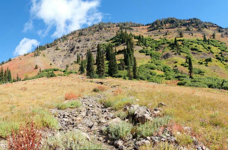
At 2.6 miles, the trail ascends steeply up toward the pass, which is soon gained after 350 yards of steady climbing. Once on top at 2.8 miles, one meets the east-west China Ridge Trail running across the grassy pass. For the best views, hike west (left) along this trail as it traverses long clearings and scattered trees,
Road to Trailhead
From Hwy 203, 2.9 miles east of Catherine Creek State Park and 2.7 miles west of Catherine Summit, turn east on Catherine Creek Lane (which becomes Road 7785 at the Forest boundary). Drive for 5.8 miles to a wide parking area on the right, where a bridge crosses North Fork Catherine Creek. Turn right (east) across this bridge on gravel Road 100 and drive east for 3.3 miles to where the road makes a very sharp switchback to the west. Park in the turnout on the switchback or just beyond it, taking care not to block the road or the turnaround for others. The unmarked Squaw Creek Trail starts about 75 yards west of the switchback, climbing the steep bank north off Road 100.
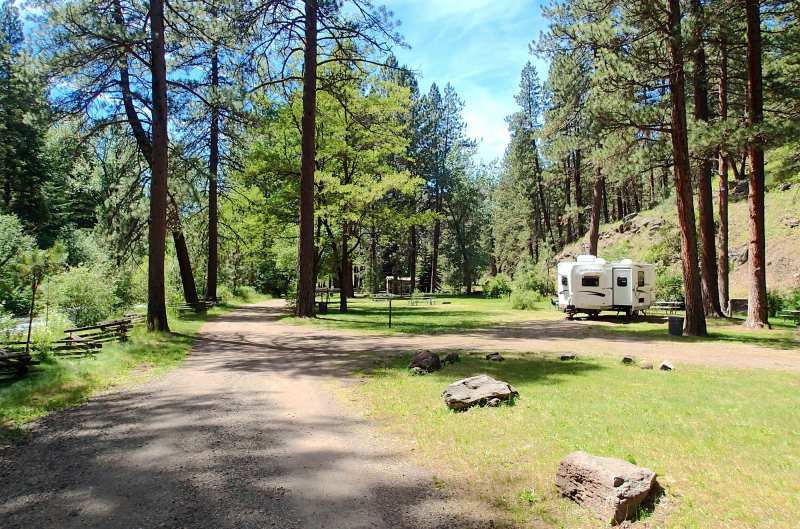
Camping Options
The nearest camping area is the North Fork Catherine Creek Campground at the end of Road 7785, about 3.5 driving miles from the trailhead. There are 7 basic campsites spread out over a mile between the Buck Creek turnoff and the road's end. These are pull off parking areas and small campsites along the road, which are suitable for tents, pickup campers or small travel trailers. Each site has a picnic table and fire ring, but there's no drinking water or camping fees. Several vault toilets are along Road 7785, including the group campground and the North Fork Catherine Creek Trailhead.
Agency Contact: Wallowa-Whitman Natl. Forest, La Grande District, (541) 963-7186
DISCLAIMER: Every effort has been made to ensure the accuracy of this information, but the authors do not guarantee that it is either current or correct. The reader assumes full responsibility for any use of this information, and is encouraged to contact local public land agencies to inquire about current conditions before traveling.
Page last updated: 12/10/14