Less Traveled Northwest
Day Hikes for the Adventurous

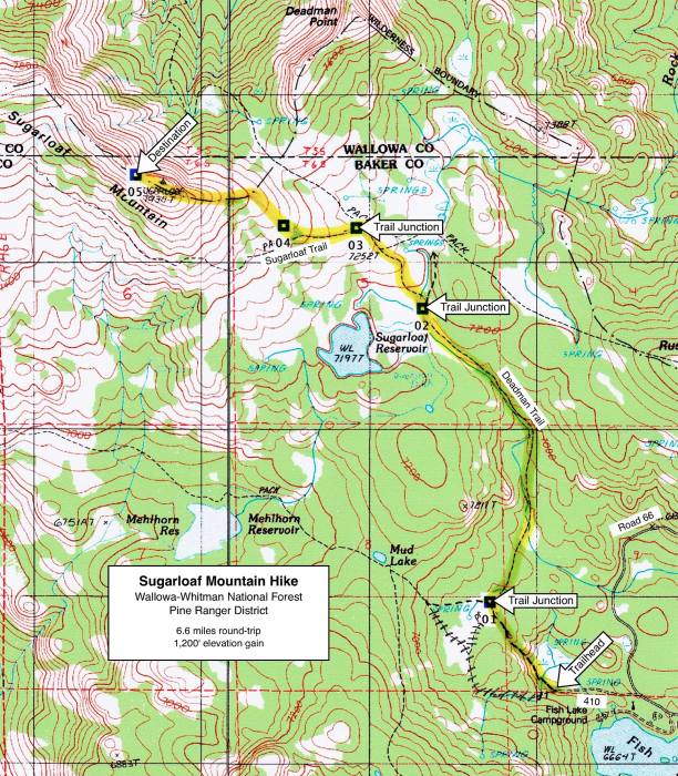
Sugarloaf Mountain Hike

Hike Rating: Easy
Hike Length: 6.6 miles roundtrip
Elevation Gain: 1,200’
Trailhead Elevation: 6,750’
Best Season: June through September,
once access road is snow-free
Driving Access: Any vehicle
Plus Points
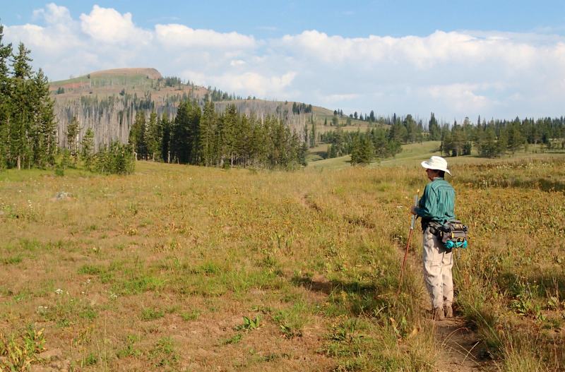
• A cross-country ramble up a broad alpine ridge to exceptional High Wallowa views
• The hike is outside the Wilderness Area, but ATVs and dirt bikes are prohibited
• Panoramic vistas over the Imnaha River valley of the entire alpine Wallowa skyline
• Spring wildflowers, including arnica, monkshead, monkeyflower and pearly everlasting
• A first hand look at a forest recovering from a stand replacement fire in 1995
• Solitude nearly guaranteed along the cross-country ridge hike to the summit
Minus Points
• Basic route-finding skills are required, as the trail system is faint and confusing
• Cows are present in the upper meadows, but not in overwhelming numbers
• Afternoon thunderstorms can be a lightning hazard on exposed ridge and summit
Download (PDF, 910 KB): Photos of Sugarloaf Mountain Hike
Download (PDF, 673 KB): Topo Map for Sugarloaf Mountain Hike
Download (GPX, 1 KB): GPS Points for Sugarloaf Mountain Hike
Download (PDF, 704 KB): Road Map for Sugarloaf Mountain Hike
Trail Notes
At 0.4 miles, one comes to a trail junction (GPS Point 1) and takes the right fork east, following the sign for the Deadman Trail. This trail soon descends into a long dry meadow, crosses Lake Creek (just a step-over stream by mid-summer), then begins a long gradual ascent up the east side of the creek. There are wet meadow wildflowers in this section that bloom into mid-summer, including yellow arnica, pink monkeyflower, purple monkshood and pearly everlasting.
Past the "Y", hiking along the broad ridge top, one comes to another trail junction at about 2.1 miles (GPS Point 3), marked by a large rock cairn and a trail sign. Take the left fork west, following the Sugarloaf Trail as it contours up across the broad hillside over bunchgrass and blue lupine. It's easy to lose the trail in this section, but if one keeps to the right (northeast) of the burned forest and keeps climbing the open hillside, the trail should soon reappear. At 2.5 miles, the Sugarloaf Trail reaches the top of the burned forest and starts to bend sharply to the west (GPS Point 4). Here, the route leaves the trail and starts northwest, cross-country up the ridge line toward the summit.

Road to Trailhead
From Halfway, OR, drive north 0.4 miles on the Cornucopia Hwy, then turn north on Fish Lake Road. Drive north on Fish Lake Road for 3.5 miles to the Clear Creek Road. Turn left (west) here and follow the Clear Creek Road (which turns into Road 66 at the Forest boundary) for 16.5 miles to Road 410 on the left (west). This turnoff is just north of the entrance to the Fish Lake Campground. Coming from the north on Road 39 (Wallowa Mtn. Loop Road), turn right (west) on Road 66 and follow it for 14.6 miles to Road 410.
Drive west on Road 410 for 0.3 miles to the Deadman Trailhead at road’s end. Road 410 is easily driven by any passenger car and there’s plenty of parking space at the trailhead.
Camping Options
There are a few tent camping sites right at the Deadman Trailhead, scattered among the trees overlooking the meadow. There's two big parking areas for trailers here, a few picnic tables and a vault toilet, but no drinking water. This trailhead gets a lot of stock use, so be prepared for stock campers, plus their horses and mules in the holding corrals.
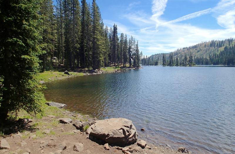
A quieter, less-developed camping area, suitable only for tents and small trailers, is the Twin Lakes Campground on Road 66 about 4 driving miles northeast of the trailhead. On a pine-covered knoll above several shallow lakes, there are 6 sites with picnic tables and fire rings. There's also a vault toilet, a boardwalk for fishing, but no drinking water or camping fees. This campground is minimally developed and appears little-used.
Agency Contact: Wallowa-Whitman Natl. Forest, Pine Ranger District, (541) 742-7511
DISCLAIMER: Every effort has been made to ensure the accuracy of this information, but the authors do not guarantee that it is either current or correct. The reader assumes full responsibility for any use of this information, and is encouraged to contact local public land agencies to inquire about current conditions before traveling.
Page last updated: 12/10/14