Less Traveled Northwest
Day Hikes for the Adventurous
Temperance Creek Trail
Hike Rating: Moderate
Hike Length: 5.6 miles roundtrip
Elevation Loss: 1,300’
Trailhead Elevation: 6,710’
Best Season: June through September,
once access road is snow-free
Driving Access: High-clearance vehicle
Plus Points
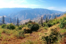
• Hike descends to mid-canyon viewpoints, with sweeping Hells Canyon vistas
• The trail is lightly used and entirely within the Hells Canyon Wilderness Area
• Panoramic views north to Somers Point and south to Hat Point and beyond
• Wildflowers form a thick carpet all along the trail into early August
• With binoculars, potential bighorn sheep sightings on the rocky benches below
• Trail is well-built on a good grade, with waterbars and over 30 switchbacks
Minus Points
• Trail is rarely maintained, so one can expect deadfall trees and overgrown brush
• Very little shade along the lower trail, so try to get an early AM start on hot days
• Afternoon thunderstorms present a lightning hazard on the exposed viewpoints
Download (PDF, 845 KB): Photos of Temperance Creek Trail
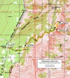
Download (PDF, 806 KB): Topo Map for Temperance Creek Trail
Download (GPX, 1 KB): GPS Points for Temperance Creek Trail
Download (PDF, 677 KB): Road Map for Temperance Creek Trail
Trail Notes
The unsigned Temperance Creek Trail starts due east behind the vault toilet and parking area at the Warnock Corral Trailhead. Within 50 yards, it enters the Wilderness, climbs a low hill and then gradually ascends through fir forests and open meadows toward the rim. Look for thick carpets of lupine, asters and other wildflowers on the open slopes into mid-August. At 0.4 miles, the trail crosses the rounded rim of Hells Canyon, with long views of the Seven Devils Range to the east in Idaho.
From the rim, the trail turns north and descends gradually to a trail junction at a large rock cairn at 0.6 miles (GPS Point 1). Bear right at this junction and follow the trail downhill through stands of douglas fir and across open slopes with Spring wildflowers (horsemint, mountain balm, paintbrush and aster) — which occur all the way to the destination. At about 1.0 miles, the trail leaves the scattered firs and begins a series of over 30 switchbacks down across the open hillside into the Temperance Creek watershed. All the standing timber here was killed in the 1989 Summit Fire, leaving silver snags and re-grown shrubs of maple, ninebark and willow.
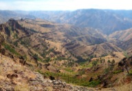
One advantage of these treeless slopes is spectacular views, up and down the Hells Canyon gorge and across to the eastern rim in Idaho. At 2.4 miles, the trail enters a green, brushy saddle with several big silver snags. Follow the trail through the saddle and then northeast down towards Temperance Creek to the first big trail switchback (GPS Point 2). From this switchback, the route is cross-country on game trails up across the hillside toward the dark, rocky viewpoints on the eastern skyline.
One has a choice of two viewpoints, Point 5691 back to the south, and Point 5641 further along the ridge to the north (GPS Point 3). Both require a steep scramble up their grassy backslope to their rocky points — but one is rewarded by breathtaking, panoramic vistas in all directions. The green Snake River is visible from both viewpoints, as well as the entire Idaho rim and the snow-capped Seven Devils Range to the southeast.
Road to Trailhead
From Hwy 82 in Joseph, OR, turn east on the Imnaha Highway and drive 29 miles on the paved road, down Little Sheep Creek, to the small hamlet of Imnaha. Following the sign for Hat Point, drive the good gravel Hat Point Road up the hill for 21.1 miles to a "Y", where the road to Hat Point branches off to the right.
At this "Y", bear left on gravel Road 4240 and drive for 4.1 miles to the Warnock Corral Trailhead, marked by a bulletin board, a vault toilet and a large parking area. The unsigned Temperance Creek Trail starts up the hill to the east, behind the parking area. A Northwest Forest Pass is required to park at this trailhead.
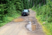
NOTE: The first 7 miles of the Hat Point Road past Imnaha are very steep (16% grade). The entire road is single lane, with turnouts, so camping trailers and RVs are not recommended. The last 2.5 miles of Road 4240 to Warnock Corral Trailhead are rocky and rutted, requiring a high-clearance vehicle.
Camping Options
The nearest developed campground is the Saddle Creek Campground, on the Hat Point Road 7.5 miles southwest of the trailhead. This has 7 walk-in sites for tent campers only, with a vault toilet, and each site has a picnic table and fire ring. There is no drinking water and no fees. Though the campground is on the well-used Hat Point Road, all the sites are along the edge of the Hells Canyon rim, with unbelievable views east over the deep gorge to the rugged Seven Devils Range across the Snake River in Idaho.
For tent campers with high-clearance vehicles, there are 2-3 campsites right at the Warnock Corral Trailhead, above the spring, which are somewhat protected from the cows by a log barrier. There's a picnic table here and a few grassy sites for tents, plus the vault toilet at the nearby trailhead — but the water from the spring is non-potable. A Northwest Forest Pass is required to stay at this recreation site.
Agency Contact: Hells Canyon National Recreation Area, (541) 426-5546
DISCLAIMER: Every effort has been made to ensure the accuracy of this information, but the authors do not guarantee that it is either current or correct. The reader assumes full responsibility for any use of this information, and is encouraged to contact local public land agencies to inquire about current conditions before traveling.
Page last updated: 12/10/14


