Steens Mountain Area Hikes
Steens
Mountain has become the premier recreation destination in
Southeast Oregon. Not only has the loop road to the summit
been recently improved, but land exchanges have
consolidated public ownership into nearly 500,000 acres of
protected BLM land — including 175,000 acres of designated
wilderness (100,000 acres now cow-free) and over 100 miles
of designated wild-and-scenic rivers. With several nice
campgrounds and established hiking trails, it’s not hard to
see the attraction. Gas and groceries are available nearby
in Frenchglen on the west side of the range and at Fields
Station on the east side.
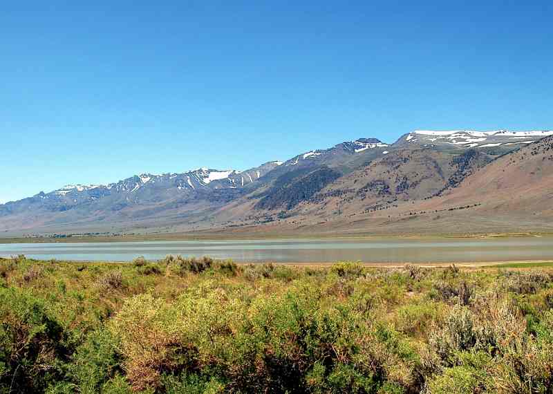
This 50-mile
long, north-south mountain range was created 5-7 million
years ago by faulting and uplift along its eastern edge,
raising the massive basalt block 5,000’ above the Alvord
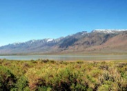
Basin to the east. The Ice Age then brought glaciers,
gouging out several 2,000’-deep, U-shaped canyons. The High
Steens escarpment — over 9,000’ high, often snow-covered
and rising sharply above the arid, alkaline Alvord Desert —
provides some of the most dramatic scenery in Oregon. Along
with this higher elevation comes higher precipitation,
averaging over 40 inches per year at the summit, and
spawning numerous rivers and streams flowing into the
desert below.
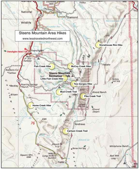
Download
(PDF, 581 KB): Location Map of Steens Mountain Area
Hikes
Download
(PDF, 582 KB): Photos of Steens Mountain
Area
With over 150,000 visitors per year, Steens Mountain has
become one of the few desert hiking areas where solitude is
not guaranteed. Most hikers and equestrians frequent the
established trails in the two big glaciated river canyons,
Little Blitzen Gorge and Big Indian Gorge, plus the alpine
hike down into Wildhorse Lake. From 40 to 60 groups per
month use these trails in summer and they are definitely
worth visiting.
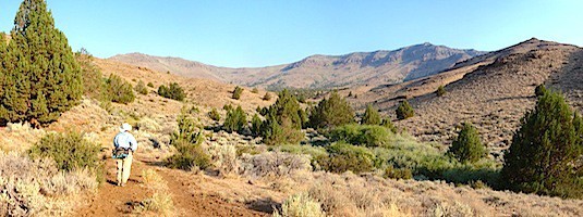
For those day hikers seeking more solitude and a wilderness
experience, however, there are many canyons and trails in
peripheral areas of the Steens that are equally appealing.
West
Side, Lower Elevation Hikes
Due to land
exchanges, a cow free, 3.5-mile day hike is now possible
along an abandoned jeep road into ill-named Mud Creek,
where perennial springs create a green desert oasis.
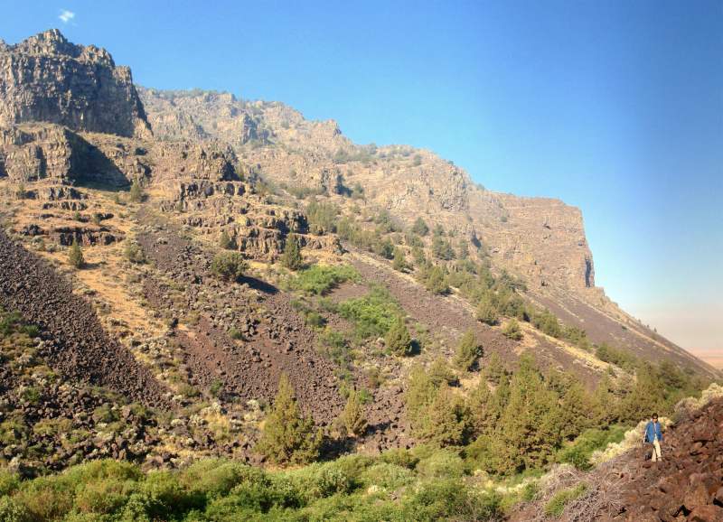
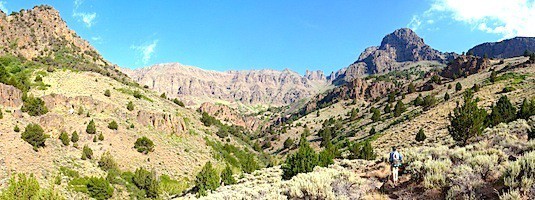
Further south, dramatic basalt palisades rise more than
1,000’ in rugged and seldom-visited Home Creek, draining
the Catlow Rim portion of the Steens Wilderness. Finally,
we feature a route into hard-to-access Fish Creek, dropping
through a basalt-rimmed side canyon to the perennial,
willow-lined stream below the rimrock.
> Mud Creek
Trail
> Home Creek
Hike
> Fish Creek
Hike
West
Side, Higher Elevation Hikes
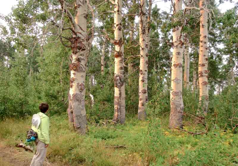
Once the
upper snow gates on the Steens Mtn. Loop Road open in
mid-summer, several higher elevation day hikes become
accessible. Our Little Fish Creek hike features old-growth
aspen groves, beaver dams, historical cabins and a sweeping
gorge overlook. The hike into the McCoy Creek canyon,
though a bit rugged, offers a close-up view of a glaciated,
U-shaped valley and an excellent chance for solitude.
Finally, just off the Loop Road at almost 9,000’, we
feature a cross-country hike that visits the rims of two
spectacular gorges, both Big Indian and Little Blitzen, in
one easy day hike.
> Little Fish Creek
Hike
> McCoy Creek
Hike
> Two Gorges
Hike
East
Side Hikes
Land
exchanges have now made possible a 3.7-mile day hike up an
old road into Carlson Creek, in the Andrews Rim portion of
the Steens Wilderness. Further north, a newly built trail
in the upper Pike Creek canyon makes this stunning,
mid-elevation wilderness much more accessible for day
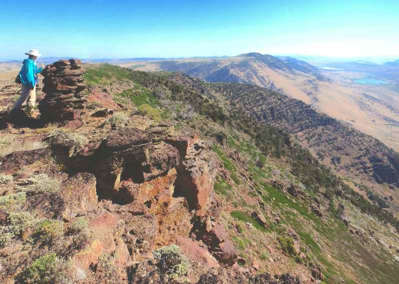
hiking. Finally, for those willing to drive the steep,
4-wheel drive road up Stonehouse Canyon, a spectacular 3
mile cross-country ramble can be enjoyed along the
6,500’-high Stonehouse Rim, with sweeping views of the High
Steens escarpment and the Alvord Valley below.
> Carlson Creek
Trail
> Pike Creek
Trail
> Stonehouse Rim
Hike
Clickable
map of Steens Mountain area hikes:

Page last updated:
1/15/13

