Less Traveled Northwest
Day Hikes for the Adventurous

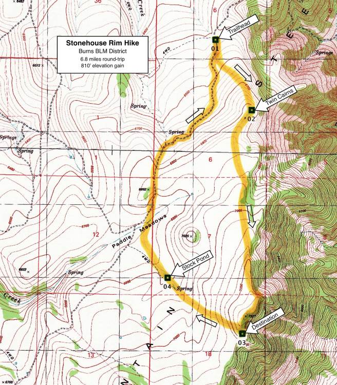
Stonehouse Rim Hike
Hike Rating: Easy
Hike Length: 6.8 miles roundtrip
Elevation Gain: 810’
Trailhead Elevation: 6,520’
Best Season: June through September
Driving Access: 4-wheel drive vehicle,
after upper access road is snow-free
Plus Points
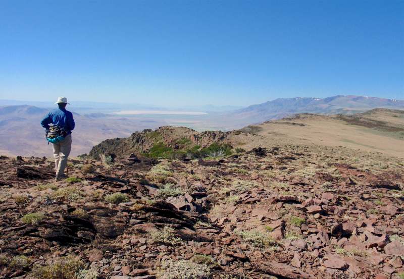
• A cross-country hike along a 7,000'-high rim with panoramic views of the Alvord Basin
• This part of the rim is within the Lower Stonehouse Wilderness Study Area
• Wildflowers at their peak by mid-July, including bush lupine, paintbrush and asters
• Many raptors seen soaring along the rim, including red-tails, harriers and kestrels
• Large herds of antelope on the sage steppe and bunchgrass flats behind the rim
• Solitude is almost guaranteed in this rarely-visited spot
Minus Points
• Steep, rocky access road up Stonehouse Canyon requires a 4-wheel drive vehicle
• No trail, but hiking is easy through the low sage scrub along the rim
• Afternoon thunderstorms can present a lightning hazard along the rim
Download (PDF, 516 KB): Photos of Stonehouse Rim Hike
Download (PDF, 769 KB): Topo Map for Stonehouse Rim Hike
Download (GPX, 4 KB): GPS Points for Stonehouse Rim Hike
Download (PDF, 772 KB): Road Map for Stonehouse Rim Hike
Trail Notes
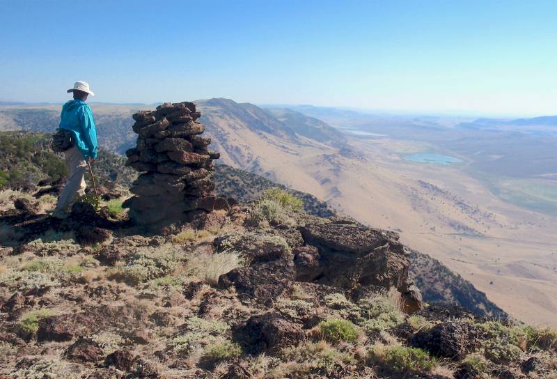
From these twin cairns, the route follows the rim south to other viewpoints and overlooks. The easiest walking is over the low sage scrub and bunchgrass below the rock fields right at the edge of the rim, but above the large sagebrush further downhill.
Road to Trailhead
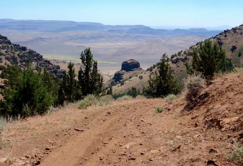
Be forewarned: The road up Stonehouse Canyon is a steep, rocky track, climbing over 2,400' in 4.5 miles — and is passable ONLY by 4-wheel drive vehicles. 4-wheel drive is only needed in a few short steep sections, where the road surface is loose rock, but you won’t make it to the rim without it. In the first mile, the roadbed is the worst, with deeply eroded ruts and exposed rocks. Higher up in the canyon, the road narrows and becomes much steeper, but the road surface itself actually improves as one ascends the canyon.
Camping Options

Agency Contact: Burns BLM District, (541) 573-4411
DISCLAIMER: Every effort has been made to ensure the accuracy of this information, but the authors do not guarantee that it is either current or correct. The reader assumes full responsibility for any use of this information, and is encouraged to contact local federal land agencies to inquire about current conditions before traveling.
Page last updated: 1/17/13