Less Traveled Northwest
Day Hikes for the Adventurous

Three Forks Hike
Hike Rating: Moderate
Hike Length: 4.2 miles roundtrip
Elevation Gain: 50’
Trailhead Elevation: 3,780’
Best Season: September, when days are
cooler and river levels are lower
Driving Access: High-clearance vehicle
Plus Points
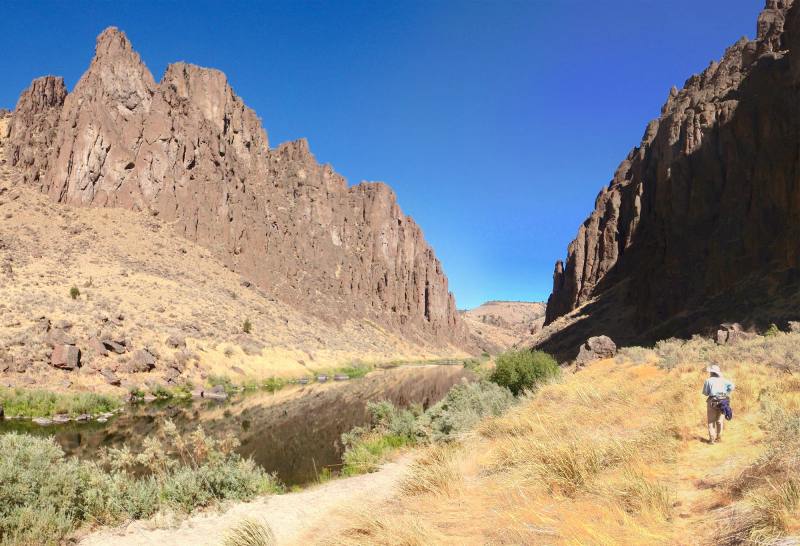
• Spectacular, 500'-high rhyolite cliffs and spires flank a placid blue-green river
• The mainstem Owyhee is designated as a Wild-and-Scenic River
• Three Forks is an historical river crossing, used by Native Americans and early pioneers
• The hiking is easy along the remains of an old military wagon road from the late 1800s
• Osprey, golden eagles and red-tailed hawks can be spotted soaring overhead
• Natural warm spring pools at the hike's end offer an enticing destination
Minus Points
• The final 1.4 miles of the access road is passable by high-clearance vehicles only
• Two knee-deep river crossings are required to complete the hike
• Rattlesnakes are a possibility throughout the summer, so caution is advised
• Solitude is not guaranteed, as campers and 4-wheelers frequently use the area
Download (PDF, 512 KB): Photos of Three Forks Hike
Download (PDF, 756 KB): Topo Map for Three Forks Hike
Download (PDF, 613 KB): Road Map for Three Forks Hike
Trail Notes

Once you reach the big sagebrush at the foot of the slope, about 100 yards from the river ford, you're on the old military wagon road and you'll find a prominent trail heading west into the canyon. The hike then follows this trail west, past an old wire fence and through big sagebrush to the edge of the main Owhyee River. For the next 1.3 miles, the trail is on the old military wagon road, built over stone embankments on the west and south side of the river, as it passes beneath dramatic, 500'-high cliffs of colorful rhyolite.

Follow the wagon road south through the burned area for about 0.3 miles until you arrive at Warm Springs Creek. Here, below the road, are a series of natural rock pools above a 10' waterfall with 95 degree water that is ideal for soaking your feet or body. Beware of poison oak here. It's also possible to have company at these warm pools as 4-wheel enthusiasts sometimes drive to the area just across the river. Return as you came.
Road to Trailhead
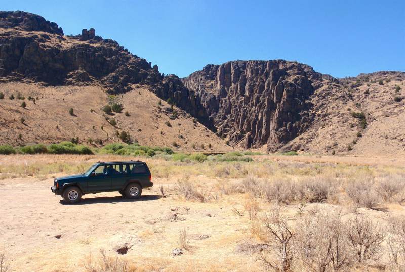
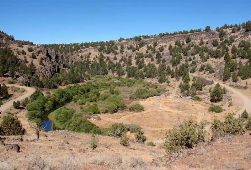
Drive about 2.7 miles further, staying on the primary route, until you come to a stock corral on the edge of the rim overlooking Three Forks. Those with low-clearance vehicles will need to park here and walk the 1.4 miles down to the trailhead, 900' below. High-clearance vehicles can navigate the steep, rocky track down to the river.
Camping Options
For tent campers with high-clearance vehicles: It's possible to camp right at Three Forks, either around the large flat parking area just west of the toilet building, or amidst willows near the confluence of the North Fork Owyhee and the mainstem Owyhee River. There is no drinking water or trash pickup at Three Forks, but there is the public toilet.
Agency Contact: Vale BLM District, (541) 473-3144
DISCLAIMER: Every effort has been made to ensure the accuracy of this information, but the authors do not guarantee that it is either current or correct. The reader assumes full responsibility for any use of this information, and is encouraged to contact local federal land agencies to inquire about current conditions before traveling.
Page last updated: 1/18/13