Less Traveled Northwest
Day Hikes for the Adventurous

Hoodoo Canyon Trail
Hike Rating: Easy
Hike Length: 6.2 miles roundtrip
Elevation Change: 850’
Trailhead Elevation: 2,920’
Best Season: May to September
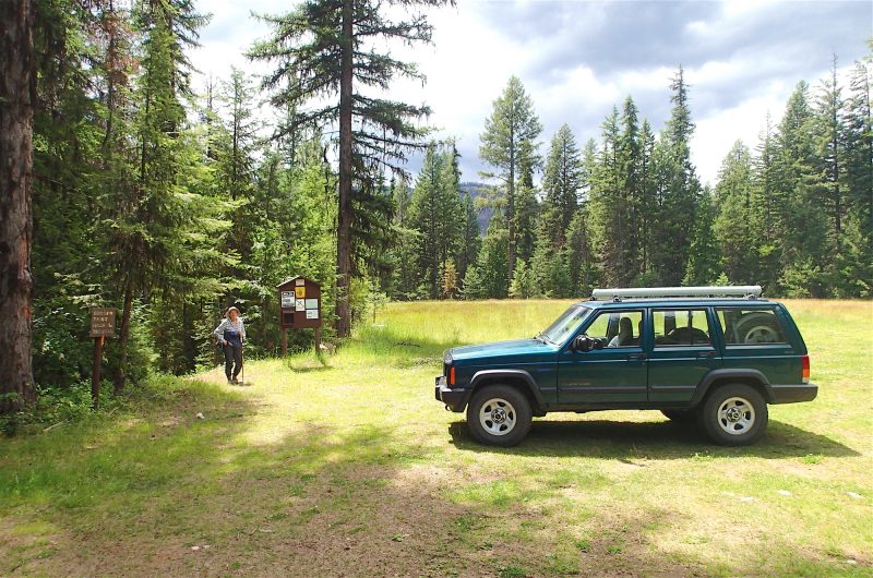
Driving Access: Any vehicle
Plus Points
• A diverse hike, up through deep forest and down across granite benches to a small lake
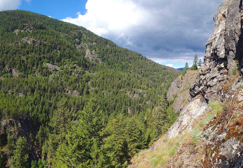
• Wide views of granite outcrops and escarpments above a deeply-cut, glaciated canyon
• Thick forests of cedar and fir, with an understory of maple, ironwood and thimbleberry
• Wildflowers in spring, including buckhorn clarkia, larkspur, paintbrush, aster and yarrow
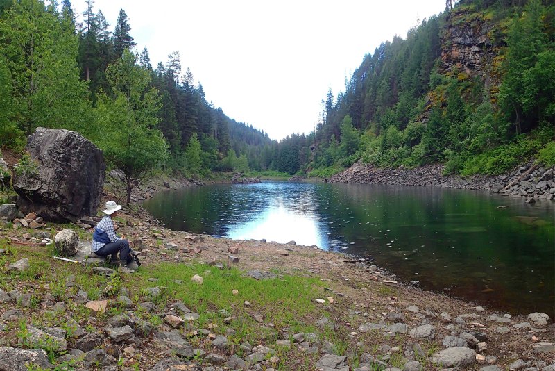
• An attractive hike destination at charming Emerald Lake, set below sheer granite cliffs
Minus Points
• Trail has an inconsistent grade — e.g., steep, then flat or down, then up steeply again
• Water levels in Emerald Lake fluctuate with the season, so may be low late in the year
• Mosquitoes can be bothersome, so be sure to pack insect repellent
Download (PDF, 901 KB): Photos of Hoodoo Canyon Trail
Download (PDF, 705 KB): Topo Map for Hoodoo Canyon Trail
Download (PDF, 718 KB): Road Map for Hoodoo Canyon Trail
Trail Notes
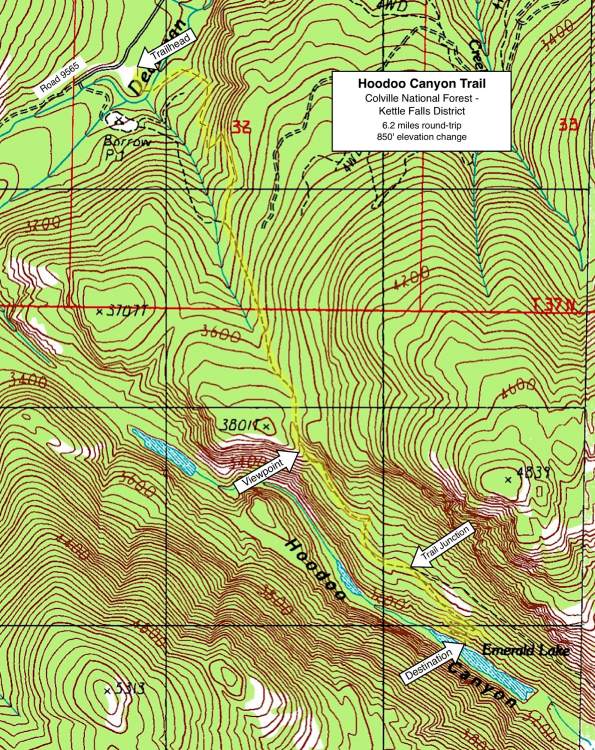
At 1.8 miles, in a small saddle thick with maple, the trail crosses over the crest of the ridge and begins its descent east down into Hoodoo Canyon. About 250 yards past the saddle crest, a wide granite bench opens on the right (west), providing a spectacular viewpoint within 25 yards of the trail. The views are mainly southwest to the granite outcrops and ledges across the canyon on Coyote Mountain, but also deep into the canyon below, to the ponds and marshes on the valley floor.
Road to Trailhead
From Hwy 395, about 6 miles north of Kettle Falls and 200 yards south of the Kettle River Campground turnoff, turn west onto Deadman Creek Road (eventually Forest Road 9565). Follow this road for 8.6 miles, bearing left on the main gravel road at each unsigned junction. Look for a wide grass meadow on the south side of Road 9565 and the trailhead sign and parking area in the meadow.
Camping Options
To the east down Deadman Canyon, the nearest developed camping area is the National Park Service's Kettle River Campground, set amid ponderosa pines on a narrow arm of Roosevelt Lake, just off Hwy 395 about 6 miles north of Kettle Falls, WA. There are 13 first-come, first-served campsites here, each with a picnic table and fire grill, which will accommodate any camping setup from large travel trailers to tents. Two vault toilets are available, but no drinking water. Camping fees were $18.00 per night in 2016.

Finally, for those campers entirely self-contained with their own water and sanitation, a few dispersed campsites are found along Deadman Creek Road (Forest Road 9565) within 2 miles east of the trailhead, on USFS lands along Deadman Creek. There's also plenty of room for dispersed camping right in the trailhead meadow and parking area, but not much privacy to be found.
Agency Contact: Colville National Forest, Kettle Falls District, (509) 738-7700
DISCLAIMER: Every effort has been made to ensure the accuracy of this information, but the authors do not guarantee that it is either current or correct. The reader assumes full responsibility for any use of this information, and is encouraged to contact local public land agencies to inquire about current conditions before traveling.
Page last updated: 2/1/17