Less Traveled Northwest
Day Hikes for the Adventurous

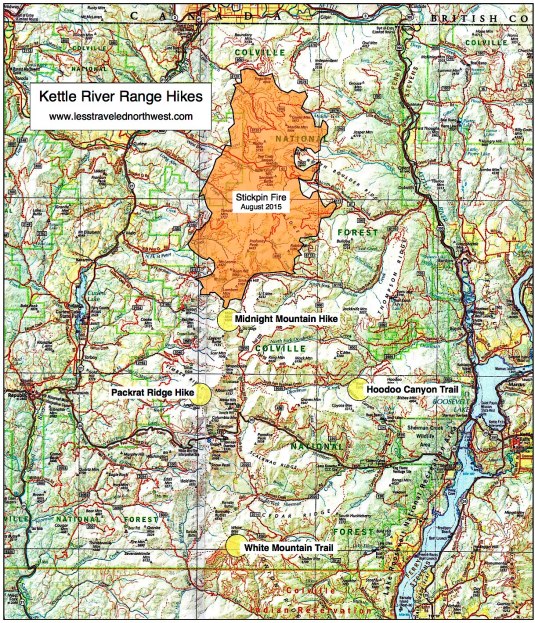
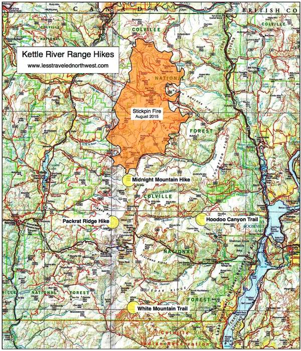
Kettle River Range Hikes
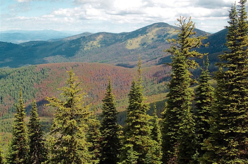
Formed by intrusive granite 50 to 70 million years ago, the Kettle Range was ground down by the continental ice sheet during the last Ice Age — leaving the smooth, rounded topography seen today, with just a few peaks over 7,000’. Though covered with a climax forest of douglas fir,
Download (PDF, 989 KB): Location Map of Kettle Range Hikes
Download (PDF, 818 KB): Photos of the Kettle River Range
Because State Hwy 20 crosses at mid-range over Sherman Pass, adjacent trailheads can be relatively busy, especially on summer weekends. With easy access to the Kettle Crest Trail and nearby tracks, this pass area is now heavily-used by mountain bikers and is a good place to avoid if seeking hiking solitude. Since the northern half of the range recently burned in the massive Stickpin Fire of August 2015, we’ve focused our day hikes on those other parts of the range still relatively pristine and less-visited.

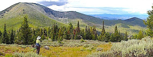
The four day hikes we’ve selected offer a good sampling of the Kettle Range, from its deep glaciated canyons to its high alpine ridges. The 3.4-mile (one way) White Mountain Trail offers perhaps the most outstanding views in the range from its alpine meadows and 6,920’ summit. The easy Hoodoo Canyon Trail climbs through uncut firs and cedars to a low pass, then descends to Emerald Lake at 3.1 miles. Both the Packrat Ridge Hike (3.3 miles one-way) and the Midnight Mountain Hike (3.0 miles) follow developed trails at first, then climb cross-country to high ridges with panoramic vistas.
> White Mountain Trail
> Hoodoo Canyon Trail
> Packrat Ridge Hike
> Midnight Mountain Hike