Less Traveled Northwest
Day Hikes for the Adventurous

Midnight Mountain Hike

Hike Rating: Moderate
Hike Length: 6.1 miles roundtrip
Elevation Gain: 1,220’
Trailhead Elevation: 5,450’
Best Season: May to September
Driving Access: Any vehicle, with care
Plus Points
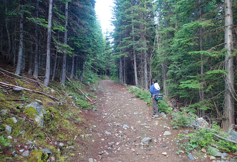
• First, an easy hike to the Kettle Crest on the historical Old Stage Road, built in 1892
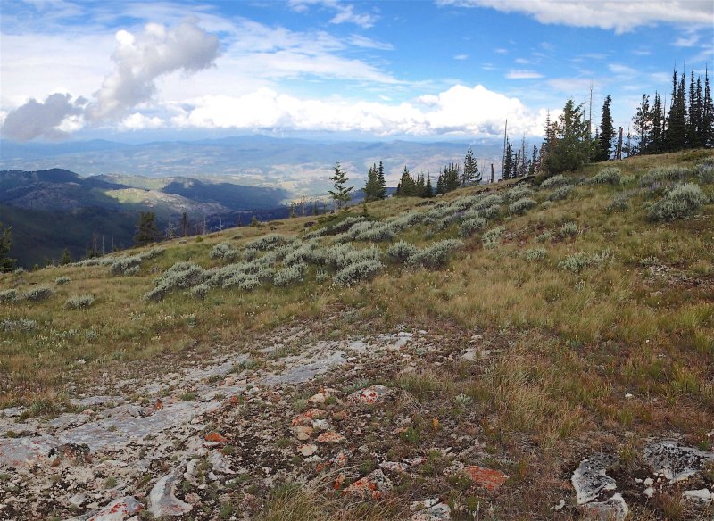
• Next, a cross-country ramble up a broad, grassy ridge to panoramic summit vistas
• On the way, lodgepole and fir forests in various stage of regeneration from old fires
• High alpine meadows thick with wildflowers in mid-summer, prominently blue lupine
• Long summit views west to the Okanogan Highlands and east to the Selkirk Mountains
• Solitude is almost guaranteed on the cross-country route up to the summit ridge
Minus Points
• Cows may be found in the high meadows late in the season (August/September)
• Afternoon thunderstorms can present a lightning hazard on the exposed ridge line
• A few mountain bikers or equestrians might be encountered on the Old Stage Road
Download (PDF, 794 KB): Photos of Midnight Mountain Hike
Download (PDF, 691 KB): Topo Map for Midnight Mountain Hike
Download (GPX, 2 KB): GPS Points for Midnight Mountain Hike
Download (PDF, 697 KB): Road Map for Midnight Mountain Hike
Trail Notes
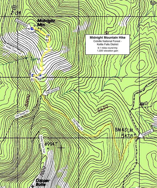
From the saddle on the Kettle Crest at 1.7 miles, one follows the Kettle Crest Trail north for 450 yards, to where the doghair lodgepole pine and downed, fire-killed trees first give way to alpine meadow (GPS Point 1). If you reach a "Kettle Crest Trail #13" sign next to the trail, you've gone 30 yards too far! The route leaves the crest trail here and climbs steeply cross-country due east up the grassy hillside, switchbacking across the alpine meadows amid scattered downed trees, toward the ridge top above.
Road to Trailhead
From Sherman Pass, drive 4.1 miles east on Highway 20, then turn left (north) onto signed Albian Hill Road (Forest Road 2030) at a sharp, horseshoe bend in the highway. From the east, this turnoff is about 22 miles from the junction of Hwys 20 & 395. Follow Road 2030 for 7.1 miles north to the signed Old Stage Road Trailhead on the left (west). Though rough in spots, Road 2030 is passable by any passenger car, with care.
Camping Options
The nearest developed camping areas are found along Albian Hill Road (Road 2030) at the Jungle Hill and Wapaloosie Trailheads. Jungle Hill has 10-12 campsites spread out for a half-mile past the turnoff to the trailhead, with room for large RVs and travel trailers
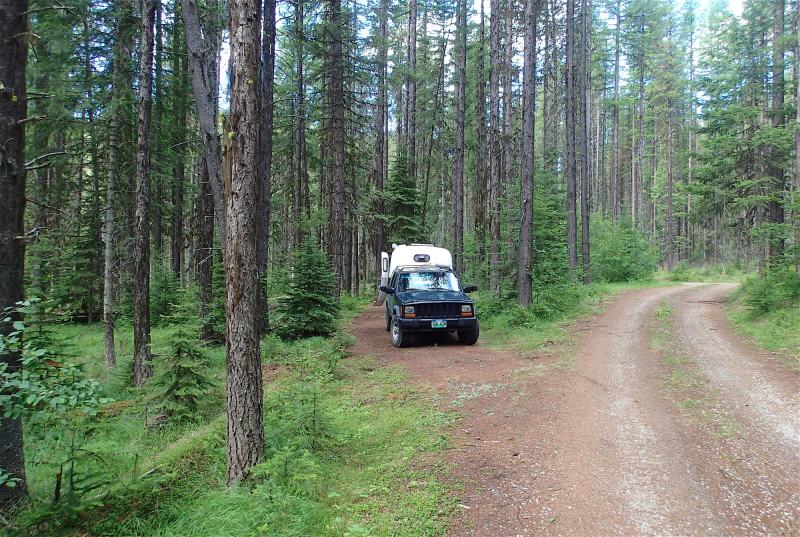
Also, there are 2-3 camping sites right at the Old Stage Road Trailhead, but without much privacy. It has a vault toilet and a couple of picnic tables nearby, but no drinking water or fees. Finally, one option could be the USFS Sherman Overlook Campground on Hwy 20, one mile east of Sherman Pass and about 10 driving miles from the trailhead. It has 10 campsites, vault toilets and drinking water, but it's been closed during the 2013-16 seasons, due to hazard trees. Check with the USFS Kettle Falls Office for updates.
Agency Contact: Colville National Forest, Kettle Falls District, (509) 738-7700
DISCLAIMER: Every effort has been made to ensure the accuracy of this information, but the authors do not guarantee that it is either current or correct. The reader assumes full responsibility for any use of this information, and is encouraged to contact local public land agencies to inquire about current conditions before traveling.
Page last updated: 2/1/17