Less Traveled Northwest
Day Hikes for the Adventurous

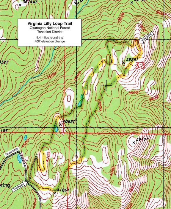
Virginia Lilly Loop Trail
Hike Rating: Easy
Hike Length: 4.4 miles roundtrip
Elevation Change: 400’
Trailhead Elevation: 4,025’
Best Season: May to September
Driving Access: Any vehicle
Plus Points
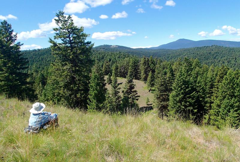
• A view and forest hike that provides a good introduction to the Okanogan Highlands
• Panoramic vistas of the Kettle River Range, Buckhorn Mountain and Mount Bonaparte
• Old-growth fir, larch and ponderosa pine in stands that have never been logged
• Spring wildflowers include lupine, twinflower, prairie smoke and nootka rose
• Overlooks the Bodie Mtn. mining district and ghost town of Bodie, dating from 1888
• A seldom-visited trail, where one can enjoy solitude and a sense of quiet and peace
Minus Points
• The trail is faint in places, so one often has to explore and look around for it
• Trail maintenance seems infrequent and blown-down trees are common
• The trail follows the up and down contours of the land, with few switchbacks
• Lots of cow activity along the trail later in the season, after about July 1
Download (PDF, 660 KB): Photos of Virginia Lilly Trail
Download (PDF, 688 KB): Topo Map for Virginia Lilly Trail
Download (PDF, 619 KB): Road Map for Virginia Lilly Trail
Trail Notes
Over the next 0.8 miles, the trail drops 280' in elevation down across a series of forested benches, through stands of uncut douglas fir and western larch with a grass understory. Several prominent cow trails contour off in this section, but one wants to stick to the main descending trail, following the occasional trail markers.
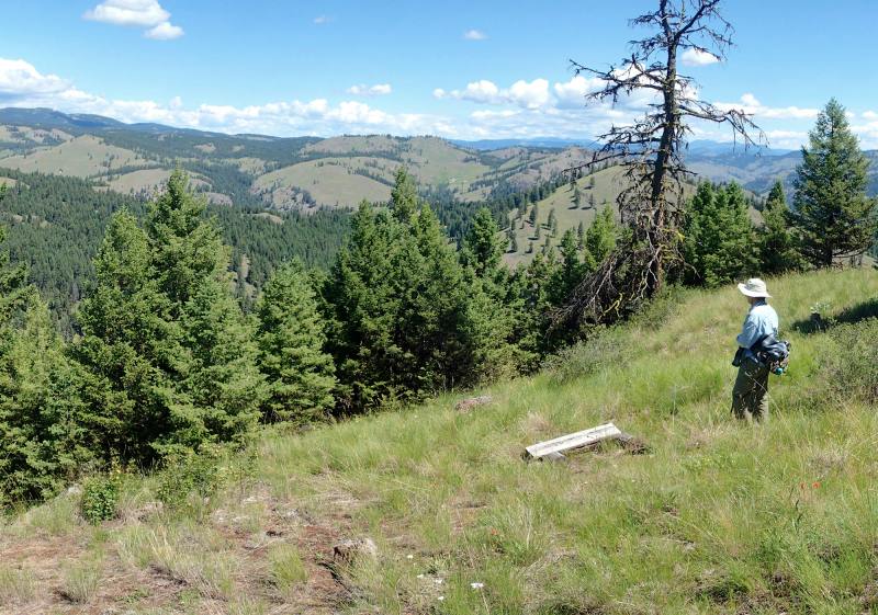
From the viewpoint, the trail loops down around the end of the ridge and descends west onto thickly-forested benches with big firs and larches. Soon the trail again becomes faint and is obscured by blown-down trees in a grassy draw — and here one wants to avoid the easy cow trail going up the draw, and instead climb up onto the rounded ridge to the west to find the official trail. Once on the ridge trail, it climbs gradually southwest along the crest, through big old-growth ponderosas and firs.
As the trail ascends the forested ridge, it passes through a rebuilt section (with switchbacks!), then emerges on top of the last open, rocky knoll at 4.0 miles, with vistas east to Bodie Mountain and the mine buildings high on its south flank. As the trail goes south along the grassy ridge top, it's easy to lose it in the thick bunchgrass — and one should look for a grey, faded trail sign on a post near the south end of the ridge. From this post, the trail descends west and south around the end of the ridge, dropping down to a dirt road and the old trailhead. From here, it's an easy walk downhill along the old road for about 350 yards to the new trailhead and parking area.
Road to Trailhead
From the south on Hwy 20, turn north on County Road 4953 and drive 6.9 miles north to the signed turnoff for gravel Road 3240 on the right (east).
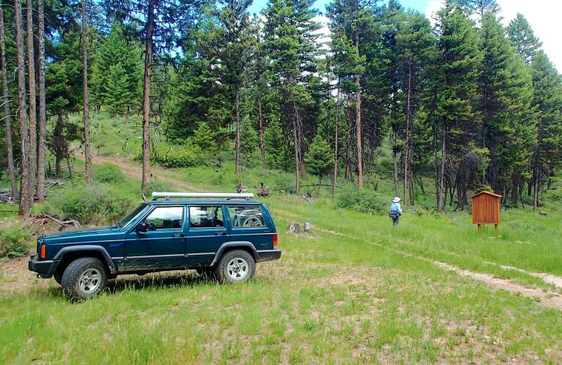
Drive gravel Road 3240 for 1.0 miles to a "Y", then take the left fork, following the sign for the Virginia Lilly Trail. Past the "Y", drive 5.6 miles on a good gravel road to the signed trailhead on the left. There's a new parking area and a trailhead sign just off Road 3240, accessible by any passenger car. One can also walk or drive uphill to the north on a rough dirt road to the old trailhead, to start a clockwise loop hike.
Camping Options
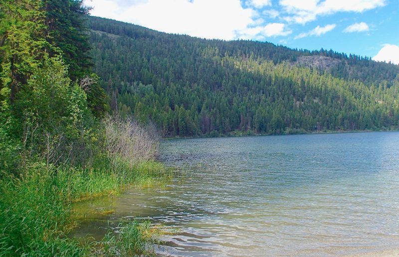
The nearest developed campground is the USFS Bonaparte Lake Campground, about 8 driving miles from the trailhead. This is a heavily-used campground, especially on weekends, with 28 campsites ranging from small tent sites to large RV spaces.
Also nearby are the less-used USFS Beaver Lake and Beth Lake Campgrounds, about 12 driving miles northwest of the trailhead on the paved Chesaw Road. Beaver Lake CG has 9 campsites for tents or small travel trailers on a small forested loop road, with drinking water and a vault toilet. Beth Lake CG, just a mile away, has 16 campsites spread out over 3 forested loop roads, with 3 vault toilets, drinking water, and a garbage dumpster. Fees in summer 2015 were $8.00 per night at both campgrounds.
Agency Contact: Okanogan National Forest, Tonasket District, (509) 486-2186
DISCLAIMER: Every effort has been made to ensure the accuracy of this information, but the authors do not guarantee that it is either current or correct. The reader assumes full responsibility for any use of this information, and is encouraged to contact local public land agencies to inquire about current conditions before traveling.
Page last updated: 11/1/15