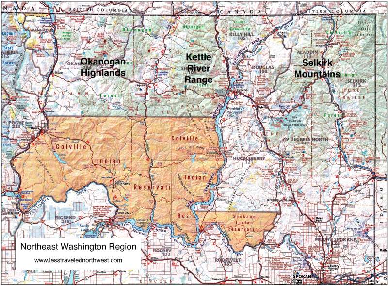
Northeast Washington Hikes
Hikers are
few and far between in the remote mountain ranges
stretching north from the Columbia Basin to Canada and east
from the Okanogan River to Idaho, often called the
"forgotten corner" of the Inland Northwest. The three
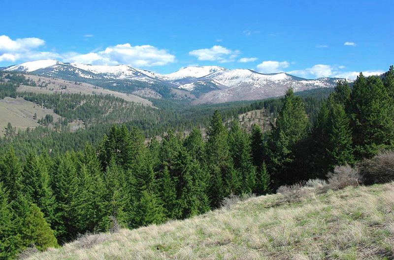
rounded and forested mountain ranges found here — the
Okanogan Highlands, the Kettle River Range and the Selkirk
Mountains — all have summits barely exceeding 7,000'. But
what these mountains lack in height and alpine scenery,
they more than make up for in biological diversity and a
sense of remoteness and solitude. It's not uncommon to have
trails entirely to oneself here, and camping sites are
plentiful, even on the most popular summer weekends.
Considered
western foothills of the Rockies, these ranges offer a
diverse gradient of habitats. The Okanogan Highlands in the
west, with less than 20 inches of rain per year, have open
forests of ponderosa pine and expanses of sagebrush on dry
southern slopes. In contrast, the Selkirk Mountains in the
east, with over 60 inches of rain, feature moisture-laden
forests of red cedar, hemlock, white pine and yew. In
between, the Kettle River Range is a transition zone.
Wildfire is also a dominant force on this landscape,
creating successional forests of lodgepole pine and larch,
but also open expanses that have never recovered. This
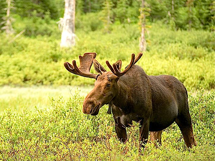
diversity of habitats supports a remarkable array of fauna,
from mule deer in the drier west to moose, mountain caribou
and grizzly bears in the wetter east, with elk and bighorn
sheep in transition zones between.
Download (PDF, 500 KB): Northeast Washington Regional
Map
The Forest
Service manages over 1,500 square miles of public land in
this corner of Northeast Washington, but only about 65
square miles, or 4%, are formally protected as wilderness
(the Salmo-Priest Wilderness in the Selkirks). In the
unprotected areas, industrial-scale logging, including
clear cutting, has been widespread from the 1950s to the
1990s. What's left today in the way of unspoiled wildlands
are a collection of semi-primitive, non-motorized Roadless
Areas (RAs), ranging from 5,000 to 30,000 acres, which are
currently administered as "backcounty" by the USFS. Nearly
all of these RAs are on remote mountain ridges and peaks,
forming small islands of pristine habitat and natural
landscape amid the heavily logged areas. The good news is
that most of these RAs feature developed hiking trails,
with trailheads accessible by long drives on the remnant
logging roads.
> Hikes in the Okanogan
Highlands
> Hikes in the Kettle River
Range
> Hikes in the Selkirk
Mountains
 Page last updated:
10/30/15
Page last updated:
10/30/15