Less Traveled Northwest
Day Hikes for the Adventurous

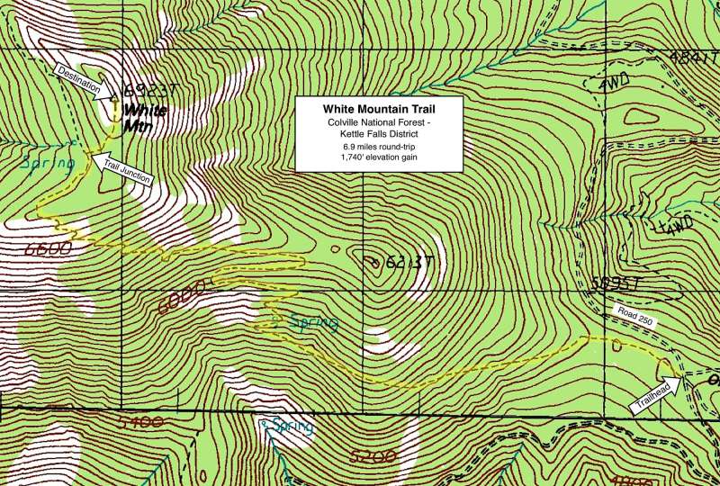
White Mountain Trail

Hike Rating: Moderate
Hike Length: 6.9 miles roundtrip
Elevation Gain: 1,740’
Trailhead Elevation: 5,190’
Best Season: May to September
Driving Access: Any vehicle, with care
Plus Points
• A premier view hike, with panoramic vistas over the southern Kettle River Range
• Variety of landscapes, from fir forests to rocky talus slopes to high alpine meadows
• Carpets of wildflowers in early summer — lupine, paintbrush, larkspur and buckwheat
• Picturesque silver snags in the high meadows, still recovering from a 1988 wildfire
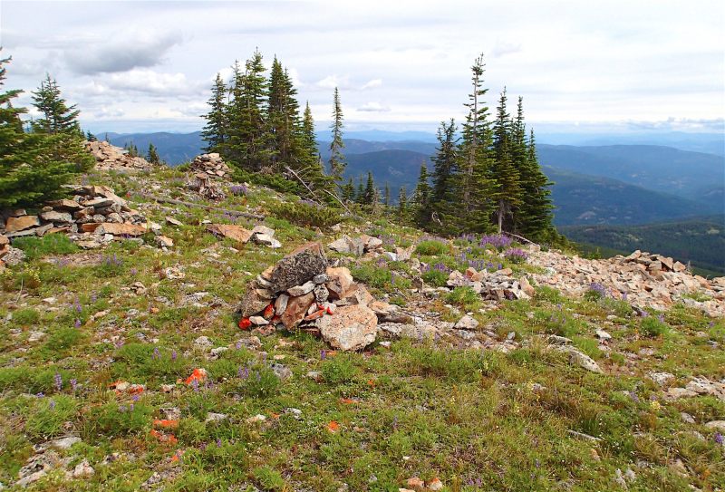
• A sacred mountain to Native Americans, with vision quest cairns along summit ridge
• A very well-built trail on a good grade, though seemingly not heavily-traveled
Minus Points
• Not much shade on the upper slopes, so try to get to an early AM start on hot days
• Afternoon thunderstorms may be a lightning hazard on exposed slopes and ridges
Download (PDF, 772 KB): Photos of White Mountain Trail
Download (PDF, 766 KB): Topo Map for White Mountain Trail
Download (PDF, 618 KB): Road Map for White Mountain Trail
Trail Notes
Well to the west around the mountain, the trail begins a series of switchbacks up a fir-covered slope, between the wide talus fields on the mountain's south face. Blue lupine form carpets in the grassy understory here in early July. Look for a sign to a piped spring a few yards off the trail on one of the east switchbacks. At 1.9 miles and 6,000', the trail leaves the fir-covered slope and begins a long traverse across open alpine meadows and white granite talus. Prominent here are silver snags killed in the 1988 fire, plus profusions of sun-loving wildflowers such as paintbrush, buckwheat, phlox and yarrow.
Road to Trailhead
From the junction of Hwy 395 and Hwy 20 west of Kettle Falls, drive west on Hwy 20 for 10.3 miles and turn left (south) onto South Fork Sherman Creek Road (Forest Road 2020). Coming from the west, this good gravel road is also accessible off of Hwy 20 at 3.6 miles east of Sherman Pass.

Camping Options
On the east side of the Kettle Range, about 14 miles from the trailhead, are two secluded USFS campgrounds at Lake Ellen, located at each end of the 75-acre lake. The east campground has 11 sites, suitable for tents and small camping trailers, with picnic tables, fire rings and tent pads. The west campground has 5 small campsites, plus a fishing dock and boat ramp. Both campgrounds have vault toilets, but no drinking water or garbage disposal. Camping fees were $6.00 a night in 2016.
Just east of Sherman Pass on Highway 20, about 17 miles from the trailhead, the USFS Sherman Overlook Campground has been closed for the 2013-16 seasons, due to hazard trees. However, less formal, but still developed campsites are found nearby to the north on the Albian Hill Road (Forest Road 2030) at the Jungle Hill and Wapaloosie Trailheads. Both of these sites have a vault toilet, but no drinking water and no camping fees.
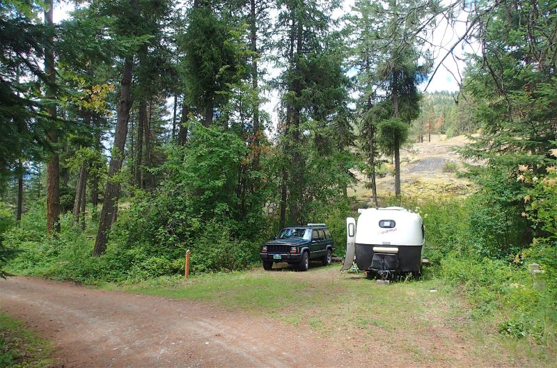
Finally, for those campers entirely self-contained with their own water and sanitation, it's possible to camp right in the large parking area at the White Mountain Trailhead. There's plenty of room for camping setups of all sizes, from large trailers to small tents.
Agency Contact: Colville National Forest, Kettle Falls District, (509) 738-7700
DISCLAIMER: Every effort has been made to ensure the accuracy of this information, but the authors do not guarantee that it is either current or correct. The reader assumes full responsibility for any use of this information, and is encouraged to contact local public land agencies to inquire about current conditions before traveling.
Page last updated: 2/1/17