Less Traveled Northwest
Day Hikes for the Adventurous

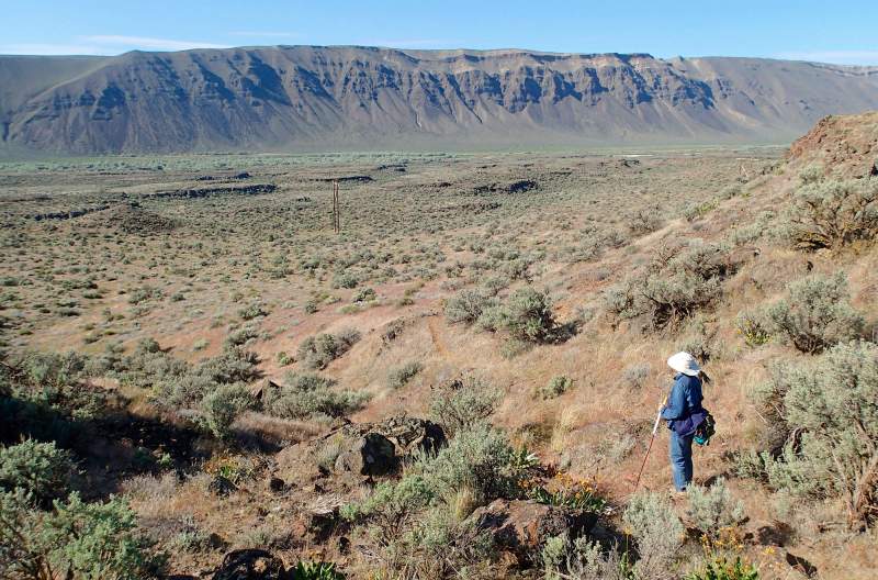
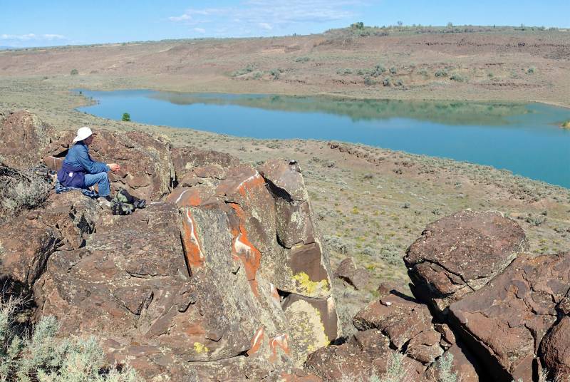
Dry Island Hike
NOTE: The Dry Island Hike and environs burned in the 243 Command Fire of June 2019. It may be a few years before this area recovers for recreational use.
Hike Rating: Easy
Hike Length: 6.2 miles roundtrip
Elevation Gain: 440’
Trailhead Elevation: 560’
Best Season: April-June and September
Driving Access: Any vehicle
Plus Points
• A diverse desert hike with marshes, basalt buttes, sage steppe and rimrock views
• Panoramic vistas of Saddle Mountain range, Lower Crab Creek and Jericho coulees
• Marshes along Crab Creek support many wetland waterfowl and songbird species
• Spring wildflowers include balsamroot, purple sage, phlox and evening primrose
• Little sign of recent cow activity, though old cow trails make easy hiking routes
• A sense of peace and solitude in this quiet, little-visited corner of SE Washington
Minus Points
• No established trail, so good route finding skills and our GPS points will be helpful
• Mosquitoes can be bothersome at Crab Creek and pothole ponds, so bring repellent
• Very little shade or cover on this hike, so plan to start in the early AM on hot days
• Rattlesnakes are a possibility throughout the summer, so be alert
Download (PDF, 812 KB): Photos of Dry Island Hike
Download (PDF, 606 KB): Topo Map for Dry Island Hike
Download (GPX, 1 KB): GPS Points for Dry Island Hike
Download (PDF, 691 KB): Road Map for Dry Island Hike
Trail Notes
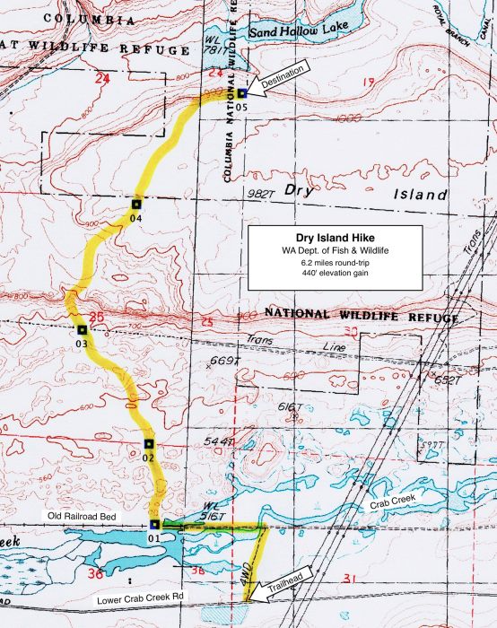
At 0.7 miles, where the marsh ends on the north and the first rock outcrops appear (GPS Point 1), turn off the railroad bed and start north cross-country through the sagebrush. Within 100 yards, one comes to grassy channels with willow trees winding among the basalt buttes. The easiest hiking is along these channels bottoms, following old cow trails north between the buttes. There's no correct route, but a prominent draw at 1.2 miles (GPS Point 2) offers easy access up toward Dry Island.

At 2.4 miles (GPS Point 4), one reaches the highest plateau of Dry Island, where the route continues northeast through the sage steppe toward the north rim.
Road to Trailhead
From the north on State Hwy 26, 1.5 miles east of Royal City and 6.3 miles west of Hwy 262, turn south on Road E SW (aka Red Rock Coulee Road). Drive south for 3.7 miles to a "T". Bear right (west) onto Lower Crab Creek Rd and drive 6.9 miles, past the end of the pavement, to a large, salt flat parking area on the left (south).
From the west on State Hwy 243, turn east onto the Beverly/Crab Creek Road, just south of a huge railroad trestle bridge. Drive 9.2 miles east, past the Beverly Dunes ORV Area, to the large, salt flat parking area on the right (south) side of the road.
From the parking area, cross the road and start the hike north on a jeep track, heading toward the railroad trestles at Crab Creek. A WA State Discover Pass is required here.
Camping Options
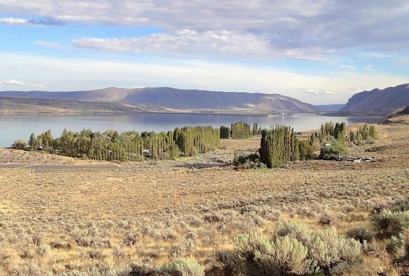
The nearest full-service campground is Ginkgo-Wanapum State Park on the west bank of Wanapum Lake on the Columbia River, 3 miles south of the Vantage I-90 Bridge and about 21 driving miles
Another full-service campground is Potholes State Park, about 30 driving miles northeast of the trailhead. This is a large campground with 126 sites, 60 with full hookups for travel trailers and RVs, and 66 more primitive sites for tent and car camping. It features drinking water, flush toilets, coin-operated showers and boat ramps into Potholes Reservoir. Reservations are available April 15 through September 15 and are highly recommended for the summer months. Visit the WA State Parks website or call (888) 226-7688. Camping fees are based on the type of campsite selected.
Finally, there are 5-6 primitive campsites at Beverly Dunes ORV Area, just 7 miles west of the trailhead on Lower Crab Creek Road. This campground has portable toilets and a few picnic tables with fire rings, but no drinking water. A WA State Discover Pass is required.
Agency Contact: Washington Dept. of Fish & Wildlife, (509) 765-6641
DISCLAIMER: Every effort has been made to ensure the accuracy of this information, but the authors do not guarantee that it is either current or correct. The reader assumes full responsibility for any use of this information, and is encouraged to contact local public land agencies to inquire about current conditions before traveling.
Page last updated: 12/8/14