Less Traveled Northwest
Day Hikes for the Adventurous

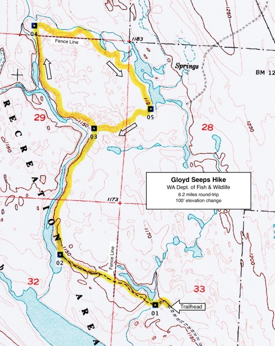
Gloyd Seeps Hike

Hike Rating: Easy
Hike Length: 6.2 miles roundtrip
Elevation Change: 100’
Trailhead Elevation: 1,150’
Best Season: April-June and early September
Driving Access: Any vehicle
Plus Points
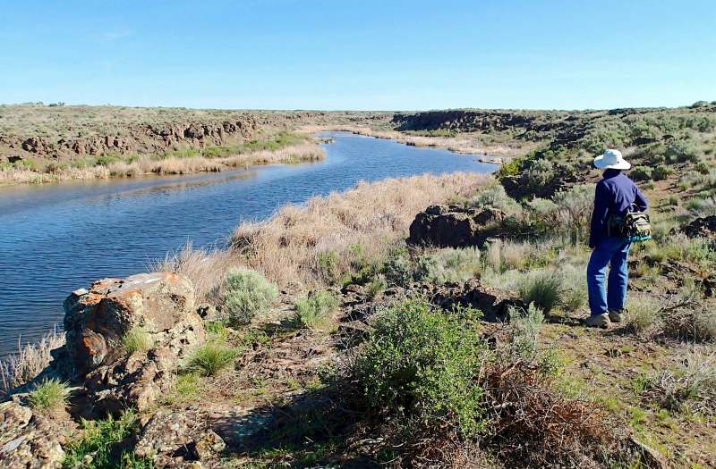
• An easy ramble on game trails past wetlands, lakes and streams in a desert setting
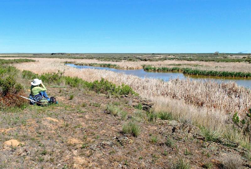
• Abundant birdlife, including ducks, geese, herons, egrets, avocets and white pelicans
• Low basalt bluffs along marshes and streams provide views down into the wetlands
• Spring wildflowers include purple larkspur, phlox, yarrow and yellow mountain dandelion
• Very little sign of recent cow activity on the trails or in the marshes
• A strong sense of desert solitude, despite the irrigated farmlands just a few miles away
Minus Points
• Basic route-finding and orienteering skills required, as there's no established trail
• Very little shade or cover, so it's best to start in the early AM on hot days
• Rattlesnakes are a possibility throughout the summer, so be aware
• Waterfowl hunting season is from late September thru January — a good time to avoid
Download (PDF, 785 KB): Photos of Gloyd Seeps Hike
Download (PDF, 431 KB): Topo Map for Gloyd Seeps Hike
Download (GPX, 1 KB): GPS Points for Gloyd Seeps Hike
Download (PDF, 675 KB): Road Map for Gloyd Seeps Hike
Trail Notes
Walk north along the lake shore, finding a good game trail on the low basalt bluffs overlooking the lake. Look for waterfowl, herons and egrets and even white pelicans on this lake. Past the end of the lake, the route continues north along an old channel of Crab Creek, above a free-flowing stream in the bottom of the coulee. At 1.9 miles, the route crosses a prominent draw coming in the from the east (GPS Point 3). Look for mule deer among the willow tree thickets down in the coulee.
At 3.4 miles, the big cattail marshes of Gloyd Seeps come into view, with numerous waterfowl. The route continues southeast, keeping above the prickly saltbush thickets on the marsh edges. At 4.0 miles, one arrives at open-water,
Road to Trailhead
From State Hwy 28 on the north, 10.3 miles east of Soap Lake, WA, or 7 miles west of Wilson Creek, turn south into the small hamlet of Stratford and look for Road J NE. South of town, near the big grain elevators, this road turns into Stratford Road. Drive 11.5 miles south on Stratford Road and turn right (west) onto Road 12 NE. From State Hwy 17 on the south, just north of Moses Lake, turn north on Stratford Rd. and go 8.6 miles, then turn left (west) on Road 12 NE.
Drive west on Road 12 NE for 1.4 miles, beyond the end of the asphalt, and follow it as it bends northwest for 0.5 miles of gravel road to the trailhead. A WA State Discover Pass is required at this trailhead.
Camping Options
A much smaller, no-frills, no-fee alternative is the BLM Pacific Lake/Lakeview Ranch Campground, about 45 driving miles east of the trailhead, north of Odessa on the Lakeview Ranch Loop Road. Here, northeast of the old Lakeview Ranch buildings and corrals, on a flat bench above now dry Pacific Lake, are a vault toilet and gravel parking areas suitable for travel trailers. A grassy area with a few shade trees, plus tables and fire rings, serves tent campers and picnickers. There is no potable water here, but drinking water jugs can be filled at the City Park in downtown Odessa.
Campsites are also available at two private campgrounds in Soap Lake, WA, about 24 driving miles northwest of the trailhead on State Route 17.
Agency Contact: Washington Dept. of Fish & Wildlife, (509) 765-6641
DISCLAIMER: Every effort has been made to ensure the accuracy of this information, but the authors do not guarantee that it is either current or correct. The reader assumes full responsibility for any use of this information, and is encouraged to contact local public land agencies to inquire about current conditions before traveling.
Page last updated: 12/8/14