Less Traveled Northwest
Day Hikes for the Adventurous

Lake Creek Coulee Hike
Hike Rating: Moderate
Hike Length: 4.8 miles roundtrip
Elevation Loss: 400’
Trailhead Elevation: 1,840’
Best Season: April-May and September
Driving Access: Any vehicle
Plus Points
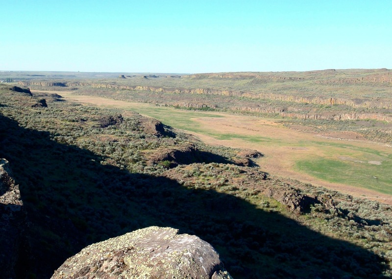
• A scenic cross-country hike along the coulee rim, returning on the dry lake bed
• Magnificent, sweeping vistas up and down the picturesque Lake Creek coulee
• Vertical columnar basalt walls, covered with colorful yellow and orange lichen
• Spring wildflowers, including delphinium, phlox, white lupine and horse mint
• Mule deer are abundant on the rim, with red-tailed hawks common overhead
• A place where solitude can be enjoyed in a cow-free, desert landscape
Minus Points
• The 1.6 mile section along the rim is cross-country over rugged and rocky terrain
• Little shade throughout the hike, so an early morning start is best on hot days
• Rattlesnakes are a possibility throughout the summer, so be aware
Download (PDF, 607 KB): Photos of Lake Creek Coulee Hike
Download (PDF, 653 KB): Topo Map for Lake Creek Coulee Hike
Download (GPX, 1 KB): GPS Points for Lake Creek Coulee Hike
Download (PDF, 545 KB): Road Map for Lake Creek Coulee Hike
Trail Notes

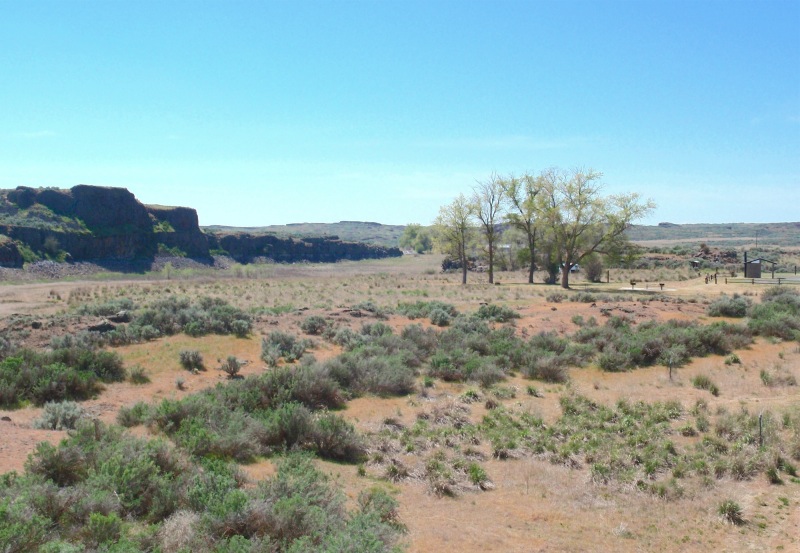
For the next mile, the route is cross-country south along the rim, following game trails just back from the vertical rock edge. Every few hundred yards, one can wander over to the rim edge and take in the spectacular views up and down the Lake Creek coulee. Mule deer are common in the uplands here, as well as spring wildflowers. After a mile along the rim, one enters a low draw trending south and the route follows cattle trails down the draw through thick sagebrush. At 2.1 miles, the draw intersects the BLM Odessa-Lake Creek Trail running east-west (GPS Point 3), a developed trail popular with equestrians. Follow this marked trail west for about 0.3 miles, down through the rim and past a developed spring and water trough, to the coulee floor.

Road to Trailhead

If dry, one can pull off the gravel road onto a small dirt road running west and park at the BLM "Road Closed" sign. If wet or muddy, it's best to stay on the gravel road and park off to the side, near the corner. This trailhead is easily accessible by any passenger car.
Camping Options
The nearest developed camping area is the BLM Pacific Lake/Lakeview Ranch Campground, about 2 miles north of the trailhead on the Lakeview Ranch Loop Road. Here, northeast of the old Lakeview Ranch buildings and corrals,
Agency Contact: Spokane BLM District, (509) 536-1200
DISCLAIMER: Every effort has been made to ensure the accuracy of this information, but the authors do not guarantee that it is either current or correct. The reader assumes full responsibility for any use of this information, and is encouraged to contact local public land agencies to inquire about current conditions before traveling.
Page last updated: 11/5/13