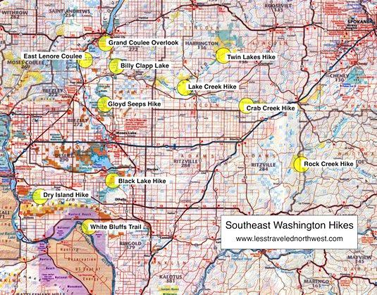
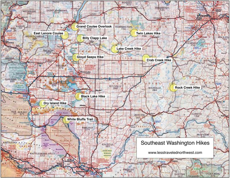
Southeast Washington Hikes
Southeast
Washington is an anomaly in the Inland Northwest, having
little public land compared with other regions. The reason
is the deep loess soils and long growing season that
support dryland wheat farming and irrigated agriculture,
despite a desert climate with less than 15 inches of rain
each year. In many counties here, more than 80% of the land
area is cultivated. However, due to the unique geology of
the region, the remaining natural areas under public
ownership offer some of the best, less-traveled desert
hikes in the Northwest.
This unique
geology stems from Ice Age megafloods that scoured the basalt
bedrock of Southeast Washington 18,000 to 15,000 years
ago. These enormous floods, caused by repeated damming
and cataclysmic release of rivers in Montana by the
continental ice sheet, roared through the Inland
Northwest on their way to the sea. The volume and
velocity of water was so great it swept away soils and
bedrock in the existing valleys, leaving deep "coulees"
flanked by vertical walls of basalt and "scablands"
washed clean of overlying soils. Today, these channeled
scablands — some with rimrock lakes or pothole marshes,
some with small streams, and others completely dry —
form a unique desert terrain for day hiking.
Download
(PDF, 941 KB): Location Map of Southeast Washington
Hikes
Download
(PDF, 662 KB): Photos of Southeast Washington
Area
Though these flood channels
cover nearly 2,000 square miles in Southeast Washington,
most are privately-owned and used for livestock grazing.
Fortunately, public land agencies have acquired a few
ranches within the scablands, through both purchases and
land exchanges. Notably, the BLM has acquired several
tracts of 10 to 25 square miles and Washington State has
also accumulated significant holdings. Several of these
scabland tracts are large enough to provide a feeling of
wilderness solitude, even though wheat fields are just a
few miles away.
It’s these larger and more remote tracts within the coulee
flood channels that are the focus of our day hikes:
Eastern
Scabland Hikes
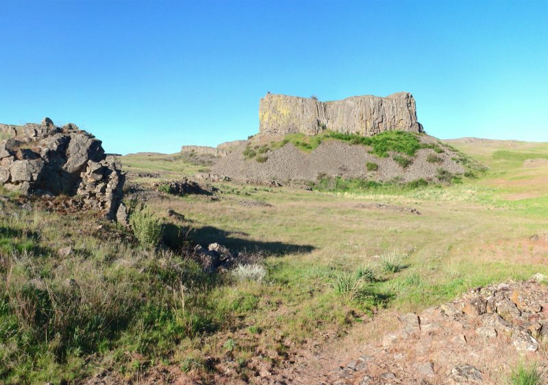
The most
remote and extensive channeled scablands are in the eastern
portion of the region. All four of our chosen hikes here
are more than an hour's drive from Spokane, all are on
lands managed by the BLM and they represent a wide spectrum
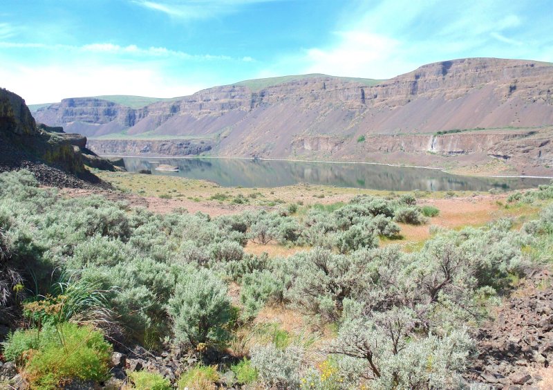
of scabland terrain. The coulees at Rock Creek and Crab
Creek both have perennial streams flowing through them. The
lower Lake Creek coulee, though dry since the 1990s due to
groundwater pumping, still offers spectacular scenery. The
Twin Lakes hike features deep rimrock lakes, marshes and
stands of ponderosa pine.
> Rock Creek Coulee
Hike
> Lake Creek Coulee
Hike
> Twin Lakes
Hike
> Crab Creek Coulee
Hike
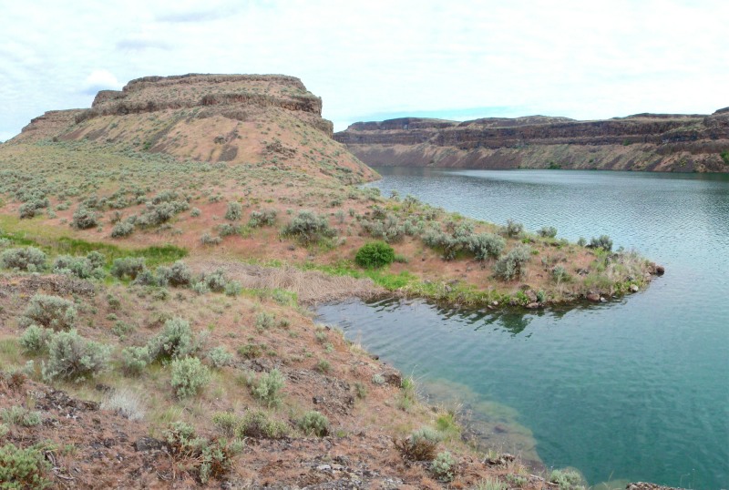
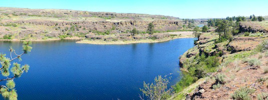
Grand
Coulee Area Hikes
By far the
largest and most diverse coulee in Southeast Washington is
Grand Coulee — more than 60 miles long, up to 4 miles wide
and more than 1,000' deep in places. Our hike here follows
an historical stagecoach road up a side canyon to a
panoramic overlook on the rim. Both the Billy Clapp Lake
and East Lenore Coulee hikes explore nearby flood channels,
the first with a 5-mile long reservoir and the second a
hidden, dry coulee with dramatic basalt cliffs. The Gloyd
Seeps hike features pothole marshes and lakes, Spring
wildflowers and abundant birdlife.
> Grand Coulee Overlook
Hike
> Billy Clapp Lake
Hike
> East Lenore Coulee
Hike
> Gloyd Seeps
Hike
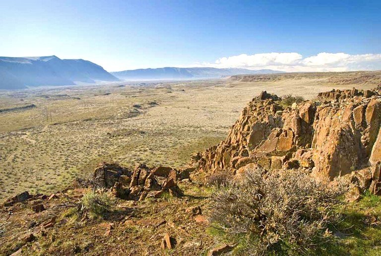
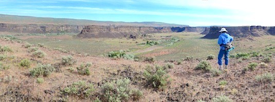
Southern
Scabland Hikes
Least remote
and extensive are the southern scablands. We’ve selected
three contrasting hikes, each more than an hour's drive
from major cities and each with wilderness solitude. The
hike to Black Lake is a cross-country trek along benches
above several deep rimrock lakes. The Dry Island hike is an
overland desert ramble, traversing the lower Crab Creek
coulee to a scenic rim. Finally, we include the White
Bluffs Trail, a dramatic hike on sandstone bluffs and dunes
above the last free-flowing reach of the upper Columbia
River.
> Black Lake
Hike
> Dry
Island Hike
> White Bluffs
Trail
NOTE: Since the Northern Blue Mountains extend only about
30 miles into Southeast Washington, for the sake of
simplicity these hikes are included in our Northeast Oregon
geographic region (see our Northern Blue Mountain
Hikes), rather than on a separate
Southeast Washington web page here.
Clickable
map of Southeast Washington hikes:
Page last updated:
12/8/14

