Less Traveled Northwest
Day Hikes for the Adventurous

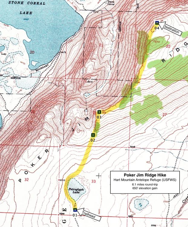
Poker Jim Ridge Hike

Hike Rating: Moderate
Hike Length: 6.1 miles roundtrip (variable)
Elevation Gain: 650’
Trailhead Elevation: 5,670’
Best Season: June through September
Driving Access: High-clearance vehicle
Plus Points
• A cow-free, cross-country hike along a 1,500’-high, fault block escarpment
• Sweeping, panoramic vistas west to the Warner Valley and its pothole lakes
• Long views to the east of Steens Mtn., the Catlow Rim and the Pueblo Mtns.
• Pronghorn antelope and mule deer are commonly seen on the open sage flats
• Bighorn sheep sightings are a possibility along Poker Jim Ridge
• Native American pictographs on a low basalt rim beside a desert lake
Minus Points
• No established trail, but walking is easy over the low sage and short bunchgrass
• Few trees or shade, except along rim, so it’s best to start in early AM on hot days
• Afternoon thunderstorms can present a lightning hazard along the rim
Download (PDF, 605 KB): Photos of Poker Jim Ridge Hike
Download (PDF, 693 KB): Topo Map for Poker Jim Ridge Hike
Download (GPX, 4 KB): GPS Points for Poker Jim Ridge Hike
Download (PDF, 605 KB): Road Map for Poker Jim Ridge Hike
Trail Notes

Road to Trailhead
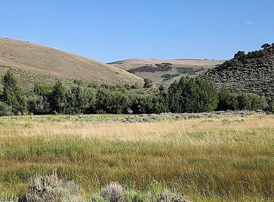
From the headquarters of the Hart Mountain Antelope Refuge, drive about 0.8 miles northwest on the main refuge road to a dirt road on the northeast. There may be a small sign here to Petroglyph Lake. If it's dry and hard, turn onto this dirt road and follow it for about 1.5 miles to a small parking area and a “Road Closed” sign. When dry, the first mile of this dirt road is passable by any passenger car. However, the last half mile gets rocky and rough, so unless you have a high clearance vehicle, you may want to park at some point (taking care not to block the roadway) and walk this last section.
Camping Options
The next nearest developed campground is Camp Hart Mountain, an old CCC camp located in the Warner Valley about 10 driving miles southwest from the trailhead and about 15 miles north of Plush on the paved road to the Hart Mountain Antelope Refuge (Road 3-12). This campground has 9 free campsites that will accommodate any size camping rig, vault toilets and drinking water. It has a camp host during the summer and is also managed by the U.S. Fish and Wildlife Service.
Agency Contact: Hart Mountain Antelope Refuge, (541) 947-2731 or (541) 947-3315
DISCLAIMER: Every effort has been made to ensure the accuracy of this information, but the authors do not guarantee that it is either current or correct. The reader assumes full responsibility for any use of this information, and is encouraged to contact local federal land agencies to inquire about current conditions before traveling.
Page last updated: 1/16/13