Less Traveled Northwest
Day Hikes for the Adventurous
Southeast Oregon Hikes
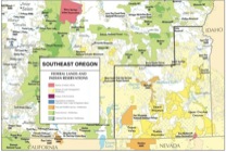
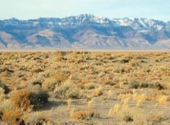
Many writers have characterized Southeast Oregon as a “sagebrush ocean” — and it’s an apt description. Covering almost 20,000 square miles, these high desert sage lands receive a scant 8”-12” inches of rain per year and support few trees. For the day hiker seeking solitude and open spaces though, this is a bonanza, as the region is seldom visited and almost entirely publicly-owned.
With this bonanza comes a dilemma, however. If one can hike anywhere across these sage lands, why focus on certain routes? Why not just park the car and strike off for the nearest rimrock? Actually, this can be a good choice in the cooler fall, winter and spring months. However, in the hot summer hiking season of June through September, with daytime highs in the 90s, these treeless expanses of sage can discourage even the most ardent walker. Thus, our selected day hikes focus on a few attractive, well-watered and accessible “islands” in this sea of sage.
Download (PDF, 248 KB): Southeast Oregon Regional Map
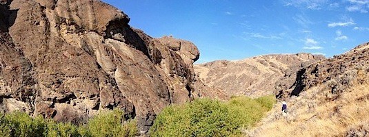
Three of these “islands” are enormous fault-block mountain ranges that are uplifted and tilted thousands of feet above the desert floor — Hart Mountain, Steens Mountain and the Pueblo Mountains. These uplifted ranges are cooler, catch more rainfall, have more vegetation and attract more wildlife than the surrounding desert. Our fourth “island” is a river system that has cut a thousand feet down into the desert floor, creating some of the most remote and scenic landscapes in Oregon — the Upper Owyhee River canyons.
Each of these four areas offers a selection of remote and enticing summer day hikes:
> Hikes in the Hart Mountain Area
> Hikes in the Steens Mountain Area
> Hikes in the Pueblo Mountains
> Hikes in the Upper Owyhee River Canyons
NOTE: Two tempting desert “islands” near the Oregon-Nevada border, the Trout Creek and Oregon Canyon Mountains, are not well-suited for day hiking. Access to their most walkable stream canyons, including Trout Creek, Whitehorse Creek and Oregon Canyon Creek, is blocked by private ranches. Their more remote, publicly-owned lands are accessible only by long, rough 4-wheel drive roads. In addition, both of these mountain ranges burned completely in the massive Holloway Fire of August 2012, so it will be years before they recover for recreational use.
To locate hikes in Southeast Oregon, click on your area of interest:
Page last updated: 1/15/13


