Less Traveled Northwest
Day Hikes for the Adventurous

Thirteenmile Mountain Hike
Hike Rating: Moderate
Hike Length: 6.2 miles roundtrip
Elevation Gain: 1,400’
Trailhead Elevation: 3,590’
Best Season: April-June and September
Driving Access: Any vehicle, with care
Plus Points
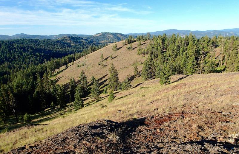
• A hike along a scenic, lightly-forested ridge, with sweeping vistas over the Highlands
• The trail is within the Thirteenmile Roadless Area and is closed to motorized travel
• Route traverses open bunchgrass slopes, with scattered old-growth ponderosas
• Elk and deer are the most common grazers on the ridge, with little sign of cows
• Colorful spring wildflowers include lupine, paintbrush, elkhorn clarkia and bitterroot
• A distinct sense of wilderness solitude and remoteness on this seldom-traveled trail
Minus Points
• Trail is overgrown with grass and faint in places, but small rock cairns guide the way
• Not much shade on the open ridge crest, so get an early AM start on hot days
• Rattlesnakes are a possibility throughout the summer months, so be alert
Download (PDF, 633 KB): Photos of Thirteenmile Mtn Hike
Download (PDF, 758 KB): Topo Map for Thirteenmile Mtn Hike
Download (GPX, 1 KB): GPS Points for Thirteenmile Mtn Hike
Download (PDF, 670 KB): Road Map for Thirteenmile Mtn Hike
Trail Notes

From this saddle, the trail begins a long traverse east, contouring around bald, bunchgrass hillsides and through open stands of big ponderosa pine, which have never been logged here. The trail maintains a good grade as it gradually ascends to the ridge crest, where one has nice views southwest to the rocks cliffs and rounded uplands of Thirteenmile Canyon. The trail can be hard to follow in the thick grass, but look for small rock cairns at intervals.
The route east is mostly across open, grassy slopes, but at times the trail passes through shady folds in the hillside that support thick stands of douglas fir and western larch, with a currant understory. Look for grouse in these shady dells. At 1.8 miles, the trail crests the ridge and one has the first views north across the Ninemile Creek drainage. Within a third of a mile, the trail is back on the south side of the ridge, with more views of the Thirteenmile Canyon watershed and its rolling headwaters.
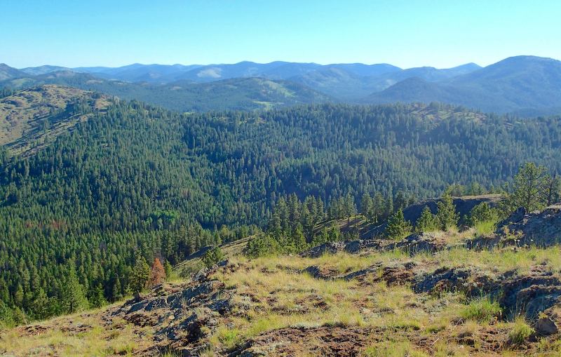
Gaining the top of the peak at 3.1 miles (GPS Point 2), one finds the remains of the old 1934 fire lookout heaped on the ground and incredible panoramic vistas in all directions — east to the Kettle River Range, northwest to the snowy peaks of the Cascade Range, and south over the Thirteenmile Creek watershed. Enjoy the views and a good lunch break, then return as you came.
Road to Trailhead
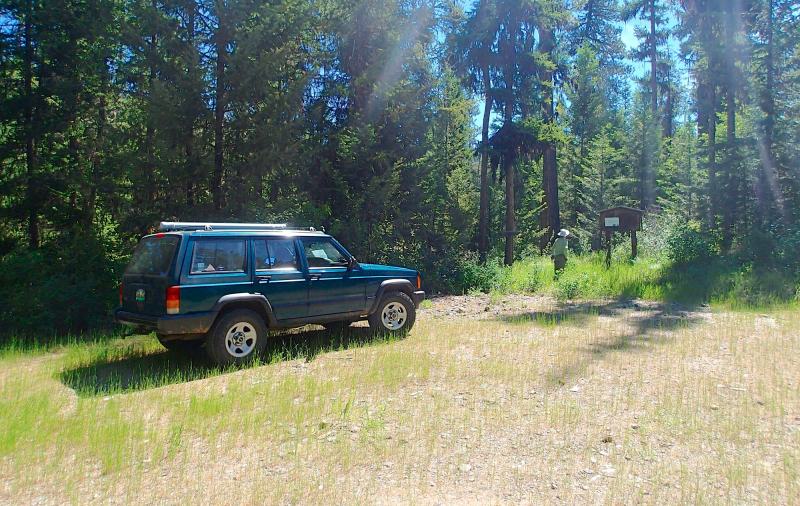
The road to the trailhead is all gravel, but with many potholes, so travel is slow — though it should be passable by any vehicle with care. NOTE: The shortcut route down Refrigerator Canyon is washed out and this road is permanently closed on its north end.
Camping Options
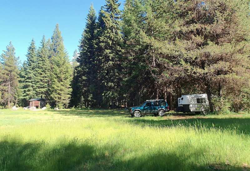
For tent trailers and travel trailers, the nearest option on public land is the O'Brien Creek Forest Camp about 3.3 miles from Hwy 20 on Hall Creek Road as one drives toward the trailhead. Immediately past a cattle guard, there is an open grassy, 1-acre flat on the right (south) with several good "back in" sites for any size camping trailer. As there are no defined campsites here, tent campers can also find spots in the shady trees along the west edge of the flat. This campground has a vault toilet, but no drinking water or camping fees.
Full service campgrounds can be found at the Ferry County Fairgrounds on Hwy 20, about 2.3 miles east of its junction with Hwy 21 south of Republic WA (and about 18 driving miles from the trailhead) — and at Curlew Lake State Park, about 9 miles north of Republic and about 26 driving miles from the trailhead.
Agency Contact: Colville National Forest, Republic District, (509) 775-7400
DISCLAIMER: Every effort has been made to ensure the accuracy of this information, but the authors do not guarantee that it is either current or correct. The reader assumes full responsibility for any use of this information, and is encouraged to contact local public land agencies to inquire about current conditions before traveling.
Page last updated: 11/1/15