Less Traveled Northwest
Day Hikes for the Adventurous

Billy Clapp Lake Hike
Hike Rating: Moderate
Hike Length: 7.6 miles roundtrip (variable)
Elevation Gain: 75’
Trailhead Elevation: 1,400’
Best Season: April-June and September
Driving Access: Any vehicle
Plus Points
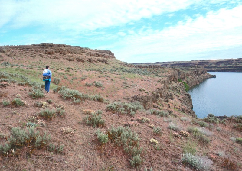
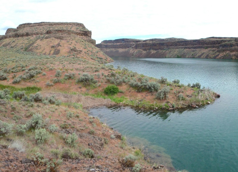
• A pleasant, cow-free hike along flat basalt benches above a steep-walled lake
• Ice Age flood features include potholes, spillover channels and hanging coulees
• A wildflower showcase in Spring, with balsamroot, bush lupine, blue flax and salvia
• Common wildlife include mule deer, coyotes, grey partridges and red-tailed hawks
• Several secluded coves on the lake allow walking access down to water's edge
• The chance for solitude increases the further north one hikes along the lake
Minus Points
• No established trail after first mile, so good route-finding skills are necessary
• Occasional powerboats on the lake can disturb the wilderness atmosphere
• Rattlesnakes are a possibility throughout the summer, so be aware
Download (PDF, 566 KB): Photos of Billy Clapp Lake Hike
Download (PDF, 680 KB): Topo Map for Billy Clapp Lake Hike
Download (GPX, 1 KB): GPS Points for Billy Clapp Lake Hike
Download (PDF, 682 KB): Road Map for Billy Clapp Lake Hike
Trail Notes

For the next half mile, the route follows game trails north along this bench, with long views of the lake and the vertical bluffs ahead. At 1.5 miles (GPS Point 2), one comes to the crest of the bench and the route gradually descends toward the lakeshore again, to the mouth of a creek running into the lake from the west.

For the next 0.7 miles, the route follows the lowest bench nearest the lake, above steep rock bluffs edging the water. At about 2.4 miles, one passes a deep circular pothole and descends into a narrow coulee with a striking rock pillar in its center to the west. Here one can turn right (east) and descend down the coulee to the lake's edge. To continue the hike, the route goes left (west) up the coulee to the north side of the rock pillar (GPS Point 4), then scrambles up onto the bench north of the pillar.
Road to Trailhead
From State Route 28, 10.3 miles east of Soap Lake and 7 miles west of Wilson Creek, turn north on Road J NE at signs for "Pinto Dam/Billy Clapp Lake." This turnoff is just east of the small town of Stratford. Drive north 2.4 miles on Road J NE to the parking area at road's end, next to the boat launch. The trail starts north up the hillside, just behind the vault toilet. A Washington State Discover Pass is required to park at this trailhead.
Camping Options
The nearest public campground is at Sun Lakes-Dry Falls State Park, about 30 driving miles from the trailhead. This is a large campground with flush toilets, showers, drinking water, full hookups and over 190 campsites,

A no-frills, no-fee alternative is the BLM Pacific Lake/Lakeview Ranch Campground, about 33 driving miles east of the trailhead, north of Odessa on the Lakeview Ranch Loop Road. Here, northeast of the old Lakeview Ranch buildings and corrals, on a flat bench above now dry Pacific Lake, are a vault toilet and gravel parking areas suitable for travel trailers. A grassy area with a few shade trees, plus tables and fire rings, serves tent campers and picnickers. There is no potable water here, but drinking water jugs can be filled at the City Park in downtown Odessa.
Finally, campsites are available at two private campgrounds in Soap Lake, WA, about 13 driving miles west of the trailhead on State Route 28.
Agency Contact: Washington Dept. of Fish & Wildlife, (509) 765-6641
DISCLAIMER: Every effort has been made to ensure the accuracy of this information, but the authors do not guarantee that it is either current or correct. The reader assumes full responsibility for any use of this information, and is encouraged to contact local public land agencies to inquire about current conditions before traveling.
Page last updated: 11/12/13