Less Traveled Northwest
Day Hikes for the Adventurous

North Fork Crooked River Hike
Hike Rating: Moderate
Hike Length: 5.8 miles roundtrip (variable)
Elevation Loss: 440’
Trailhead Elevation: 4,610’
Best Season: July through September;
after spring runoff has subsided
Driving Access: Any vehicle, when dry
Plus Points
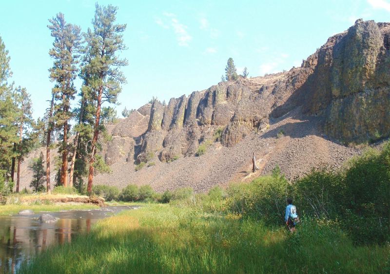
• A short, rugged hike into a spectacular Wild-and-Scenic river canyon
• Massive, lichen-covered basalt palisades throughout the canyon
• Old growth “yellow belly” ponderosa pines on the river terraces
• Seasonal wildflowers in streamside meadows and on drier uplands
• Solitude is almost guaranteed on this little-known hike
• Easy trailhead access on good gravel roads (details below)
Minus Points
• No trail down into canyon, so hike is cross-country over rocky slopes
• Two knee-deep river crossings in the lower canyon
• Ground can be gumbo mud in spring, so wait until after soils dry out
Download (PDF, 554 KB): Photos of North Fork Crooked River Hike
Download (PDF, 620 KB): Topo Map for North Fork Crooked River Hike
Download (GPX, 4 KB): GPS Points for North Fork Crooked River Hike
Download (PDF, 630 KB): Road Map for North Fork Crooked River Hike
Trail Notes

From here, it’s a short but steep walk down the ridge to the river at GPS Point 4. Once at the river, one can walk for about a half mile downstream on the north bank, under majestic basalt cliffs and big ponderosas.
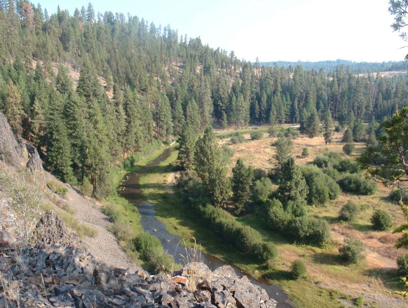
Soon the river terrace on the north bank ends, under a steep, colorful basalt palisade. Only if the spring runoff has subsided and the river is safe to wade, cross here to the opposite bank. One can then explore downstream on the riverside terraces, past Lame Dog Creek, for about another mile until reaching fenced private land. Retrace your steps back to the trailhead.
Road to Trailhead
This day hike is easily accessible on good gravel roads that can be driven by any passenger car. Be cautious about driving off the roads until the ground has dried in early summer. From paved Road 42 at Big Summit Prairie, turn south on gravel Road 4240 and travel 3.6 miles. Then turn left (east) on Road 150 and follow this road for about one mile to a low saddle. At the bottom of this saddle, an abandoned road branches off to the right (south). Park at this road junction and start the hike on the abandoned road. There is no official USFS signage or trailhead here.
Camping Options
The nearest developed campground is the Deep Creek Campground, about 9 driving miles northeast of the trailhead, off paved Road 42. This is a large but pleasant campground on the North Fork Crooked River, near its confluence with Deep Creek. There are 14 sites, two vault toilets and a potable water supply. The fee is $8.00 per night in 2011 and it can accommodate anything from small tents to large travel trailers.
Agency Contact: Ochoco National Forest, (541) 416-6500
DISCLAIMER: Every effort has been made to ensure the accuracy of this information, but the authors do not guarantee that it is either current or correct. The reader assumes full responsibility for any use of this information, and is encouraged to contact local federal land agencies to inquire about current conditions before traveling.
Page last updated: 12/26/11