Less Traveled Northwest
Day Hikes for the Adventurous

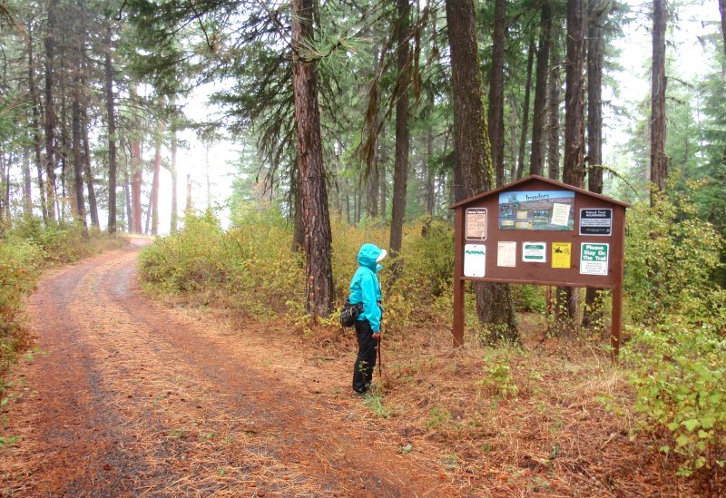
Three Forks Trail
NOTE: The Three Forks Trail burned in Grizzly Bear Complex Fire of September 2015. It may be a few years before this area recovers for recreational use.

Hike Rating: Moderate
Hike Length: 6.4 miles roundtrip
Elevation Loss: 1,600’
Trailhead Elevation: 3,960’
Best Season: June through September
Driving Access: Any vehicle
Plus Points
• A scenic hike that starts on the rim and ends on the banks of Crooked Creek
• The hike is cow-free and entirely within the Wenaha-Tucannon Wilderness Area
• Sweeping, panoramic vistas up and down the rugged Crooked Creek canyon
• Trail traverses both dry, south-facing slopes and forested, north-facing slopes
• Perennially-flowing Crooked Creek makes a cool, shady hike destination
• The trail is seldom used, so solitude is likely
Minus Points
• Hike can be brutally hot in mid-summer, so plan to start in early AM on hot days
• Rattlesnakes are commonly encountered throughout the summer, so be aware
Download (PDF, 801 KB): Photos of Three Forks Trail
Download (PDF, 755 KB): Topo Map for Three Forks Trail
Download (PDF, 655 KB): Road Map for Three Forks Trail
Trail Notes
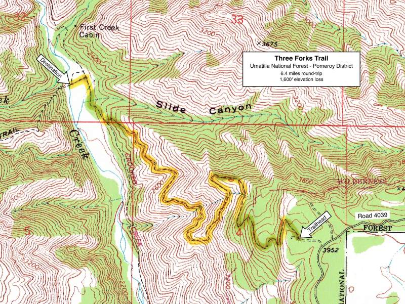
From this viewpoint, the trail begins a long descent to the south, across hillsides with sparse bunchgrass on the dry, south-facing slopes and thick shrubs (spirea, maple and thimbleberry) in the moist drainages. In late summer, look for bear sign in these thickets. At 1.6 miles, the trail switchbacks north again and begins a gradual, mile-long descent into Crooked Creek. Along the way, the route passes through mixed douglas fir and larch stands on the northern exposures and scattered ponderosa pine and even juniper on the dry, southern exposures. There are scenic basalt outcrops in this section.

Road to Trailhead
In the town of Troy, OR, turn north onto signed Bartlett Road. Drive 5.6 miles, switchbacking up out of the Wenaha River canyon, then driving northwest up along Bear Creek, to a prominent road junction. Branch left here (west) onto signed Reynolds Lane and follow it west for about 0.8 miles, then north for about a mile, then east for another mile and finally north again for about 0.6 miles to Kessler Mill Road on the left. This intersection is just past on old homestead house on the left.
Camping Options
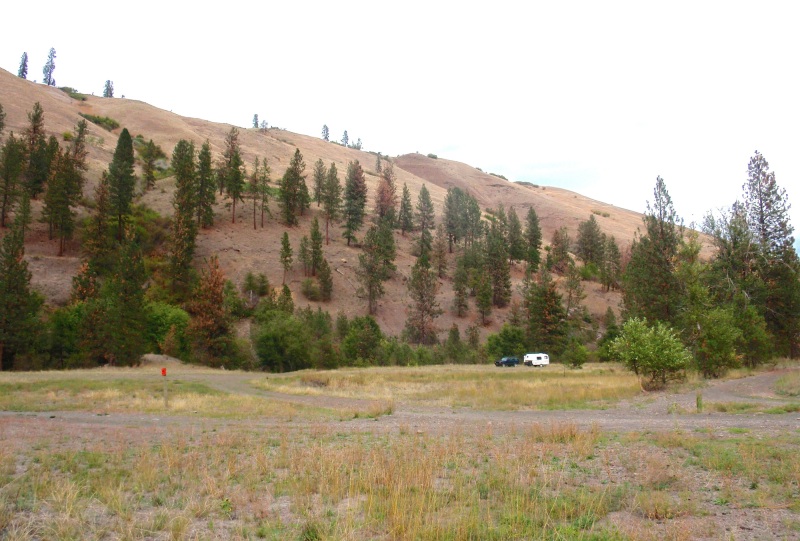
For tent campers: There are several nice dispersed camping spots under big ponderosas near the junction of Road 246 and Road 4039, just 0.2 miles from the trailhead. A vault toilet is located at the Three Forks Picnic Area just down the road, but no drinking water.
For all campers: The nearest developed camping area is at Grizz Flat, on the Wenaha River floodplain just south of Troy, and 14 driving miles from the trailhead. It is managed by Oregon State as part of the Wenaha State Wildlife Area. There are no designated campsites, but there's room for everything from large travel trailers
Other public camping sites are available about a mile east of Troy, along the Grande Ronde River, just off the paved river road. These are campsites in an open grassy meadow along the river, managed by Oregon State, across the road from the headquarters of the Wenaha State Wildlife Area. There is a vault toilet, but no drinking water and no fees.
Drinking water, showers, laundromat, gas, propane, groceries and other supplies are available at the Shiloh Resort in downtown Troy, which is open Wednesday through Sunday (closed Monday and Tuesday). Contact them at (541) 828-7773 for details.
Agency Contact: Umatilla National Forest, Pomeroy District, (509) 843-1891
DISCLAIMER: Every effort has been made to ensure the accuracy of this information, but the authors do not guarantee that it is either current or correct. The reader assumes full responsibility for any use of this information, and is encouraged to contact local public land agencies to inquire about current conditions before traveling.
Page last updated: 11/25/13