Less Traveled Northwest
Day Hikes for the Adventurous

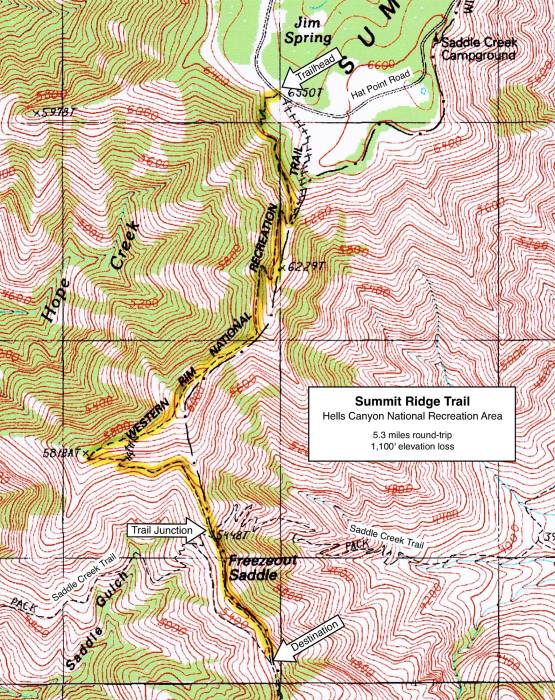
Summit Ridge Trail
NOTE: Summit Ridge burned in the Double Creek Fire of September 2022.
It may be a few years before this area recovers for recreational use.

Hike Rating: Moderate
Hike Length: 5.3 miles roundtrip
Elevation Loss: 1,100’
Trailhead Elevation: 6,280’
Best Season: June through September,
once access road is snow-free
Driving Access: Any vehicle, with care
Plus Points
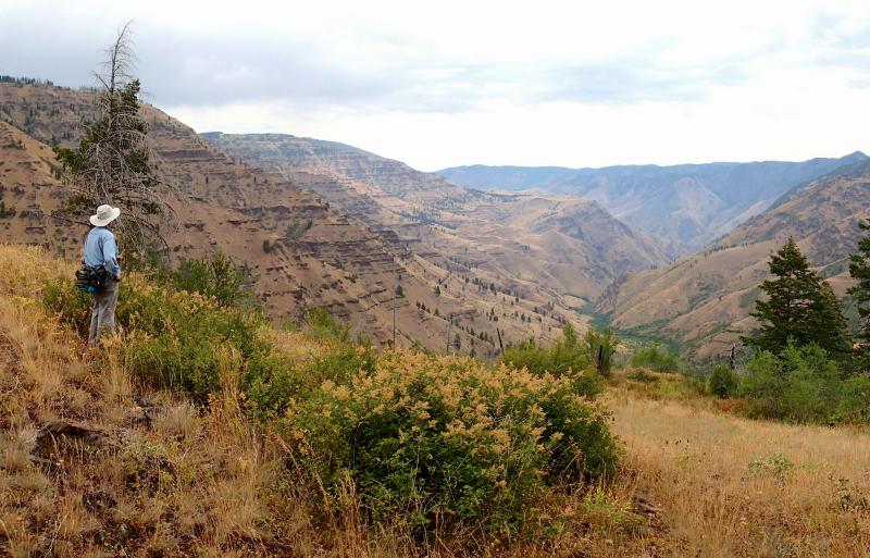
• A nice view hike down a rugged scenic ridge, with vistas to the Snake River
• Trail skirts the edge of the Hells Canyon Wilderness, from rim to Freezeout Saddle
• Long views east to the Seven Devils Range and west to the snowy High Wallowas
• Spring wildflowers include paintbrush, penstemon, goldenrod and mountain balm
• Lots of elk sign along the ridge, plus grouse are very common near the trail
• Though lightly used, the trail is well-built on a good grade, with switchbacks
Minus Points
• In a few stretches, the trail is narrow and rocky, with loose rock underfoot
• Long sections of trail have no shade, so try to get an early AM start on hot days
• Rattlesnakes are a possibility at the lower elevations in summer, so be alert
Download (PDF, 758 KB): Photos of Summit Ridge Trail
Download (PDF, 884 KB): Topo Map for Summit Ridge Trail
Download (PDF, 866 KB): Road Map for Summit Ridge Trail
Trail Notes
From this saddle, the trail climbs a short distance, then begins a long traverse around the west side of the ridge, finally topping out at 1.4 miles on a side ridge coming in from the west. The trail descends west down this side ridge, past douglas firs on the north slope and open grassland on the south. Look for grouse in the underbrush here and enjoy long views west of the snow-capped High Wallowa peaks.
Road to Trailhead
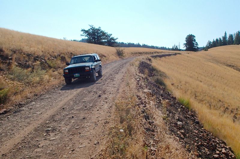
Look for a small, unsigned dirt road on the right (west), just across the Hat Point Road from the Jim Springs dispersed camping area. This turnoff is about 0.5 miles before the Saddle Creek Campground. About 20 yards up this dirt road, look for a large rock cairn on the right, with a faded "Summit Ridge, Trail #1774" sign.
NOTE: The first 7 miles of the Hat Point Road past Imnaha are very steep (16% grade). The entire road is single lane, with turnouts, so camping trailers and RVs are not recommended. The gravel surface is OK for passenger cars.
Camping Options
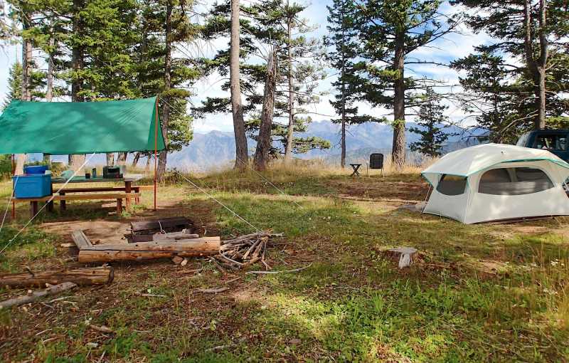
For those campers that are entirely self-contained, with their own sanitation, another option is dispersed camping sites in the Jim Springs area, just across the Hat Point Road from the trailhead. There are 5-6 sites here, some in open grass meadows, others in pullouts among the trees. The sites are very primitive, with no tables or fire rings, but they are isolated.
Please note there is no overnight camping at the Hat Point Lookout and there is no potable drinking water available anywhere in the area. Campers will need to bring enough drinking water for the entire length of their stay.
Agency Contact: Hells Canyon National Recreation Area, (541) 426-5546
DISCLAIMER: Every effort has been made to ensure the accuracy of this information, but the authors do not guarantee that it is either current or correct. The reader assumes full responsibility for any use of this information, and is encouraged to contact local public land agencies to inquire about current conditions before traveling.
Page last updated: 12/10/14