Less Traveled Northwest
Day Hikes for the Adventurous

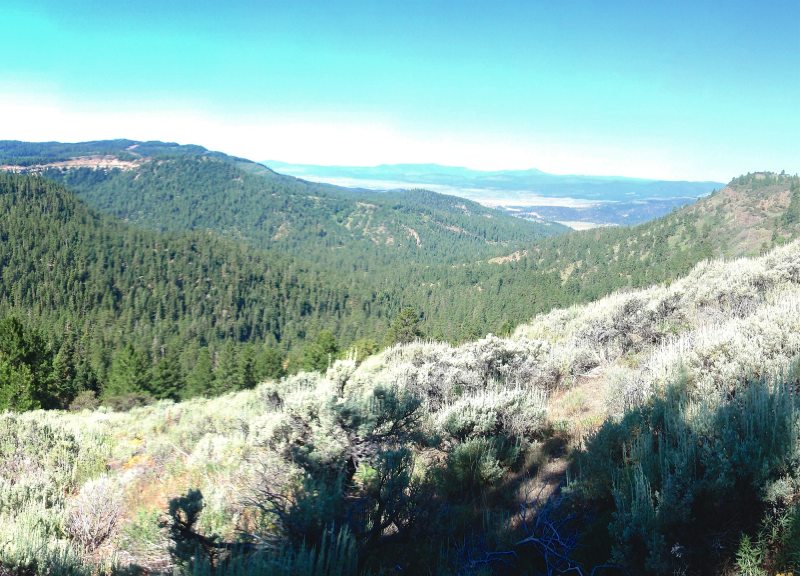
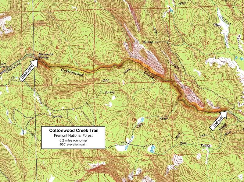
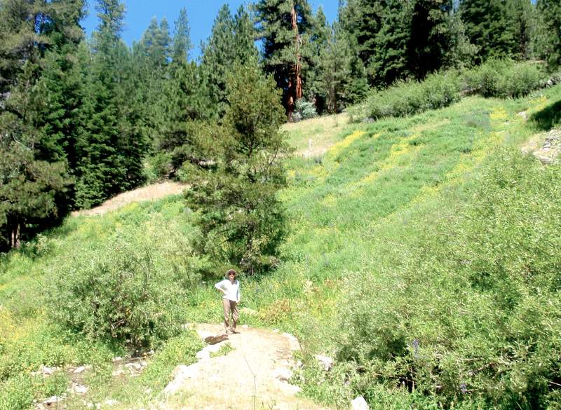
Cottonwood Creek Trail
NOTE: The Cottonwood Creek Trail burned in Cougar Peak Fire of September 2021. It may be a few years before this area recovers for recreational use.
Hike Rating: Easy
Hike Length: 6.2 miles roundtrip (variable)
Elevation Gain: 660’
Trailhead Elevation: 5,260’
Best Season: July through September;
after spring runoff has subsided
Driving Access: Any vehicle
Plus Points
• Attractive stream canyon, featuring mature cottonwood and aspen groves
• Bright fall colors in September and October, as leaves turn
• Clear, burbling stream appears at intervals alongside the trail
• Trail is a reclaimed forest road, so walking is easy on a moderate grade
• Mammoth Spring is a wonder, gushing out of the hillside amid wildflowers
• Easy, though remote, driving access to the trailhead (details below)
Minus Points
• The two stream crossings can be hazardous during heavy spring runoff
• Some cow activity in the canyon, but it’s not overwhelming
Download (PDF, 665 KB): Photos of Cottonwood Creek Trail
Download (PDF, 516 KB): Topo Map for Cottonwood Creek Trail
Download (PDF, 496 KB): Road Map for Cottonwood Creek Trail
Trail Notes
For the next two miles, the trail again follows the north bank, past groves of cottonwood and aspen on wide streamside flats, with scattered stands of pine and fir on the hillsides. There are many nice spots here for a rest in the shade along the stream.
Road to Trailhead
The trailhead is easily accessible on good gravel roads that can be traveled by any passenger car. From paved Road 3870, just before it enters the Cottonwood Meadow recreation area, turn right onto an extension of Road 3870. Follow this gravel road for about 7.2 miles, until it descends down into the canyon near Cottonwood Creek. Turn left here on dirt Road 014 and go northwest 0.5 miles, crossing the creek. Turn immediately left again on a small dirt road and follow this upstream for a few hundred yards along the north bank, to where it dead ends at the trailhead.
Camping Options
The best camping options are all at the Cottonwood Meadow recreation area, about 8 driving miles west of the trailhead. Here there are more than 30 developed campsites, some around Cottonwood Meadow Lake and some along Cougar Creek. Each campground has a vault toilet, potable drinking water and costs $6.00 per night in 2011. This recreation area gets plenty of use on summer weekends, but is in a beautiful setting around a small lake with old growth ponderosas and a few resident bald eagles.
Agency Contact: Fremont National Forest, Lakeview District, (541) 947-3334
DISCLAIMER: Every effort has been made to ensure the accuracy of this information, but the authors do not guarantee that it is either current or correct. The reader assumes full responsibility for any use of this information, and is encouraged to contact local federal land agencies to inquire about current conditions before traveling.
Page last updated: 12/24/11