Less Traveled Northwest
Day Hikes for the Adventurous

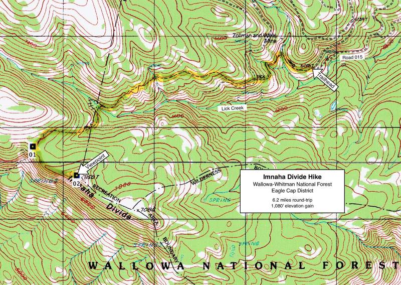
Imnaha Divide Hike
NOTE: The Imnaha Divide burned in the Nebo Fire of September 2022.
It may be a few years before this area recovers for recreational use.
Hike Rating: Moderate
Hike Length: 6.2 miles roundtrip
Elevation Gain: 1,080’
Trailhead Elevation: 6,070’
Best Season: June through September,
once access road is snow-free
Driving Access: High-clearance vehicle
Plus Points
• A trail through diverse habitats and terrain to panoramic vistas of the High Wallowas
• Most of the hike is outside the Wilderness Area, but ATVs and dirt bikes are prohibited
• Wide views over the Imnaha River valley to its alpine headwater peaks on the skyline
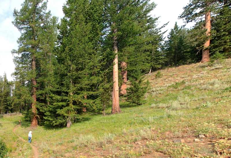
• Trail passes through a mix of shady forests and open "balds," with diverse wildflowers
• A few specimens of big old-growth fir and western larch are found along the trail
• The Imnaha Divide is prime summer elk habitat, with sightings possible if stealthy
Minus Points
• Trail is built on an inconsistent grade, with few switchbacks, waterbars or drains
• Afternoon thunderstorms can present a lightning hazard on the exposed viewpoint
Download (PDF, 873 KB): Photos of Imnaha Divide Hike
Download (PDF, 799 KB): Topo Map for Imnaha Divide Hike
Download (GPX, 1 KB): GPS Points for Imnaha Divide Hike
Download (PDF, 904 KB): Road Map for Imnaha Divide Hike
Trail Notes
Past the stream (crossed on a convenient log), the trail climbs up to a second small tributary, then climbs again to an open rocky point at 0.5 miles, where one has nice views east back down the Lick Creek canyon. After another steep climb, the trail levels out at about 0.7 miles and begins a long, gradual ascent toward the Imnaha Divide. For the next two miles, the trail alternates between sections of shady forest, with moist-soil wildflowers like paintbrush, aster and larkspur, and open rocky "balds" with dry-soil wildflowers such as yarrow and various buckwheats — all of which bloom into early August here.
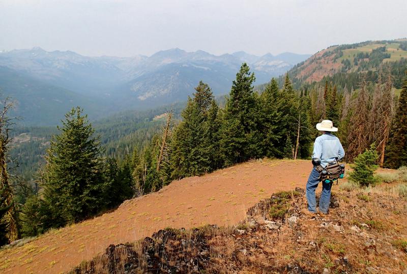
At 2.6 miles, the trail reaches a saddle on the Imnaha Divide and starts to descend south to the Imnaha River. Just over the saddle (GPS Point 1), the route leaves the trail and goes cross-country southeast along the grassy ridge, just below the trees. Here one finds a prominent game trail that winds in and out of the trees along the ridge top. Look for elk beds in this section. At 3.1 miles (about 800 yards southeast from the saddle), the game trail climbs up to a bald rocky knob with a few stunted trees (GPS Point 2). From this viewpoint, one can hear the roaring river far below and has dramatic panoramic vistas over the Imnaha River valley and its headwaters. Various alpine peaks can spotted on the skyline, including Sugarloaf, Red, Marble and Cusack Mountains. Return as you came.
Road to Trailhead
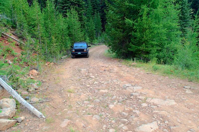
Just opposite the campground entrance, turn south on gravel Road 3925 and follow it for 0.2 miles to a road junction. At this junction, turn right on dirt Road 015 (which crosses Lick Creek), then drive 2.1 miles to the Lick Creek Trailhead on a big switchback. A self-issued Wilderness Permit is required at the trailhead. Note: Road 015 is quite rough, with exposed rocks, and is best traveled with a high-clearance vehicle.
Camping Options

Agency Contact: Wallowa-Whitman Natl. Forest, Eagle Cap District, (541) 426-5546
DISCLAIMER: Every effort has been made to ensure the accuracy of this information, but the authors do not guarantee that it is either current or correct. The reader assumes full responsibility for any use of this information, and is encouraged to contact local public land agencies to inquire about current conditions before traveling.
Page last updated: 12/10/14