Less Traveled Northwest
Day Hikes for the Adventurous

West Eagle Creek Trail
Hike Rating: Moderate
Hike Length: 7.0 miles roundtrip
Elevation Gain: 680’
Trailhead Elevation: 5,520’
Best Season: June through September,
after Spring runoff has subsided
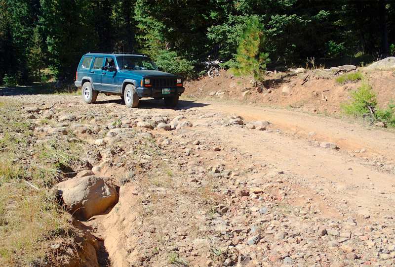
Driving Access: High clearance vehicle
Plus Points
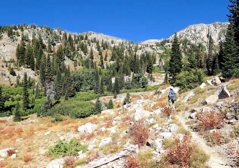
• A quintessential Wallowas hike — wet meadows, waterfalls, glaciated granite peaks
• The trail is mostly within the Eagle Cap Wilderness Area and is mostly cow-free
• Dramatic and picturesque white granite cliffs rise over 2,000' above the route
• The trail winds through several groves of 4' thick, old-growth grand fir trees
• Sightings of bighorn sheep, mountain goats and elk are always a possibility
• The exceptionally well-built trail leads to a secluded, little-visited alpine canyon
Minus Points
• The two fords of West Eagle Creek are treacherous during high Spring runoff
• Cows inhabit the lower West Eagle Meadows area through mid-September
Download (PDF, 629 KB): Photos of West Eagle Creek Trail
Download (PDF, 752 KB): Topo Map for West Eagle Creek Trail
Download (PDF, 729 KB): Road Map for West Eagle Creek Trail
Trail Notes
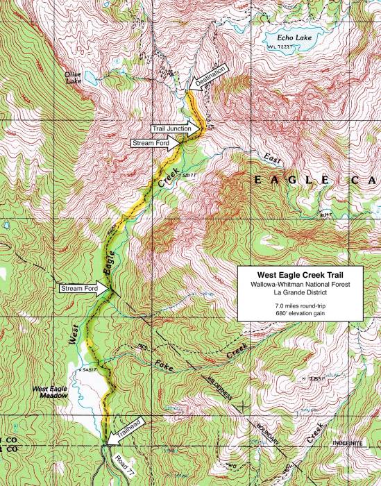
At 1.2 miles, the trail comes to the first ford of West Eagle Creek, which is a serious knee-deep wade in early Summer, but just an ankle-deep crossing in August and September. There are a few log crossings 100 yards upstream from the trail ford, but bushwhacking is required to reach them. Past the ford, the trail enters the Wilderness Area and gradually ascends the west side of the canyon, through stands of enormous grand fir. At intervals, snow avalanche chutes cross the trail, creating grassy meadows that allow breathtaking views of the white granite cliffs rising above.
The trail descends to a second ford of West Eagle Creek at 2.6 miles. The stream is smaller here, but spread out into several channels, so the crossing is still tricky and logs are scarce. Past the ford, the trail climbs up the steep hillside on a good grade, thanks to ten well-constructed switchbacks. Near the top, one has long views east into the hanging valley and early summer waterfalls on the East Fork of West Eagle Creek. At 3.1 miles, on the top of the knoll above the switchbacks, one comes to a signed trail junction at a rock cairn, with one fork leading straight ahead to Echo Lake and the other bearing left (north). Take the left fork, following the sign for "Elk Creek."

Road to Trailhead
From the hamlet of Medical Springs on Hwy 203, turn southeast on the paved Big Creek Road, following signs for Boulder Park. At 1.6 miles, after the road becomes gravel, bear left (east) at a junction onto gravel Road 67 and follow it for 14.6 miles to a major road junction, just past the bridge over West Eagle Creek. If coming from the east on Road 77, this road junction is 0.7 miles west of the Tamarack Campground.
Camping Options
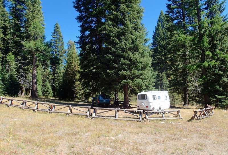
For tent campers with high-clearance vehicles, campsites are available right at the West Eagle Meadow Trailhead. There are 12 sites here, 5 for car campers and 7 that are walk-in tent sites, each with a picnic table and fire ring. There is also a vault toilet that's shared with the trailhead, but no drinking water or trash pickup. A separate camping area for stock users is also located nearby, with 6 sites plus corrals, hitching rails and a loading ramp. Camping fees were $5.00 per night in 2014.
Also nearby is the Tamarack Campground, about 6 driving miles from the trailhead on Road 77. This too is a shady, forested site on a bench above Eagle Creek, but it's a much more formal campground with 12 clearly defined and numbered sites, suitable for tents or camping trailers, each with a picnic table and fire ring. There's a vault toilet, drinking water and a camp host through the summer. Camping fees were $6.00 per night in 2014.
Agency Contact: Wallowa-Whitman Natl. Forest, La Grande District, (541) 963-7186
DISCLAIMER: Every effort has been made to ensure the accuracy of this information, but the authors do not guarantee that it is either current or correct. The reader assumes full responsibility for any use of this information, and is encouraged to contact local public land agencies to inquire about current conditions before traveling.
Page last updated: 12/10/14