Less Traveled Northwest
Day Hikes for the Adventurous

Grand Coulee Overlook Hike
Hike Rating: Moderate
Hike Length: 6.4 miles roundtrip
Elevation Gain: 540’
Trailhead Elevation: 1,070’
Best Season: April-June and September
Driving Access: Any vehicle
Plus Points
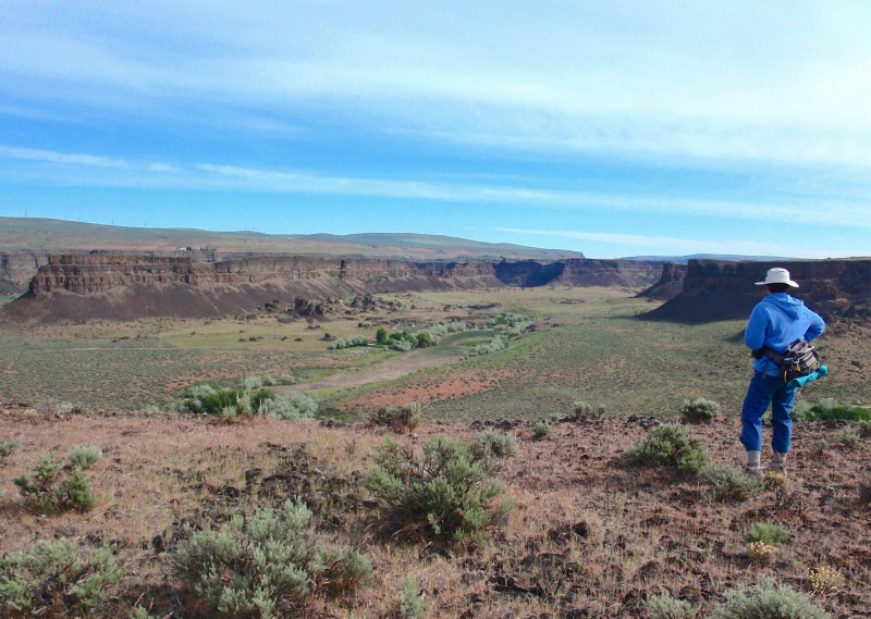
• A walk along jeep trails leading to a dramatic, panoramic overlook of Grand Coulee
• Arguably one of the most scenic day hiking destinations in Southeast Washington
• For the first mile, the hike is over the historical Caribou Trail wagon road
• On uplands, the route follows wet meadows and grasslands between low rock benches
• Spring wildflowers include wild iris, bush lupine, globe mallow, wooly daisy and aster
• Small groves of hawthorn trees en route provide welcome shade on hot days
Minus Points
• Basic route-finding skills are needed to follow the jeep trails leading to the rim
• Cows may be encountered in the upland meadows in very early Spring
• Rattlesnakes are a possibility throughout the summer, so be aware
Download (PDF, 629 KB): Photos of Grand Coulee Overlook Hike
Download (PDF, 632 KB): Topo Map for Grand Coulee Overlook Hike
Download (GPX, 1 KB): GPS Points for Grand Coulee Overlook Hike
Download (PDF, 733 KB): Road Map for Grand Coulee Overlook Hike
Trail Notes
Past this gate, the old road is difficult to follow and it's best to just walk cross-country up the coulee bottom, through grasslands between the rock walls. At about 1.0 miles, one meets a jeep
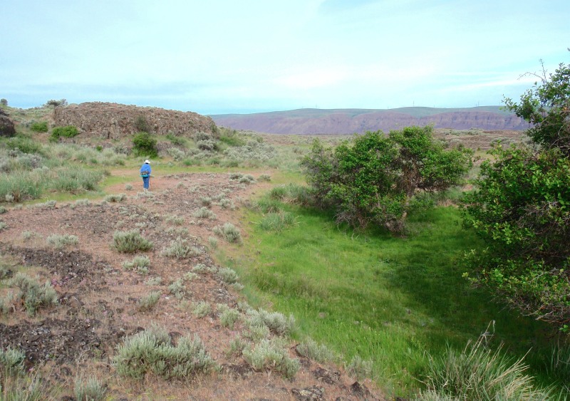
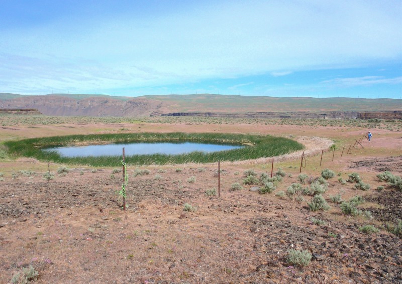
Once on top, the jeep road is easy to follow as it crosses the dry desert. At 1.8 miles, the road descends steeply into a shallow coulee near a grove of hawthorn trees (GPS Point 3). For the next 1.9 miles to the overlook, the route winds and turns west and north through this shallow coulee, past dry grasslands, wet meadows and small reed marshes. The road is faint and discontinuous in this section, but if one keeps to the bottom of the coulee, following prominent cow trails, it's hard to go astray. At 2.3 miles (GPS Point 4), next to small hawthorn trees, one finds a green wet meadow encircled with wild iris in Spring.
Road to Trailhead
From State Route 17, about 17 miles north of Soap Lake and 4 miles south of Dry Falls Junction, turn east into Sun Lakes-Dry Falls State Park. Drive 1.2 miles, past the State Park Campground, before turning left (east) onto the park road to Deep Lake. Drive for 2.1 miles to the Caribou Trailhead parking area on the left (north) side of the road. The trail starts south across the Deep Lake Road, on the jeep track behind the white gate.
A Washington State Discover Pass is required to park at this trailhead. Also note that the Deep Lake Road is closed in winter, opening after April 1 each year.
Camping Options
The nearest camping area is right at Sun Lakes-Dry Falls State Park, just 2.1 miles from the trailhead. This is a large campground with flush toilets, showers, drinking water,
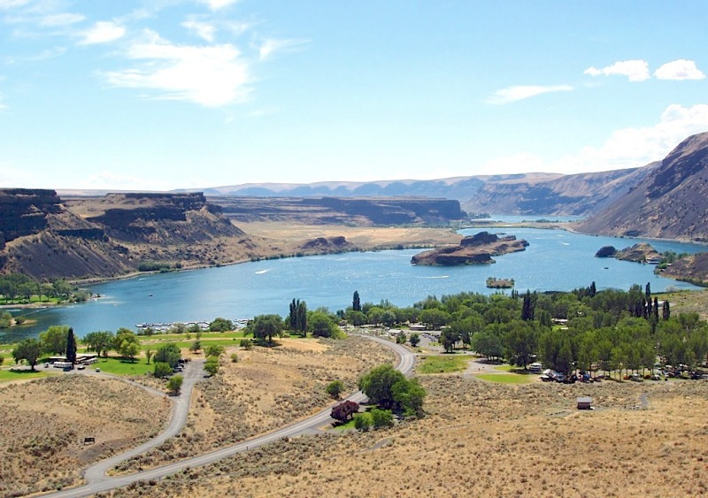
Also within the park is a private concessionaire, Sun Lakes Resort, offering campsites, rental cabins, a park store, boat rentals, propane, firewood and a laundromat. The resort can be reached at (509) 632-5291.
Agency Contact: Washington State Parks, (360) 902-8844
DISCLAIMER: Every effort has been made to ensure the accuracy of this information, but the authors do not guarantee that it is either current or correct. The reader assumes full responsibility for any use of this information, and is encouraged to contact local public land agencies to inquire about current conditions before traveling.
Page last updated: 11/11/13