Less Traveled Northwest
Day Hikes for the Adventurous

Twin Lakes Hike
Hike Rating: Easy
Hike Length: 6.2 miles roundtrip (variable)
Elevation Gain: 215’
Trailhead Elevation: 1,840’
Best Season: April-June and September
Driving Access: Any vehicle
Plus Points
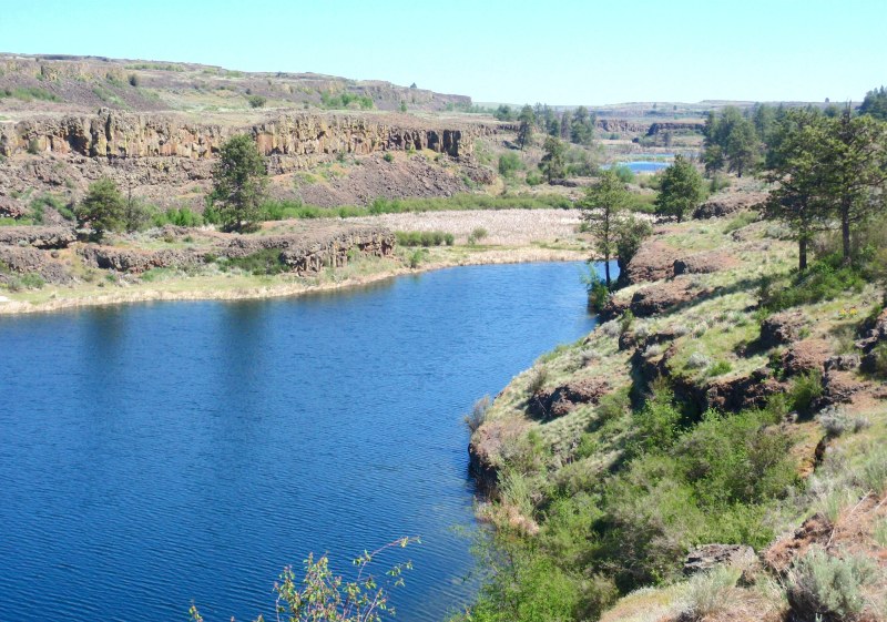
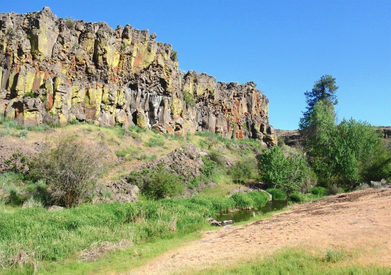
• A ramble along old abandoned roads on basalt benches above Twin Lakes coulee
• Great overviews of the rock-walled coulee, filled with lakes, marshes and wetlands
• Perhaps the richest wildlife and wildflower day hike in Southeast Washington
• Spring wildflowers range from bitterroot on dry outcrops to wild iris in wet seeps
• A birder's paradise, with ducks, geese, coots and teal, plus osprey and bald eagles
• One of the rare coulee hikes that has ponderosa pine trees for shade
Minus Points
• No marked trail, so route-finding skills required along the various basalt benches
• Rattlesnakes are a possibility throughout the summer, so caution is advised
Download (PDF, 681 KB): Photos of Twin Lakes Hike
Download (PDF, 594 KB): Topo Map for Twin Lakes Hike
Download (GPX, 1 KB): GPS Points for Twin Lakes Hike
Download (PDF, 691 KB): Road Map for Twin Lakes Hike
Trail Notes

For the next 0.8 miles, the route follows this cow trail/old road as it contours around the bench through sage and grasslands, keeping within 50'-100' of the basalt cliffs. At any point, one can wander across the bench to views of Upper Twin Lake, then return and pick up the trail. The old road does peter
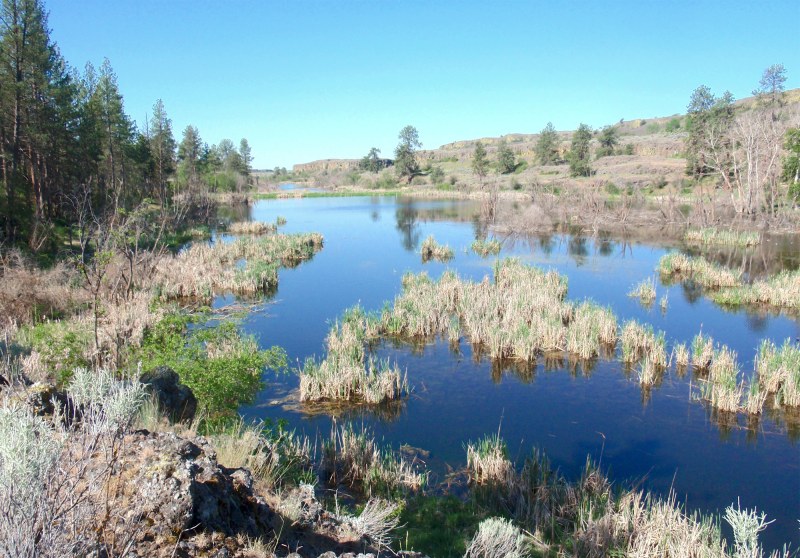
To continue the hike, one goes northeast cross-country from GPS Point 3, through a sagebrush flat, then soon picks up the cow trail/old road again below the bluffs to the north. For the next 0.3 miles, the old road contours under the bluffs until it peters out again at the head of a large draw (GPS Point 4). To visit the marshes close-up, one can descend this draw on game trails all the way to the water. For the last leg of the hike, the route continues north cross-country through the sparse sage and grasslands, with the best views found along the edge of the cliffs overlooking the marshes.
Road to Trailhead
From State Route 28 in Odessa, WA, turn north on SR 21 and follow it for about 6 miles north to the turnoff for Coffeepot Road on the right (northeast). Drive north on Coffeepot Road for 6.1 miles to a 90 degree turn to the east. Continue east on Coffeepot Road for another 6.4 miles, past the turnoff for Coffeepot Lake, then turn left (north) onto Highland Road. Coming from the east on State Route 28, one turns west onto Coffeepot Road at the town of Harrington, WA, then follows this road west for about 14 miles to the turnoff for Highland Road on the right (north).
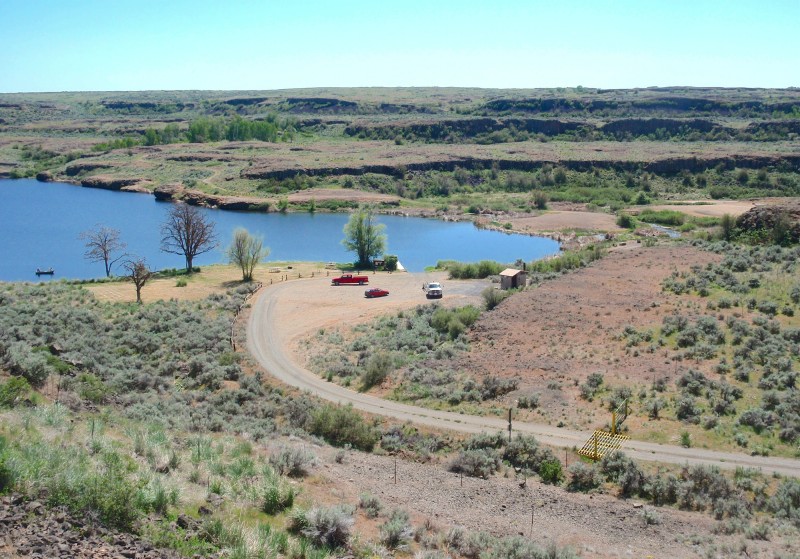
Drive 1.3 miles north on Highland Road, then turn right (east) onto the dirt road into the BLM Twin Lakes Recreation Area. Drive 2 miles down to the lakeside campground and go past the boat ramp. The trailhead is in the second parking area near the creek between the lakes and is easily accessible by any passenger car.
Camping Options
The nearest camping area is right near the trailhead in the BLM Twin Lakes Recreation Area. Tent campers will find a grassy area under sparse cottonwood trees next to the upper lake. Campers with travel trailers will find several dispersed parking spots,
NOTE: The 2-mile access road down into Twin Lakes is fairly steep in spots, with some tight switchbacks, so very large travel trailers (say larger than 20') are discouraged. A better option for these rigs is the BLM Coffeepot Lake Campground about 5 driving miles south, off Coffeepot Road. Here are 6-8 sites on a bench above the lake, with a few shade trees and a vault toilet, all easily accessible on a gravel road.
Agency Contact: Spokane BLM District, (509) 536-1200
DISCLAIMER: Every effort has been made to ensure the accuracy of this information, but the authors do not guarantee that it is either current or correct. The reader assumes full responsibility for any use of this information, and is encouraged to contact local public land agencies to inquire about current conditions before traveling.
Page last updated: 11/8/13